Shingletown Gap & Boal City Brewing

Boalsburg, PA

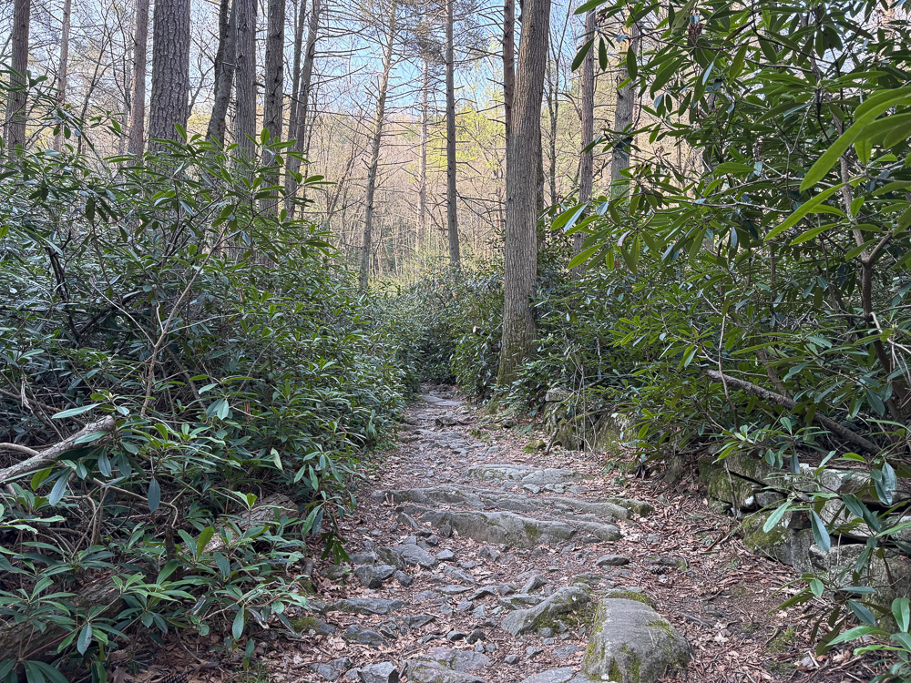
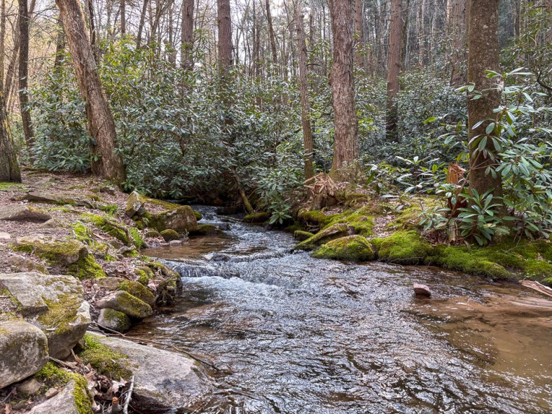
Explore the stunning trails of Shingletown Gap along the trickling waters of Roaring Run. The landscape is incredibly diverse, with thickets of rhododendrons and soaring hemlock trees. The rocky landscape will keep you on your toes, but the generally flat trail keeps this at a moderate difficulty. Cell service is spotty, so make sure to download your map beforehand. Afterward, check out the adventure-friendly Boal City Brewing in nearby Boalsburg for tasty brews with plenty of indoor and outdoor seating.

THE HIKE: Shingletown Gap

Length: 4.0 miles (Trail system offers a variety of distances)
Elevation Gain: 443 ft
Difficulty: Moderate
Time: 2 hours
Trail use: Hiking, leashed pets, mountain biking

This trail is located in a state forest where hunting is allowed during specific times. Please be aware and wear hunter orange during all hunting seasons.
Check out this post for more information about hiking safety during hunting season.

A paved road leads into the distance with trees lining one side and a fence in the background
Entrance to Shingletown Gap – Water Authority

Where to Park: 40.75430032745319, -77.81802788518827. There is a small lot for roughly 10 cars at the Shingletown Gap Water Authority at the end of Mountain Road. Please only park in designated areas and do not park along the side of the road. There are no restroom facilities at this trailhead.

The Route: The Shingletown Gap trail system is located within Rothrock State Forest. Named for PA’s “Father of Forestry” and first forestry commissioner, Dr. Joseph Trimble Rothrock, this state forest spans nearly 100,000 acres in Central PA.

This route starts from the Shingletown Gap Water Authority trailhead parking, but there are other parking areas, including the Galbraith Gap parking off of Bear Meadows road. Use the PA Department of Natural Resources map to plan your route if starting from another parking area.

The route I explored begins at the Shingletown Gap Water Authority. Begin along the paved path that passes the water treatment area. I was amused to see some ducks enjoying a swim in the fresh water! Then the paved path gives way to a natural trail. Follow along the Lower Trail (no signposts), which hugs the edge of Roaring Run. Scramble along the rocks, always staying to the left of the creek. Continue on the trail until just over a half mile when you’ll hit a fork in path. Take the Charcoal Flats Trail to the right to cross over the trickling stream and head steeply uphill, leaving behind the rhododendron thickets. Afterward climbing for roughly 1/4 mile, you’ll reach the top of the ridge. Turn left to stay on the Charcoal Flats Trail and continue for about 3/4 of a mile. This path is markedly different than the lower trail, with more deciduous trees and small rocks filling the trail. Finally, you’ll hit a trail junction with a signpost. Turn left to cross back over the creek and return to the Lower Trail. Just past this junction is a lovely spot to sit along the water and take a rest. Continue along the water’s edge for a mile before passing the trail fork from the beginning of your hike. Stay straight on the Lower Trail to return to the water authority and complete your trek.

There are many other route options in this area, but I highly recommend downloading or printing a map as the trails aren’t always marked and there is little cell service. Pennsylvania-based Purple Lizard Maps has a fantastic map of Rothrock State Forest that includes the Shingleton Gap area!

Other Attractions: Rothrock State Forest is adjacent to State College and is near a plethora of things to do, both for the outdoorsy soul and the more city-minded. Plan a day exploring the college town and be sure to get ice cream from the famed Berkey Creamery. Check out nearby Boalsburg or Bellefonte for small-town charm and shopping. For other nearby hiking, Mount Nittany is a classic hike, or for the road less traveled, hike to Ralph’s Pretty Good View on the Allegheny Front Trail in Moshannon State Forest. There are limitless trails and parks to check out near State College!

THE BEER: Boal City Brewing

Address: 281 Old Boalsburg Rd, Boalsburg, PA 16827
Distance from Trailhead: 3 miles, 6 mins 
Website: https://www.boalcitybrewing.com/
Food?: Rotating Food Trucks
Details: Parking lot for cars and bikes, indoor and outdoor seating, family-friendly, leashed pets outside

Just minutes away from the trailhead, only 6 minutes to be exact, is the cycling haven of Boal City Brewing. Located just outside of State College in the town of Boalsburg, this brewery is primed to be your new favorite hang. A sprawling outdoor space with covered seating just beckons you to come and stay awhile. Inside, the spacious taproom. The topographic map wallpaper lets you know that at Boal City Brewing, adventure is just around the corner. And that’s not just a metaphor; there’s a bike path right outside the brewery! Plus, the soaring windows in the taproom offer stunning views of the surrounding state forest. It’s the perfect spot to soak up the endorphins of some time spent in the great outdoors.

On my visit, I indulged in a few half pours of some of head brewer Mike Smith’s delicious concoctions. My favorite of the bunch was a New England IPA that was the perfect balance of hops and citrus without feeling too heavy. I also had to try the Hefeweizen, one of my favorite beer types and usually my litmus test for if a brewer is worth his salt (malt?). Thankfully, this beer was sweetly bready and light, a solid hefe.

This is the kind of brewery I would go out of my way to visit again! One that makes me wish I lived just a bit closer.

A colorful mural on the side of a building that depicts wildlife, flowers, and people doing outdoor activities

Looking for more adventures in Pennsylvania and beyond? Check out my new book: Beer Hiking Pennsylvania and New Jersey

Mount Nittany & Happy Valley Brewing

State College, PA

Okay, okay, I may be a Pitt girlie but boy do I love a weekend in State College! I visited J out here so much when we were in college and I have many fond memories of exploring the area. Shockingly though, one thing we never did was hike Mount Nittany! Well that definitely needed to change. This is a very popular hike and I would suggest tackling it during the summer when school is out or you may have some trouble finding parking. The 940 ft in elevation gained is no joke so make sure to have proper footwear and plenty of water. Afterward, recharge at Happy Valley Brewing, a hip brewpub in a renovated barn. Make sure to look up for one of the coolest brewery ceilings I’ve ever seen!

THE HIKE: Mount Nittany

Length: 5 miles
Elevation Gain: 940 ft
Difficulty: Moderate
Time: 2.5 hours
Trail use: hiking, leashed pets
Parking: Small lot at trailhead, Port-a-Potty, nature table

Mount Nittany is arguably the most popular hike in Centre County. Not only does the mountain share its name with many businesses in the area, but more famously is the namesake for  the mascot of Penn State University, the largest college in Pennsylvania. But where does the name “Nittany” come from? It’s a little unclear but it seems to come from an Algonquian word meaning “single mountain”. This would make sense since Nittany Mountain is the lone high peak along the Nittany Ridge, making it an excellent place for views of PSU and the affectionately named Happy Valley. 

This area is maintained by the Mount Nittany Conservancy, a nonprofit formed by members of the Lion’s Paw Alumni Association from Penn State. Originally members saved the mountain from the logging industry in the 1940s by raising money to purchase a large section of land on the mountain. But then again in the 1980s, the land was again under threat by developers, so the Conservancy was formed to purchase and preserve more of the mountain. Today, the Mountain Nittany Conservancy cares for over 300 acres of land and works with other landowners towards the long term preservation of the mountain. They also build trails, remove invasive species, conduct clean up days and so much more! 

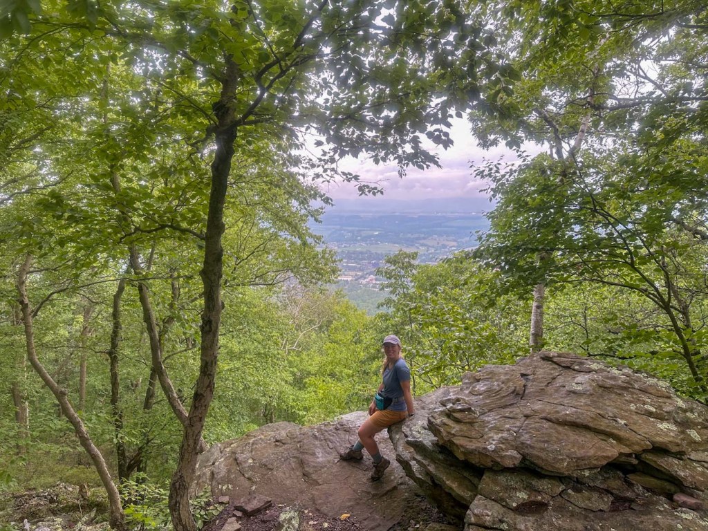
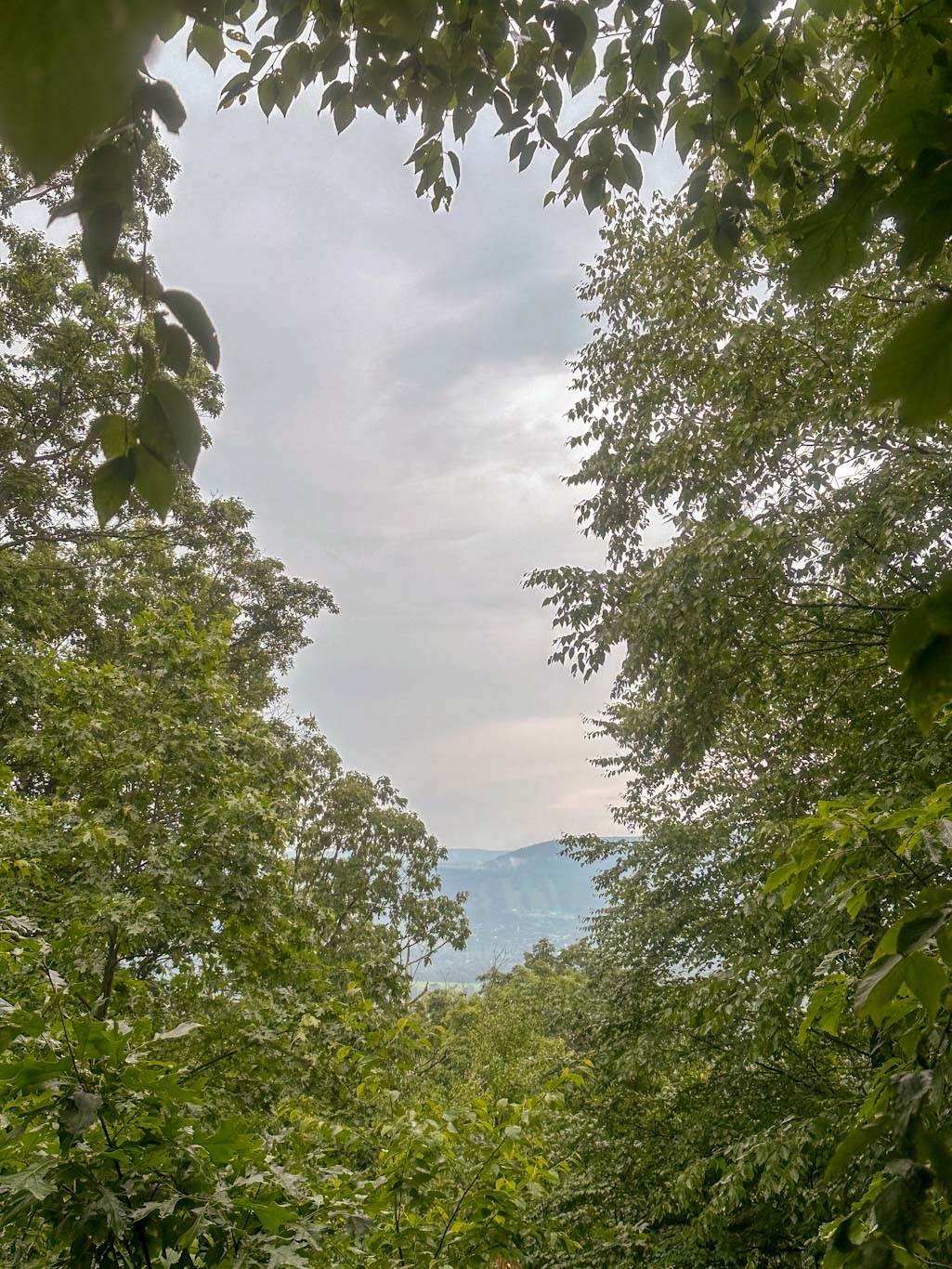
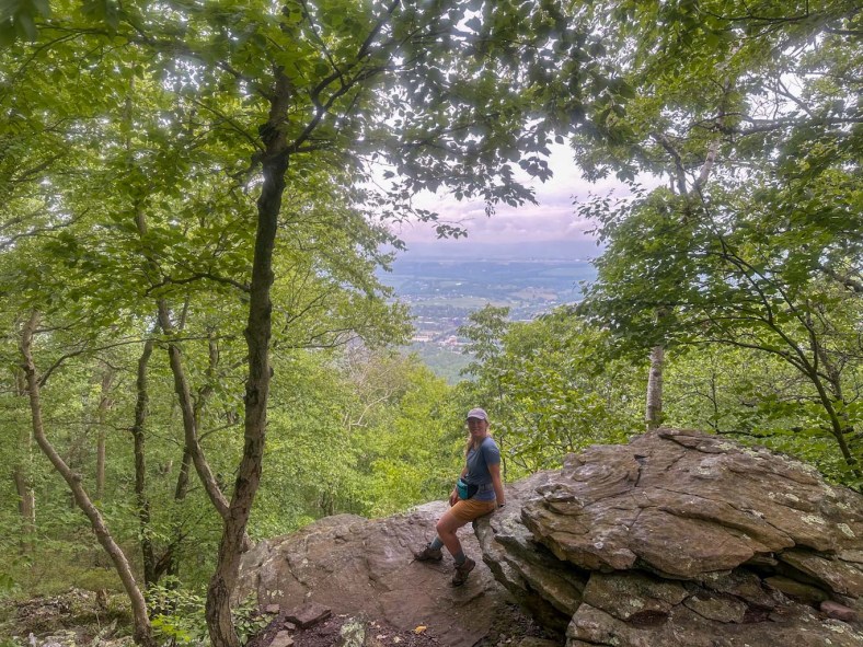
There are over 8 miles of intersecting trail on Mount Nittany, with the most popular being the 0.6 mile hike to the Mike Lynch Overlook. This overlook gives sweeping views of the Penn State Campus including the Bryce Jordan Center and Beaver Stadium. Be prepared for a trek though, this trail gains over 600ft of rocky elevation in half a mile! Unfortunately the views are a bit obscured in my pictures due to lingering wildfire smoke.

For our trek, we wanted to do the full 5 mile loop of the blue and white trails in order to see all the overlooks. Although the map may look confusing, it’s nearly impossible to get lost on this hike due to the incredible work of the MNC to include signs throughout the hike. Each signpost lists the map reference for exactly where you are on the trail and gives GPS coordinates. THere are also several “shortcut” trails if the full loop feels like too much! 

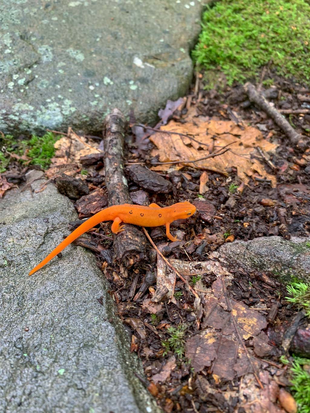
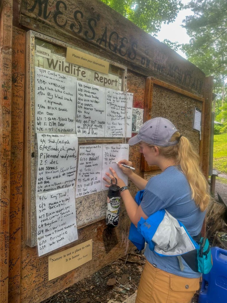
When doing this hike, it’s important to remember that it is extremely popular both with locals and students. I would suggest doing it first thing in the morning or planning a sunset hike. But know that you will most certainly be sharing the trail with others. Also, there is only room for 3-4 cars at the trailhead, but there is additional parking down the road. Be sure to follow the signs and do not block anyone’s driveway. This is a residential area so try to be courteous to everyone! There are also portable toilets at the trailhead. One of my favorite aspects of this trail was the huge white board beside the posted map where hikers could add their wildlife observations. How cool! We saw several red efts but still no bears. Sigh. 

For the actual hike, start on the blue/white trail which will take you straight up a very rocky hillside. Even for someone fit, this part can be challenging. Bring plenty of water and be aware of the temperature and humidity for the day. I suggest keeping a counter-clockwise journey (aka right turns). Now that you’ve made it up the mountain, the rest of the hike until the descent is quite flat and easy. The first overlook is the Mike Lynch overlook, probably the largest and most popular due to its views of the PSU campus. However, if you keep onward, the best overlook in my personal opinion, will actually be the last one! Continue along the trail, always keeping to the blue blazed trail. You’ll pass other overlooks, some nicer than others. The trail remains easy and the flora is diverse and inviting. Nearing the end of the circle around the summit, you’ll reach the Nittany Mall overlook. This is the last of the overlook and arguably the nicest. There’s a huge rock perfect for sitting and the trees perfectly frame the vista. What more could you ask for! Finally, it is time to head back down the mountain along the same path you came up. It feels just as rocky going down so take your time! 

THE BEER: Happy Valley Brewing Co.

Address: 137 Elmwood St, State College, PA 16801
Distance from Trail Head: 1.4 miles, 5 mins 
Website: http://happyvalleybeer.com/
Food?: Full Kitchen
Details: Outdoor seating, No pets

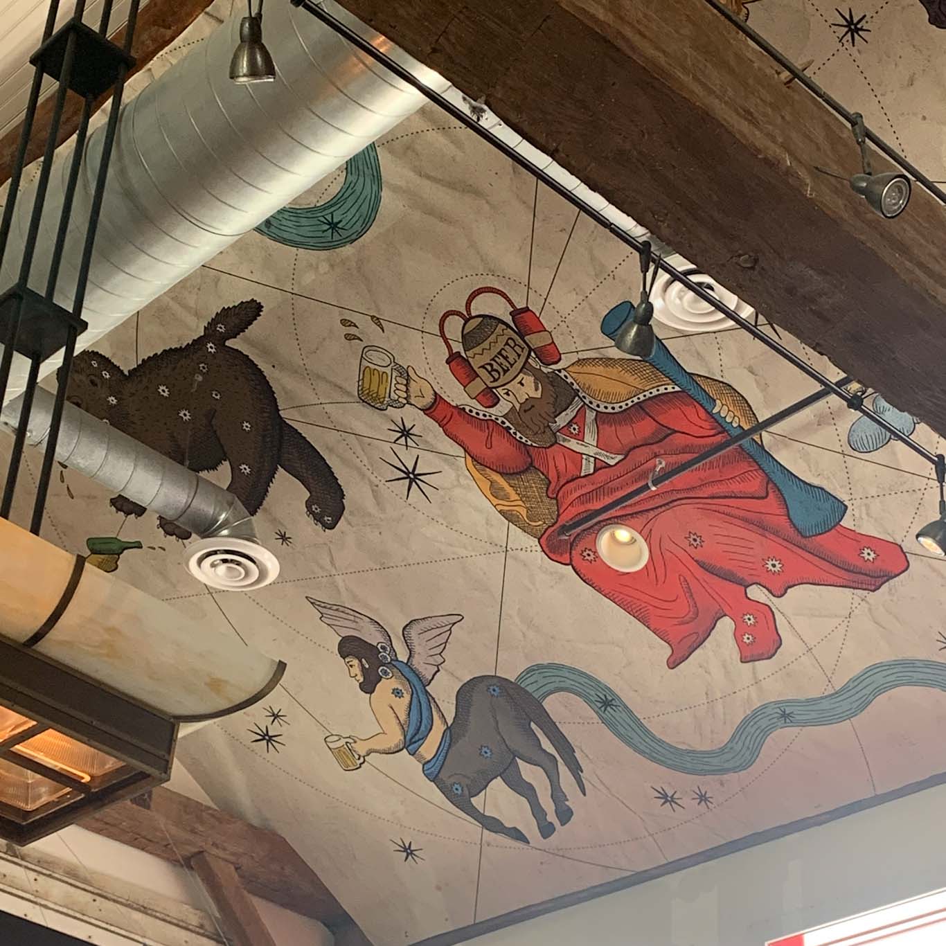
Celebrate your victory over Mount Nittany with some brews and a meal at Happy Valley Brewing. This unique brewing is housed in an old barn and all of the details and decor nod to the building’s previous life. They even preserved the old Klinger’s Farm sign and have it proudly displayed over the bar! While you’re looking, take a gaze at the wall papered ceiling and you’ll get a chuckle out of the beer-minded renaissance figures. 

Happy Valley Brewing has a full kitchen menu specializing not only on pub favorites but also offering a more sophisticated menu of farm-to-table offerings. Although if you’re like me, after hiking all I want is a big tasty sandwich! I opted for the pulled pork and it was exactly what I wanted. In addition to the upstairs restaurant, there’s also a downstairs lounge that usually has live entertainment and a relaxed vibe. 

But what about the beer?? I felt compelled to get the Tailgater Pale Ale which was a delightfully hoppy ale with a slight tangerine flavor. Coming in at a low 4.&% ABV, this made for a perfect post-hike lunchtime pour. I only wish I had time to sample more! But most importantly, we had to save room for a stop at the Creamery. You just have to! 

Looking for more Central PA hikes & hops? Check out Peter’s Mountain & ZeroDay Brewing in Harrisburg, Pulpit Rock & 1787 Brewing in Hamburg, and Rickett’s Glen & Back Mountain Brewing Near Benton