
Boalsburg, PA
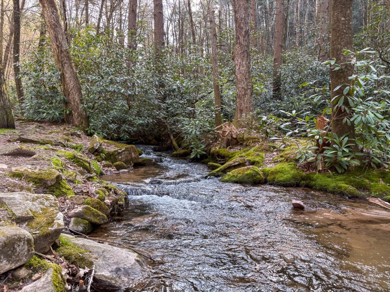
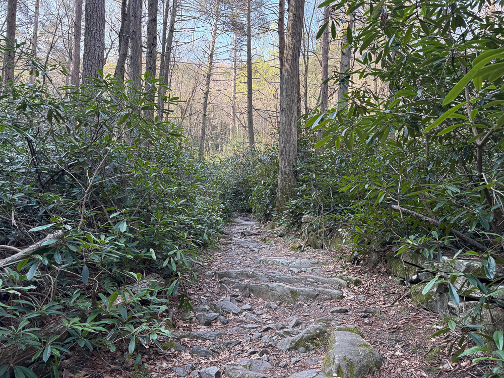
Explore the stunning trails of Shingletown Gap along the trickling waters of Roaring Run. The landscape is incredibly diverse, with thickets of rhododendrons and soaring hemlock trees. The rocky landscape will keep you on your toes, but the generally flat trail keeps this at a moderate difficulty. Cell service is spotty, so make sure to download your map beforehand. Afterward, check out the adventure-friendly Boal City Brewing in nearby Boalsburg for tasty brews with plenty of indoor and outdoor seating.
THE HIKE: Shingletown Gap
Length: 4.0 miles (Trail system offers a variety of distances)
Elevation Gain: 443 ft
Difficulty: Moderate
Time: 2 hours
Trail use: Hiking, leashed pets, mountain biking
This trail is located in a state forest where hunting is allowed during specific times. Please be aware and wear hunter orange during all hunting seasons.
Check out this post for more information about hiking safety during hunting season.

Where to Park: 40.75430032745319, -77.81802788518827. There is a small lot for roughly 10 cars at the Shingletown Gap Water Authority at the end of Mountain Road. Please only park in designated areas and do not park along the side of the road. There are no restroom facilities at this trailhead.
The Route: The Shingletown Gap trail system is located within Rothrock State Forest. Named for PA’s “Father of Forestry” and first forestry commissioner, Dr. Joseph Trimble Rothrock, this state forest spans nearly 100,000 acres in Central PA.
This route starts from the Shingletown Gap Water Authority trailhead parking, but there are other parking areas, including the Galbraith Gap parking off of Bear Meadows road. Use the PA Department of Natural Resources map to plan your route if starting from another parking area.
The route I explored begins at the Shingletown Gap Water Authority. Begin along the paved path that passes the water treatment area. I was amused to see some ducks enjoying a swim in the fresh water! Then the paved path gives way to a natural trail. Follow along the Lower Trail (no signposts), which hugs the edge of Roaring Run. Scramble along the rocks, always staying to the left of the creek. Continue on the trail until just over a half mile when you’ll hit a fork in path. Take the Charcoal Flats Trail to the right to cross over the trickling stream and head steeply uphill, leaving behind the rhododendron thickets. Afterward climbing for roughly 1/4 mile, you’ll reach the top of the ridge. Turn left to stay on the Charcoal Flats Trail and continue for about 3/4 of a mile. This path is markedly different than the lower trail, with more deciduous trees and small rocks filling the trail. Finally, you’ll hit a trail junction with a signpost. Turn left to cross back over the creek and return to the Lower Trail. Just past this junction is a lovely spot to sit along the water and take a rest. Continue along the water’s edge for a mile before passing the trail fork from the beginning of your hike. Stay straight on the Lower Trail to return to the water authority and complete your trek.
There are many other route options in this area, but I highly recommend downloading or printing a map as the trails aren’t always marked and there is little cell service. Pennsylvania-based Purple Lizard Maps has a fantastic map of Rothrock State Forest that includes the Shingleton Gap area!


Other Attractions: Rothrock State Forest is adjacent to State College and is near a plethora of things to do, both for the outdoorsy soul and the more city-minded. Plan a day exploring the college town and be sure to get ice cream from the famed Berkey Creamery. Check out nearby Boalsburg or Bellefonte for small-town charm and shopping. For other nearby hiking, Mount Nittany is a classic hike, or for the road less traveled, hike to Ralph’s Pretty Good View on the Allegheny Front Trail in Moshannon State Forest. There are limitless trails and parks to check out near State College!
THE BEER: Boal City Brewing

Address: 281 Old Boalsburg Rd, Boalsburg, PA 16827
Distance from Trailhead: 3 miles, 6 mins
Website: https://www.boalcitybrewing.com/
Food?: Rotating Food Trucks
Details: Parking lot for cars and bikes, indoor and outdoor seating, family-friendly, leashed pets outside
Just minutes away from the trailhead, only 6 minutes to be exact, is the cycling haven of Boal City Brewing. Located just outside of State College in the town of Boalsburg, this brewery is primed to be your new favorite hang. A sprawling outdoor space with covered seating just beckons you to come and stay awhile. Inside, the spacious taproom. The topographic map wallpaper lets you know that at Boal City Brewing, adventure is just around the corner. And that’s not just a metaphor; there’s a bike path right outside the brewery! Plus, the soaring windows in the taproom offer stunning views of the surrounding state forest. It’s the perfect spot to soak up the endorphins of some time spent in the great outdoors.
On my visit, I indulged in a few half pours of some of head brewer Mike Smith’s delicious concoctions. My favorite of the bunch was a New England IPA that was the perfect balance of hops and citrus without feeling too heavy. I also had to try the Hefeweizen, one of my favorite beer types and usually my litmus test for if a brewer is worth his salt (malt?). Thankfully, this beer was sweetly bready and light, a solid hefe.
This is the kind of brewery I would go out of my way to visit again! One that makes me wish I lived just a bit closer.

Looking for more adventures in Pennsylvania and beyond? Check out my new book: Beer Hiking Pennsylvania and New Jersey


