Moraine State Park & Union Brothers Brewing

Portersville, PA

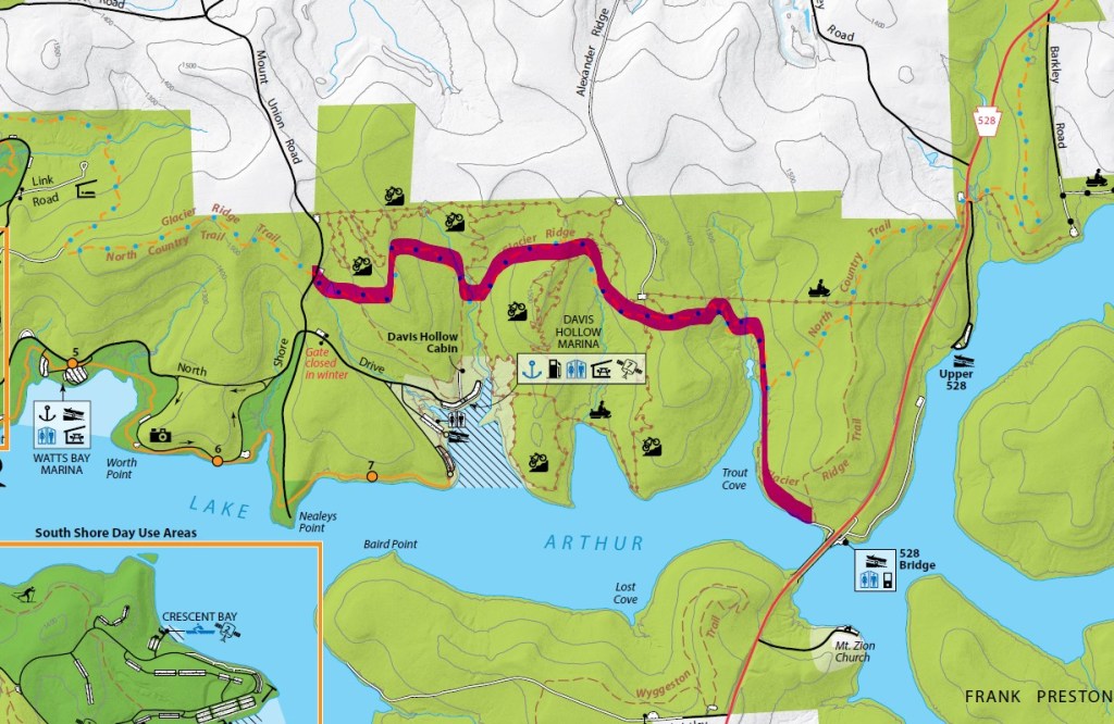
Most people associate Moraine State Park with boating and fishing, but did you know that there’s also nearly 30 miles of hiking and biking trails? Glacier Ridge Trail is popular for backpacking but can also be done as an out and back section, choosing how far you want to go. This particular section starts at the parking lot on Mount Union Road and turns around at the 528 Bridge for just over 7.2 miles. After working up a sweat on this trail, back into Harmony for a refreshing brew at Union Brothers either in their full-kitchen taproom or in their cozy outdoor patio.

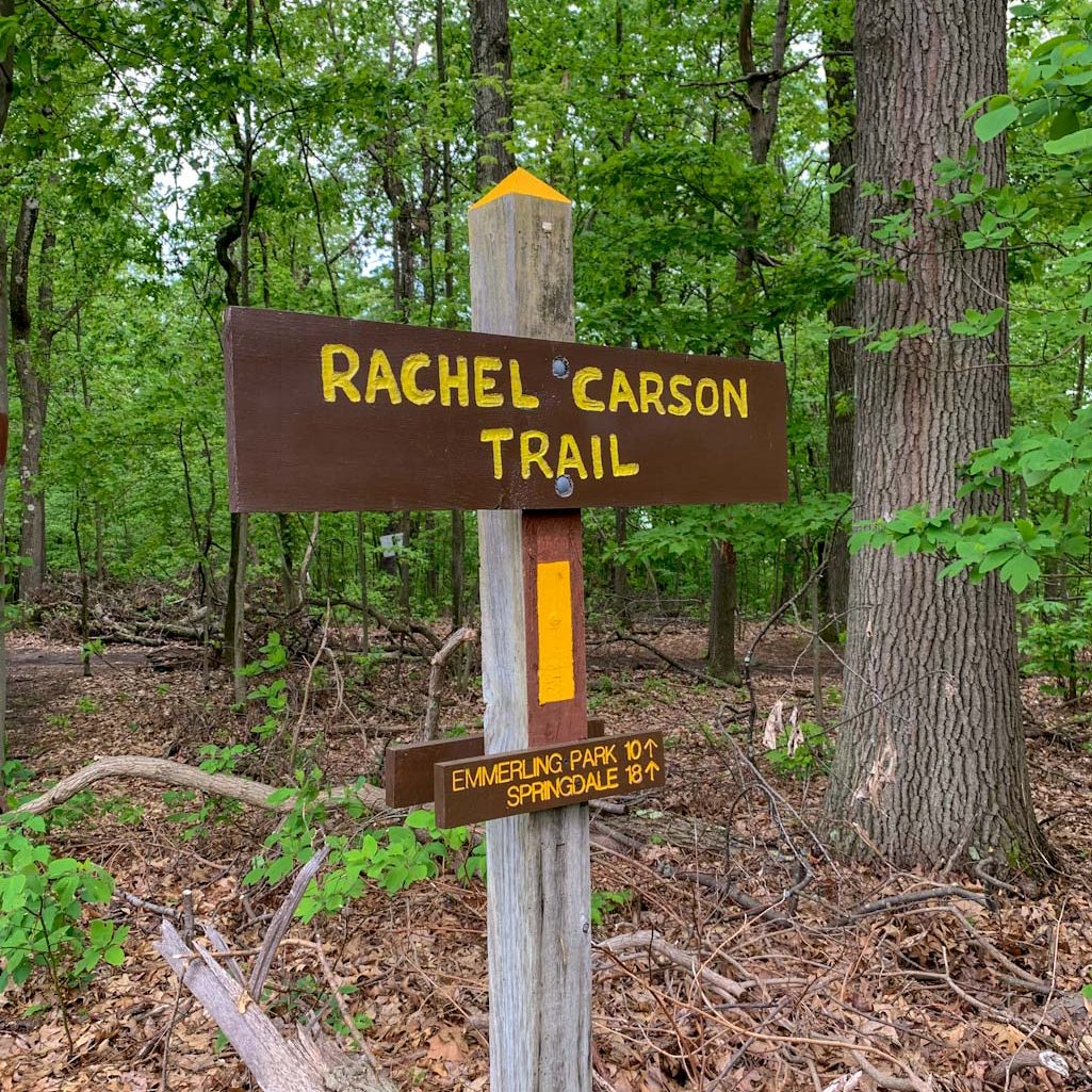
THE HIKE: Glacier Ridge Trail (Moraine State Park)

Length: 7.25 miles
Elevation Gain: 1350 ft
Difficulty: Moderate
Time: 3.5 hours
Trail use: Hiking, leashed pets
Parking: Gravel pull off for a few cars on Mt. Union Rd
Parking coordinates: 40.96781939719753, -80.07996200282916
H&H: 5/5

Moraine State Park is located in Portersville, PA only a few miles away from McConnells Mill State, another of my recent treks. Although these two have been affected by a similar geological history, they are rather unique from each other! Moraine is mainly characterized by the 3,000 acre Lake Arthur, which is why it is (justifiably) known for its draw to outdoor water sports and fishing. However, there’s lots of unique history behind that lake and its nearby trails.

History

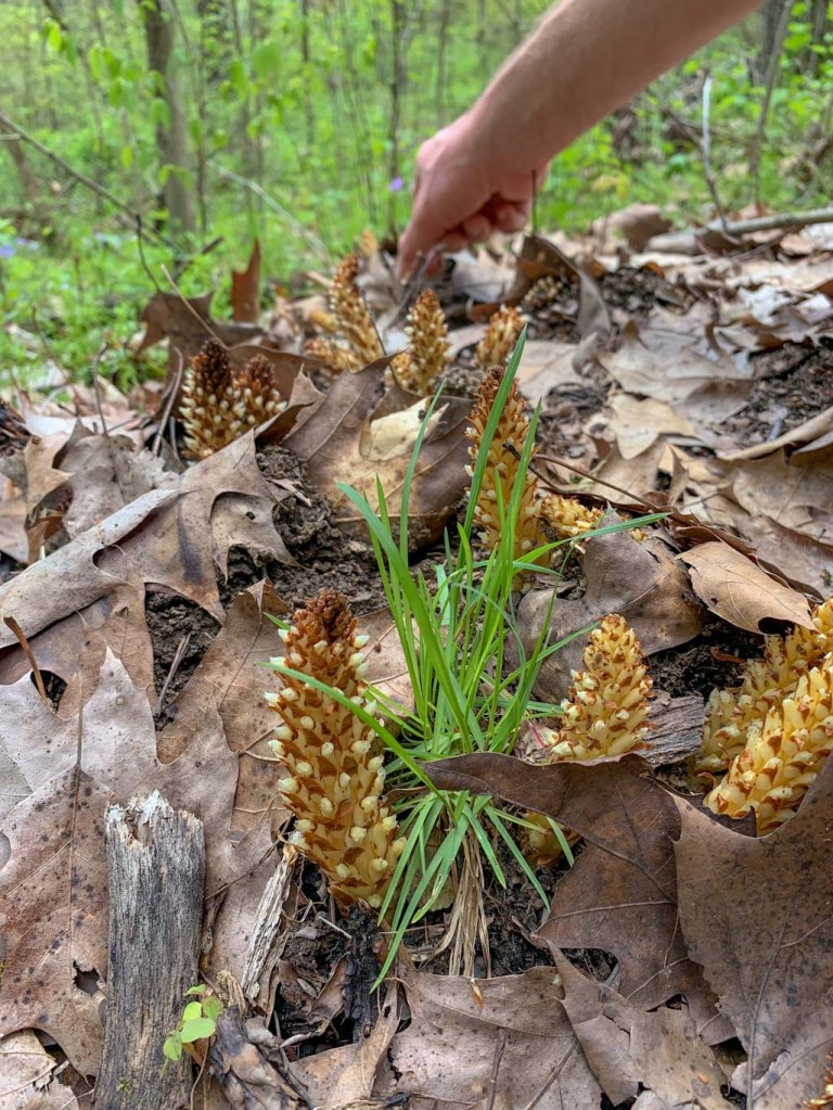
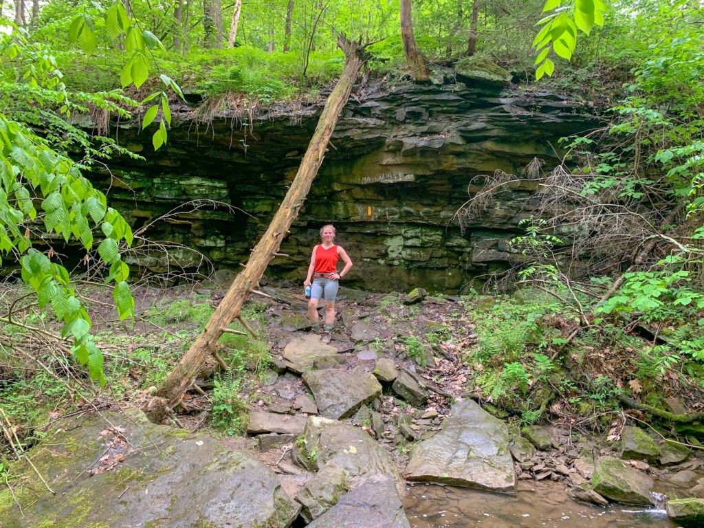
Moraine State Park gets its name because of the four separate glaciers that reached their northernmost extent just shy of Moraine State Park. Glaciers are huge ice sheets that covered much of the Earth during the Ice Age. Because of the way glaciers move, they trap and move rock and other debris. When they melt and recede, this debris is left behind, often creating ridges known by geologists as moraines. While hiking through this park, you can see evidence of these glacial deposits in the huge boulders and stone that seem to emerge out of nowhere. As I’ve mentioned before, this glacial freeze and thaw cycle is also what created the incredible Slippery Rock Gorge at McConnells Mill! At one point in time, ice dams caused the creation of glacial lakes throughout the region. Although the current Lake Arthur is manmade, it is a replica of the glacial Lake Watt that once dominated the area. 

Because of the unique glacial deposits, settlers to the region found it rich with mineral deposits. The mining industry grew throughout the 1800s until much of the area was depleted of resources and left polluted. For many decades, the area was left completely abandoned. But thanks to the efforts of researcher and naturalist Frank W. Preston (founder of the Western PA Conservancy), who recognized the uniqueness of the land, efforts were made to seal abandoned mains and restore the natural landscape. 

One of my favorite things about this blog is being able to learn the history behind the trails I hike. I’ve lived in Pittsburgh most of my life, and never knew that Moraine wasn’t a person’s name but rather a geological term. Learning more about the geological history of the area, really gives greater depth to enjoying the areas we hike. It’s one thing to hike a trail called Glacier Ridge and another to understand why it’s called that! 

The Trail

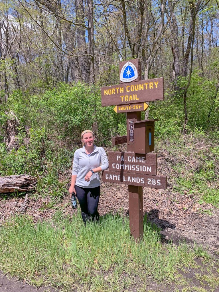
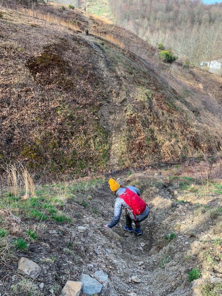
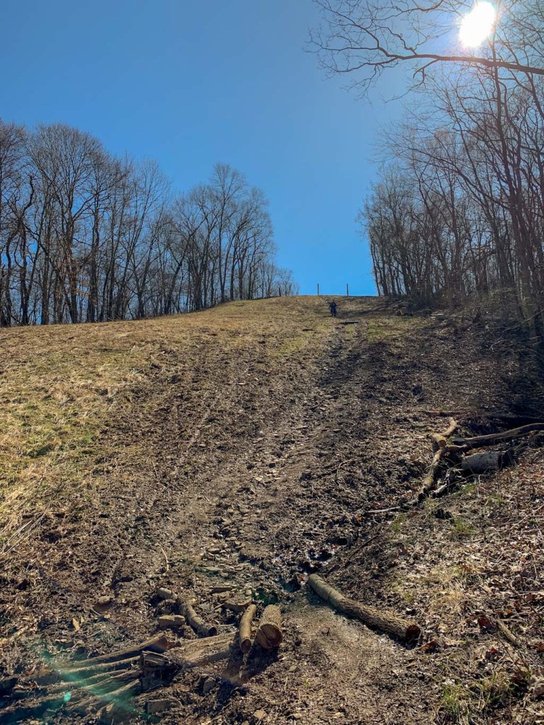
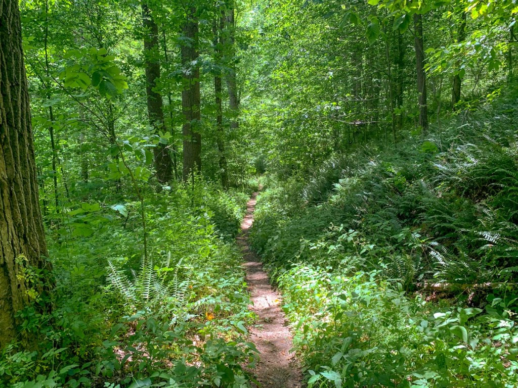
Okay, enough waxing poetic about geology (can you tell that I used to study archaeology?). Let’s get into this trail. Glacier Ridge is a 14.8 mile point to point trail that runs through the woods along the northside of Lake Arthur. It’s part of a small section of the 4,800 mile North Country Scenic Trail that runs from North Dakota to Vermont.  Glacier Ridge is popular with backpackers and there are shelters that can be booked through the PA DNR website. Please note that you must have a permit to backpack! For more info about backpacking in Moraine, check out My Trails Are Many for a great overview of her experience. For those just looking to day hike, there are several access points to the Glacier Ridge trail in Moraine: PA 528, Mount Union Road, the bike rental, and McDanels Launch Area. For our trek, we parked at the small gravel pull-off on Mount Union Road which is small, but on a sunny Sunday, we were the only ones there! Be aware that there is also a larger parking lot for the bike trails on Mount Union before you hit this lot but that’s not where I recommend parking! 

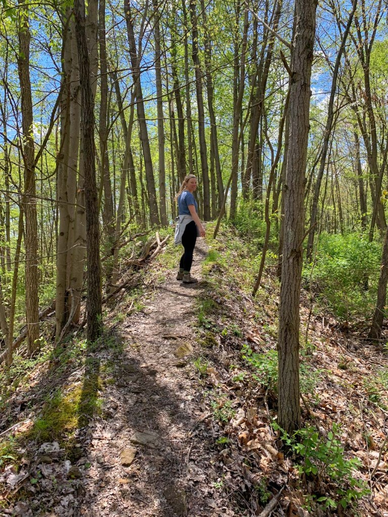
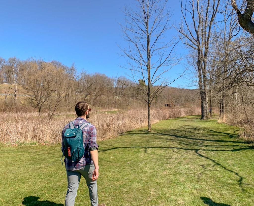
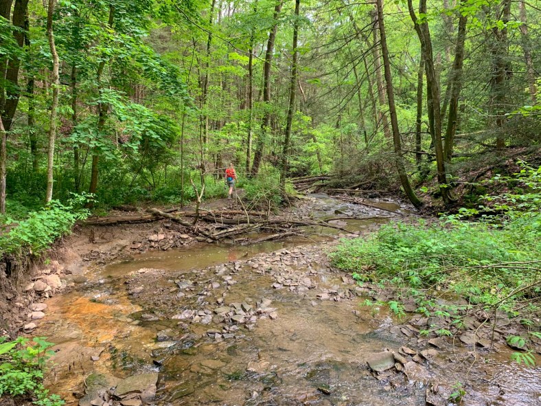
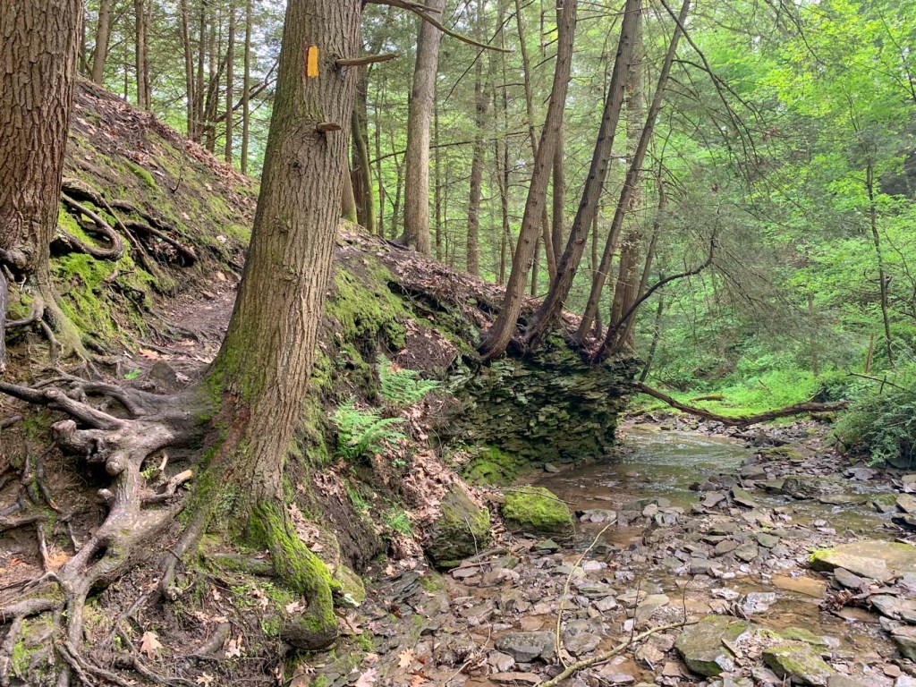
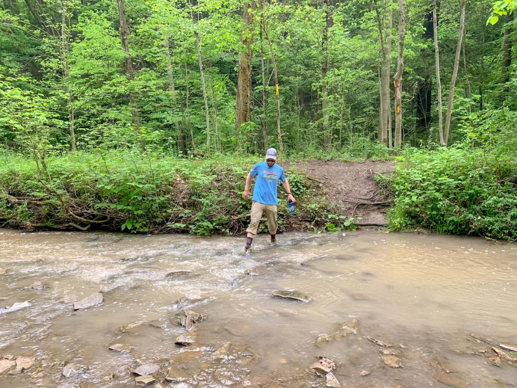
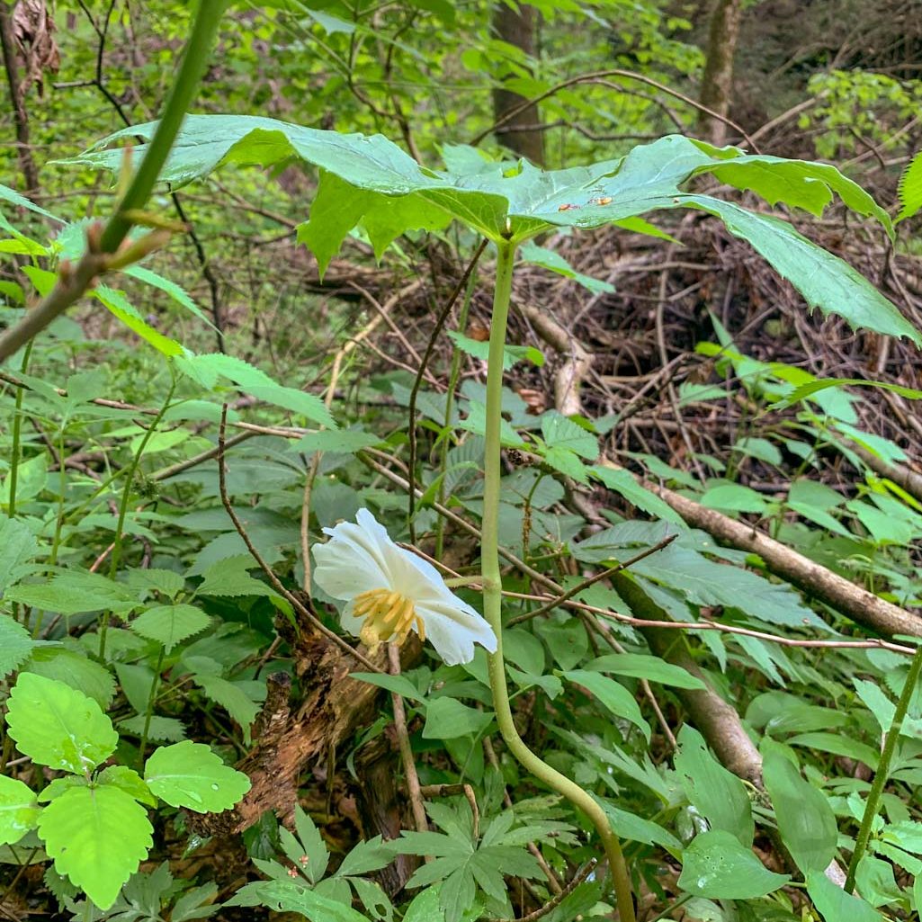
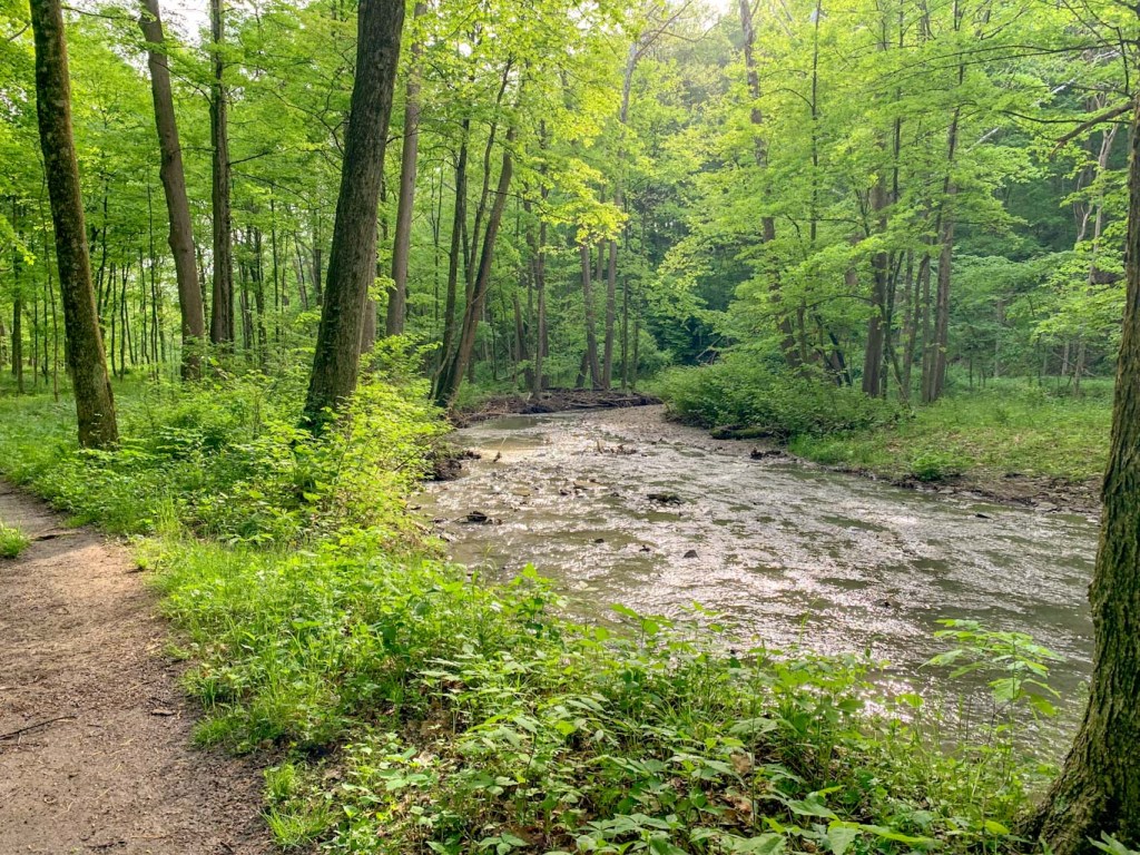
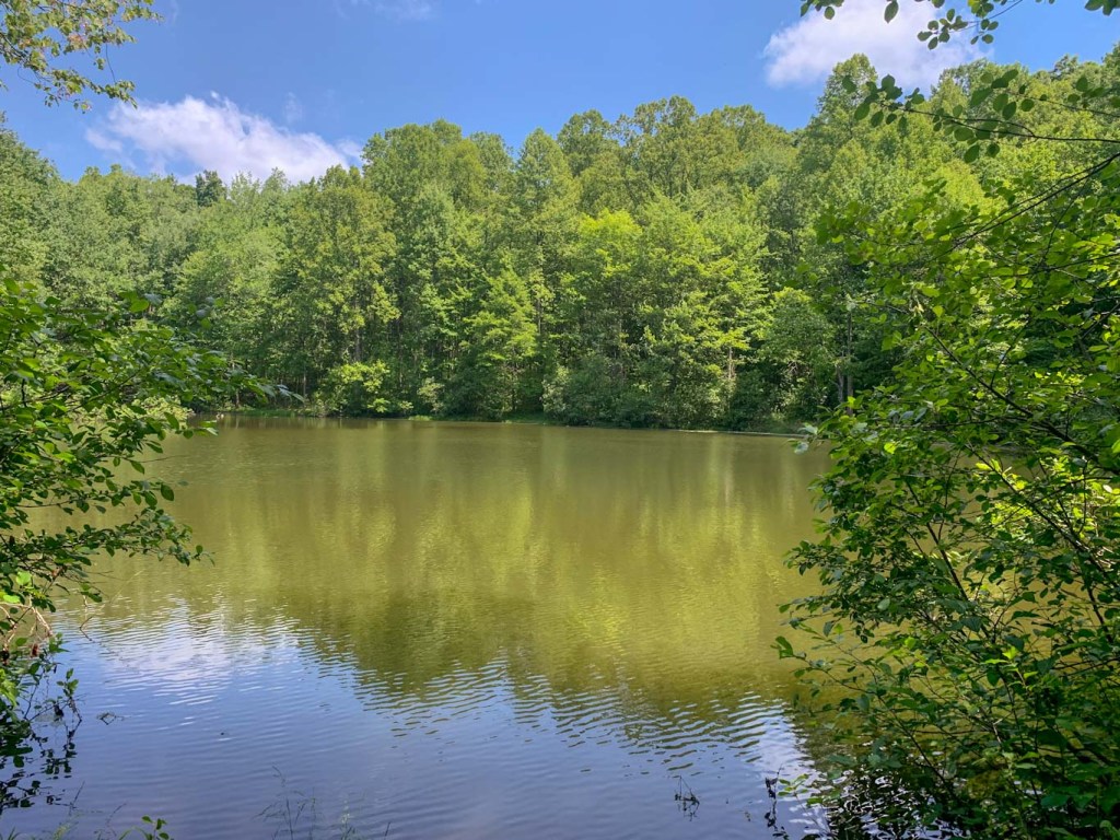
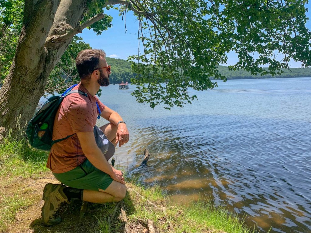
Immediately after starting the trail, it dips down to a peaceful pond that would be the perfect secluded fishing spot. Honestly, I could have spend the rest of the day lazing around this pond! From there the trail meanders through the woods, sometimes  crossing over small bridges and heading up rocky inclines. For most of the trail, you’ll be staying on the blue blazes for the NCT/Glacier Ridge Trail. Do not follow any of the signs for the bike trails or the marina! After about 3.5 miles, the North Country trail splits off and continues north but you’ll want to stay on the Glacier Ridge Trail, which is now white blazed. Now, the trail hugs directly next to the lake, so there’s plenty of gorgeous photo opportunities. Finally, the trail hits the PA 528 bridge which is where we decided to turn around. Feel free to continue on if you’ve got the time and stamina! As always, make sure to leave enough daylight to make the return trek. 

Other Things to Do

A trip to Moraine is a great day trip from the city! Aside from hiking, you can also get out on the water. There are 9 public boat docks and engines up to 20 horsepower are allowed. You can also rent pontoons, motorboats, kayaks, canoes, and rowboats. Swimming and fishing are also popular activities at Moraine. If staying on land is more your speed, check out the paved bike trails and also the more intense mountain bike routes. Looking for more to do in Moraine? Check out the PA Department of Natural Resources and the Butler County Tourism site. 

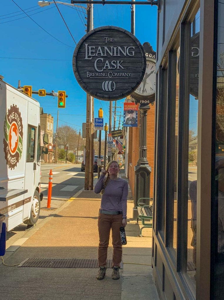
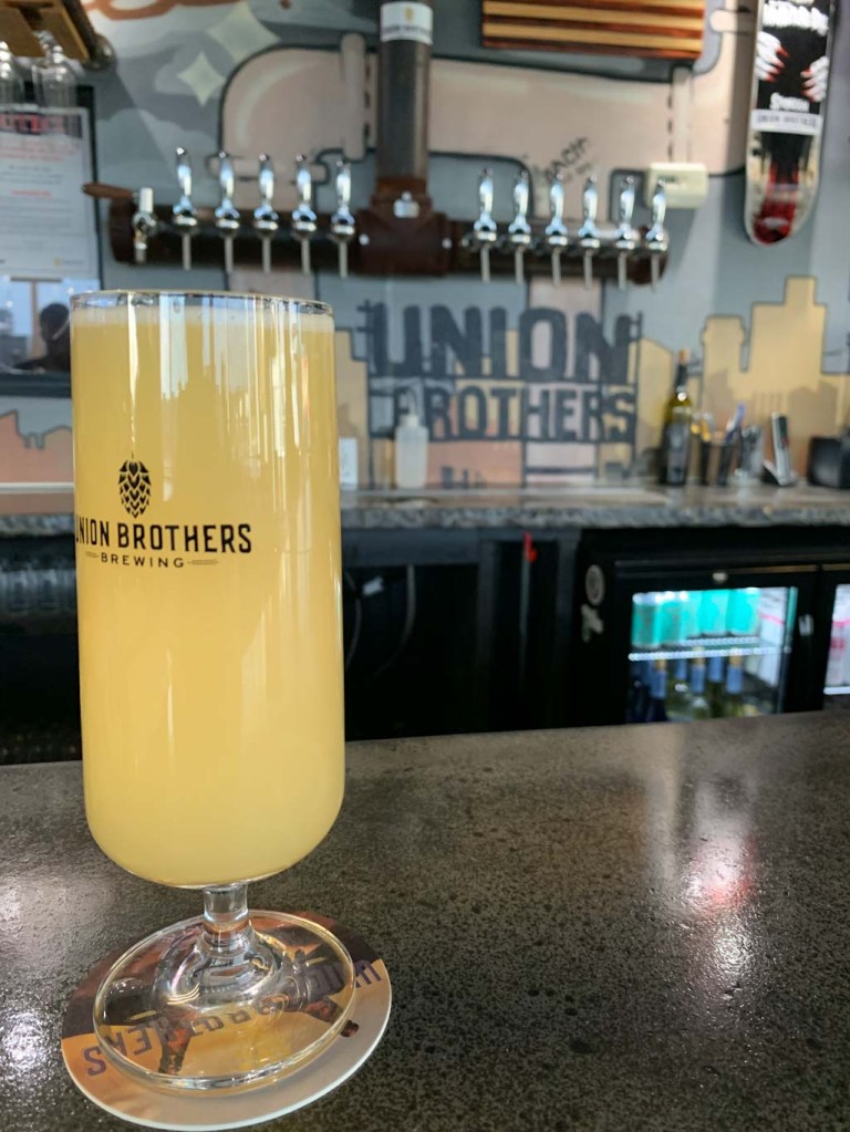
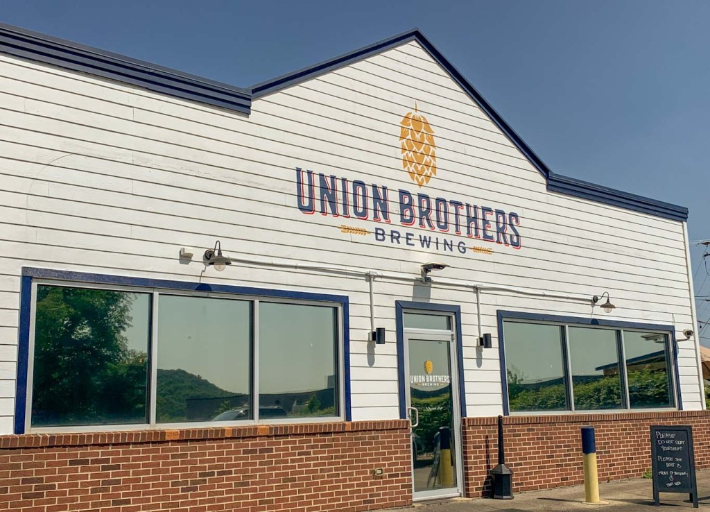
THE BEER: Union Brothers Brewing

Address: 365 Mercer Rd, Harmony, PA 16037
Distance from Trail Head: 18 miles, 22 mins 
Website: http://unionbrothersbrewing.com/
Food?: Full Menu
Details: Outdoor seating; Dog Friendly Outside

Union Brothers Brewing is a fairly recent addition to the thriving Zelienople beer scene. Friends Zachary Waltz and Jeremiah Cain began homebrewing together and perfected their craft for many years before opening a taproom. But once they did, it quickly outgrew the demand for their lineup of sours and hazy IPAs. The team has already expanded once to a larger taproom and greatly expanded their brewing capacity. From the stunning wall art by local graffiti artist Max Gonzales to its physical location across the street from the Steamfitters Union, Union Brothers is a celebration of the region’s industrial past and present. Both brewers are proud members of their local union and felt the name fit! You’ll find yourself right at home at Union Brothers whether it’s in the hip taproom or sitting around picnic tables and fire pits outside. A full food menu caps Union Brothers off as the perfect place to unwind. 

We’ve been to Union Brothers twice now and have had an awesome experience both times. It feels like the perfect neighborhood joint, whether you’re from the area or just passing through. Having an excellent taplist doesn’t hurt either! I’ve heard rumors that Union Brothers is set to expand again soon, having purchased the old nearby Moose Lodge. I’m looking forward to seeing these guys just keep getting bigger and better!

Our Beer:

  • Short Break – Hazy Pale Ale – 4.7%
  • Black Forest Hills – Dark Lager – 6%

Looking for more Hikes & Hops north of Pittsburgh? Check out Wolf Creek Narrows & Big Rail Brewing, McConnells Mill & Shubrew, and North Park & Cinderlands

NCT PA Border & Ill Will Brewing

Columbiana, OH

Sometimes you’ve just gotta get out of town! I love some of the little towns just across the PA border in Ohio and this is the perfect Hike n Hop to do before a day of exploring. This hike starts at Mile 0 of the PA portion of the North Country Scenic Trail and meanders through woods and fields, making for a lovely spring hike. Afterward, you can head into Ohio towards Columbiana and grab a beer at the sprawling Ill Will Brewery. I highly recommend sitting outside. From there, have a lazy day exploring the shops and cafes of downtown Columbiana!

THE HIKE: North Country Trail – PA Border

Length: 5 miles
Elevation Gain: 545 ft
Difficulty: Moderate
Time: 2 hours
Trail use: Hiking, backpacking, leashed pets
Parking: Small trailhead off PA 251. Blink and you’ll miss it!
H&H: 4/5

Somehow, I only learned about the North Country Trail this year! While not as well-known as some of the other multi-state trails, the North Country Trail has a lot to offer! It passes through 8 states, spanning from North Dakota to Vermont. If you’re thinking That’s a lot of miles, you’re right! Nearly 4,800 to be exact. Some fun facts about the trail from the NCT website include that it passes through:

  • 10 national forests
  • 4 NPS areas
  • Over 100 state game lands
  • Along 3 Great Lakes

We are lucky to have some incredible sections of this trail here in PA and I had hiked on them before without even realizing it! In PA, the NCT passes through McConnells Mill State, Cook Forest State Park, and Moraine State Park, as well as through a huge section of Allegheny National Forest. All in all, the trail winds along 265 miles of our great state of PA!

The NCT was established in 1980 by Congressional order as an amendment to the National Trails System Act. While it is administered by the National Park Service and managed by state and local agencies, the trail is primarily built and maintained by volunteers. The North Country Trail Association is a nonprofit with many affiliate chapters who care for individual sections of the massive trail system. When it was created, the NCT linked together several existing trails, so don’t be confused if you see it referred to as multiple names. For example near Cook Forest, the NCT links up to part of the 138-mile Baker trail. 

At mile 0 of the PA section!

This short out-and-back section of the NCT starts at the PA/OH border. There is no parking right at the border, although you may spot the sign along PA-251 (Blackhawk Rd). The parking lot is a small pull out a bit further down the road on the PA side. We definitely drove right past it and had to backtrack. The parking area is not on Google Maps but if you type in the coordinates: 40.773190, -80.513930, it should get you close enough! Coming from PA, the pull-off will be on your right and if you’ve passed into OH, you’ve gone too far! The parking area is about ¼ mile away from the start of the NCT but there is a nice little connector path from the parking lot. Be warned, there are no port-a-potties at the trailhead. Also this trail goes through State Gamelands, so be aware of hunting seasons and wear your orange! 

If you are doing this hike with a group or friend, a great idea would be to bring two cars so you can do a point-to-point hike, leaving your car at the Border parking and picking one of the other parking lots along the trail. This is a great way to see more of the trail and not have to double back! Plus you can decide how far you want to travel. Fun fact: It’s about 35.5 miles from the PA/OH border to Hell’s Hollow in McConnells Mill State Park! Maybe a bit much for a day hike though. 

Since we only had one car, we did a nice little out and back for a total of 5 miles. The turnaround spot is not well-marked nor distinctive, so just keep an eye on your mileage if you’re looking to total around 5 miles. We really enjoyed this hike because although it started on a roadside, you quickly feel lost in the woods. The path meaders up and down hillsides, keeping the elevation interesting. SInce we did this hike in spring, there were lots of delightful wildflowers poking through the underbrush. What a thrill to finally see some green on our hikes again! This trail also broke out onto grassy meadows for some stretches, which was beautiful but also be sure to check for ticks afterward and bring lots of water. Those sunny meadow stretches can get much warmer than the woods! 

One final thing, be very careful pulling back out onto the road after your hike. PA-251 is a fast road and it’s a bit difficult to see around you. 

If you’re making a day of it, after this hike head over to OH and explore Columbiana! 

For more info about the North Country Trail, check out the website here

THE BEER: Ill Will Brewery

Address: 45417 OH-14, Columbiana, OH 44408
Distance from Trail Head: 12.2 miles, 20 mins 
Website: http://www.illwillbrewing.com/
Food?: food trucks, BYOF
Details: Outdoor seating, dog friendly outside

If you live in Pittsburgh and you haven’t been to Columbiana, OH, you are missing out! J and I love finding new little towns to explore and Columbiana is one of our favorites. There really is something for everyone! Hiking (see above), breweries, antiquing, farm markets, plant nurseries, cafes, bakeries, and more! We love to grab a coffee from Generations, a sweet treat from Hogans, and then roam through the many shops and antique stores. You never know what you’ll find! 

Surprisingly for such a small area, they got not one but two awesome breweries! Either one would be a great choice for after your hike (or why not both?) but for this post, I’m going to focus on Ill Will Brewery. This is a fairly new addition to the area and they really live by the idea that bigger is better. Also the brewery has only been around since 2021, their space has grown to include a large taproom and a huge patio. Also onsite are two Airbnbs, an event space, and the future brick and mortar location for the Smokeworks food truck. Seriously this is not a place to miss! For me, the patio is really where this brewery shines. They’ve got firepits, giant lawn games, and honestly just a beautiful sunny view. It’s a great place to watch the sunset! 

Ill Will also makes some pretty interesting beer. Half their taplist is the more traditional, hop-forward brews one would expect. But the other half of the list is where things get fun. They experiment with different smoothie sours and seltzer flavors, some cool and refreshing, others tasting almost like a milkshake. They often have some of the more fruity beer available as a slushie! On a nice hot day, that would really hit the spot. 

Our Beer:

  • No Sleep Til Brooklyn – New Zealand IPA – 7%
  • Ether – NEIPA – 6.5%
  • Instigator – Doppelbock – 9.2%
  • Mean-Mugged – Hard Seltzer – 6.66%

RCT Challenge Training Hike #2

Creighton, PA

Another training hike for the RCT challenge! Let me tell you, my legs were WRECKED after this one. This was officially the longest hike I’ve never done and by far the biggest elevation gain. And I’ve hiked National Parks people! Thank god I’ve had ToryTalksTrails keeping me on task for this training! We’re slowly building miles, gaining elevation, and snacking hard. Has anyone else started their training for the challenge??

THE HIKE: Rachel Carson Trail – Saxonburg Rd to Agan Park

Length: 11.7 miles
Elevation Gain: 2800 ft
Difficulty: Challenging
Time: 4.5 hours
Trail use: Hiking, leashed pets
Parking: Small pull off for 3-4 cars. No bathrooms
H&H: 4/5

Once again, Tory and I did a point to point trail, leaving one car at Agan Park and driving the other to our starting point at Saxonburg road. If you’re looking to do this section hike, here are the coordinates: 

Saxonburg Road: 40.65513180064524, -79.72686400487738
Agan Park: 40.56013506403363, -79.78197053025322

Having done about 9 miles on our last training hike, we decided to up it to around 11 this time! Now this section of the hike is actually part of the full RCT Challenge, so I won’t actually be hiking this section in June. BUT I still think it’s super helpful to hike as much of the trail as possible to get a good feel for the hills and how much stamina you have!

What this section lacked in stream crossing, it really made up for in elevation. Our feet stayed (mostly) dry but, man were my legs throbbing towards the end! I cannot believe how much hiking with a friend for these long training ones has helped me get through! If I was on my own, I don’t know that I would have kept with it. Like most of the RCT, this section of the trail varies a lot in landscape. There were road sections, wide open fields, heavily wooded areas and lots of steep inclines. I was very grateful not to have a heavy pack on and at times I would have liked a trekking pole to help with balance. Undignified butt scooting definitely was happening! Also plenty of snacks is an absolutely must for this trail! I’m still a newbie with planning hikes so I probably didn’t bring enough to fuel me. I stuck with an apple, peanut butter pretzels, and a granola bar. I will definitely need to add in some electrolytes, especially as it gets hotter! 

Have you ever trained for a long hike? What are your go-to trail snacks?

Thanks to my friend Tory for planning out these training hikes! Check out her awesome blog that is full of hiking resources: https://mytrailsaremany.com/. You can also follow her adventures on instagram: @torytalkstrails

RCT: Springdale to Emmerling Park & Leaning Cask Brewing

Springdale, PA

Big News and Big Hills! I’ll be tackling the Homestead Challenge aka the Half Rachel Carson Trail Challenge. That means in June, I’ll be hiking 19 miles in one day. Am I crazy? Maybe! Thankfully, the weather is getting nicer and I’m able to get out for some training hikes! The first section I tackled was the starting point of the half challenge at Springdale High School, close to the Rachel Carson Homestead. A big shout out to Tory from MyTrailsAreMany for getting me out on the trail to start training! This hike is a point to point (one way) hike which is best done with two cars. You’ll trek just under 9 miles and gain 1,365ft in elevation! This hike isn’t for the faint of heart but is a great way to get a taste of the RCT

THE HIKE: RCT – Springdale to Emmerling

Length: 8.8 miles
Elevation Gain: 1,365 ft
Difficulty: Challenging
Time: 3.5 hours
Trail use: Hiking, leashed pets
Parking: Large lots at either endpoint. Bring two cars to do Point-to-Point
H&H: 4/5

Training for the RCT Challenge is best done by tackling large sections of the trail. It’s best to do it with a partner or group so that you can carpool to the trailhead and leave another car at the endpoint. If going solo, just be aware that you’ll have to double back on yourself a lot! 

My friend Tory from MyTrailsAreMany, reached out about wanting to start training together. She did the Homestead Challenge last year and is going for the Full Challenge this year. Talk about hiking goals! Tory suggested this section of the RCT from Springdale to Emmerling Park because it had some big hills and was the first section of the Homestead Challenge. This was the perfect intro to the Challenge for me because it was the longest hike I’d done so far this year and the hills were NO JOKE. It definitely helped me set a baseline of where I need to improve! J and I were so grateful to have Tory as our guide and time keeper too. 

So, as I mentioned, this trail section starts at Springdale High School parking lot, right next to the baseball field. From there, head down Marion Ave where you’ll pass the original home of Rachel Carson. It’s undergoing some renovations right now, but hopefully will be back open soon. Continue to the end of Marion Ave where you’ll see a tree line and finally head into the woods. Always keep your eyes peeled for the yellow RCT blaze. You should almost always be able to see the next blaze from where you are. Be aware that at many spots along the trail there are intersecting paths and it can be easy to get off course. Let the yellow blazes guide you! 

This section will lead you through woods, along some streets, through a couple streams, and up and down several big hills. Expect to have some wet feet along the way and remember that undignified butt scooting is always an option on those hills! Lots of water and plenty of snacks are a must for these hikes. 

If you’re interested in doing the Homestead Challenge (19 miles) or the Full Challenge (36 miles), there’s still time to enter! You can find the registration page here. If you’re already signed up for the challenge and are looking to start training, the RCT Conservancy has a number of orientation hikes and training hikes coming up or find a friend (like me!) to hike with! 

How do you prepare for long hikes? Got any leg strengthening exercises to share with me?

THE BEER: The Leaning Cask Brewing Co.

Address: 850 Pittsburgh St, Springdale, PA 15144
Distance from Trail Head: 0.5 miles, 2 mins
Website: https://www.leaningcaskbrewing.com/
Food?: BYOF, Food Trucks
Details: Outdoor seating, dog friendly

The best thing about leaving our car at Springdale for this hike? Leaning Cask Brewery is only 0.2 miles away! I’ve had my eye on Leaning Cask for ages but it always seemed so far out of the way. Thankfully this hike was the perfect reason to stop. Although I still feel bad for the amount of mud (and probable stank) that we left at the bar. Anyone else ever feel bad for going somewhere after a particularly muddy hike? I really need to start bringing a change of shoes! 

Anyway, Leaning Cask is a great post-hike spot because they’ve got a large outdoor seating area as well as frequent food trucks on the weekend. They’ve also got an awesome taplist with so many different beer types, as well as some local wine. Also, true to their name, they’ve got some beer on cask! 

Cask ale – Also known as Real Ale, Cask Beer goes through a final fermentation in a cask or barrel. It features a slight carbonation and is served unfiltered at “cask temperature” (around 55F).

The Leaning Cask has been bringing an English pub flair to Springdale since 2016. The owners found themselves heavily influenced by English pub culture and wanted to bring that warmth to their brewpub in PA. You’ll also notice that the two are big dog lovers, as evidenced by many of their beer names. Hence, the pub is friendly to well-behaved and leashed doggos. 

Our Beer:

  • Goldendoodle – Golden Ale – 4.2%
  • Um…That’s On Fire – American IPA – 5.6%
  • Celestial Canine – NEIPA – 6%
  • Pedigree: Blood Orange & Cranberry – Fruited Sour – 6.8%
Photo cred: MyTrailsAreMany

Also be sure to check out https://mytrailsaremany.com/ for hiking planning guides, tips and gear, and more!

Rachel Carson Trail & Acrospire Brewing Co

Glenshaw, PA

Last weekend it was finally time for us to tackle the (in)famous Rachel Carson trail. This trail spans 45 miles so it’s great for tackling in sections. Many sections. For our first trek, we did a 3 mile (6 mile out-and-back) section of the trail starting in North Park and turning around at Route 8. This trail is not for the faint of heart and you WILL get your feet wet! If you’re ready for a more challenging hike without going too far outside of the city, this hike is perfect for you! Afterward, grab a beer from Acrospire Brewing’s to-go only production facility. If the weather’s nice, enjoy your beverage in their outdoor biergarten!

THE HIKE: Rachel Carson Trail (North Park to Rt. 8)

Length: 6 miles
Elevation Gain: 660ft
Difficulty: Moderate
Time: 2.5-3 hours
Trail use: Hiking, Running, Leashed Pets
Parking: Large gravel lots throughout North Park
H&H: 4/5

Okay, so like I said, the Rachel Carson Trail spans just over 45 miles in northern Allegheny County, meandering between North Park and Harrison Hills Park. The trail is named, of course, for the renowned conservationist Rachel Carson, who was born in Springdale, PA. An offshoot trail actually leads to her childhood home! I can’t wait to check that out on a future hike. There are no shelters along this trail so it’s intended for day use. However, if you’re feeling up for a challenge, once a year the Rachel Carson Trail Conservancy hosts an endurance hike where hikers have 15 hours to do 34 miles of the trail. Definitely something I’d love to work up to! 

One thing I really love about this time of year is that there’s enough daylight after work to squeeze in a hike! J and I are really lucky to work close to each other, so we made sure to pack our hiking clothes and some dinner and head out right after work! The Rachel Carson Trail runs through a large part of North Park, but we choose to start at the Beveridge shelter. There’s a large gravel lot in this area by the baseball fields. The first part of this trail is quite wide and downhill. There’s a quick road crossing and then you’ll hit your first stream crossing. And yes I said first because you’ll be crossing a lot of streams on this hike! Some have some stepping stones but I guarantee that you will get your feet wet. Nothing up to the knee though, unless you make a big mistake! 

For the most part, I LOVED this trail. It was woodsy and I loved the challenges of crossing streams and climbing up ridges. However, there was a glaring part that kept this from being a 5 star hike. At the 1 mile point, you leave the woods and have to walk along the railroad tracks and then follow along the guardrail of a road to reach the next section of the wooded trail. I totally get that this trail runs through urban areas so it can’t be woods the whole time. But walking along the train tracks and the road felt a little dicey to me. Thankfully it was only for a short time and the fantastic woods really made up for it! 

As always with hiking, it’s important to remember that, as hikers, we’re just visitors in nature’s home. Always keep your eyes peeled for wildlife like this little snake we saw! He’s just a common garter snake, but it’s important to know that we do have venomous snakes in this area and it’s best to give all wildlife the space they need! 

This will definitely be just the first of many trips on the Rachel Carson Trail for Hikes & Hops! Do you have a favorite section of this trail??

THE BEER: Acrospire Brewery Company

Address: 1650 Butler Plank Rd, Glenshaw, PA 15116
Distance from Trail Head: 6.4 miles, 16 mins 
Website: http://acrospirebrewingco.com/
Food?: BYOF
Details: Outdoor seating only & dog friendly
H&H Rating: 4/5

I really need to start venturing north of the city more often because there are so many breweries! Acrospire grabbed my attention since it’s so close to North Park! It was the perfect place for us to stop by in the evening. At first, I was worried because I didn’t realize they only did to-go sales. However, they have a nice outdoor space where you can sit and enjoy draft pours. Just be aware that there’s no covered/heated seating for those not so nice days! Acrospire seems to be quite the popular place with the locals, as we saw so many people coming to get growlers and 4-packs for the weekend. I love seeing a community really embrace their local brewery. 

On our visit, we stuck with mostly pale ales since we were craving something refreshing after our sweaty hike. My favorite of the night was the Kaleidoscope which balances a deliciously fruity flavor with some solid NEIPA hoppiness. J really liked the West Coast IPA which had a very strong pine-y flavor. I’m so glad we made it out to Acrospire and I’m looking forward to what the future brings for them. They just announced future plans to open a new production facility and taproom!

Our Beer:

  • Swamp Thing – West Coast IPA – 7.2%
  • Serendipity – IPA – 7.2%
  • Kaleidoscope – New Zealand IPA – 6%
  • Hear no Evil – Ginger Wheat Beer – 5.4%

SUM UP: The Rachel Carson Trail is a 45 mile point to point trail that runs across northern Allegheny County. It’s well known for its challenging terrain and many stream crossings. This hike tackled a small portion of the trail starting in North Park and turning around at Route 8. There’s plenty of parking at the trail head and leashed pets are welcome! After your trek, head over to Glenshaw to sample the brews at Acrospire! They’ve got a surprising variety of taps for a small operation and everything is expertly made. They don’t have a taproom, but you can get drafts to-go and sit outside on their patio! Keep an eye out for their upcoming expansion and taproom!