New River Gorge: Long Point/Kaymoor Miners & Bridge Brew Works

Fayetteville, WV

Another must-do hike in New River River Gorge is the Long Point Trail. This trail gives you incredible views of the gorge and huge bridge spanning it. For an extra challenge, add on the Kaymoor Miners Trail for some serious elevation gain and a history lesson of the industry in Fayetteville. Afterwards, you’ve definitely earned a pint at Bridge Brew Works where you can enjoy a Belgian-style brew in their rustic, yet rustic outdoor biergarten.

THE HIKE: Long Point to Kaymoor Miners Trail
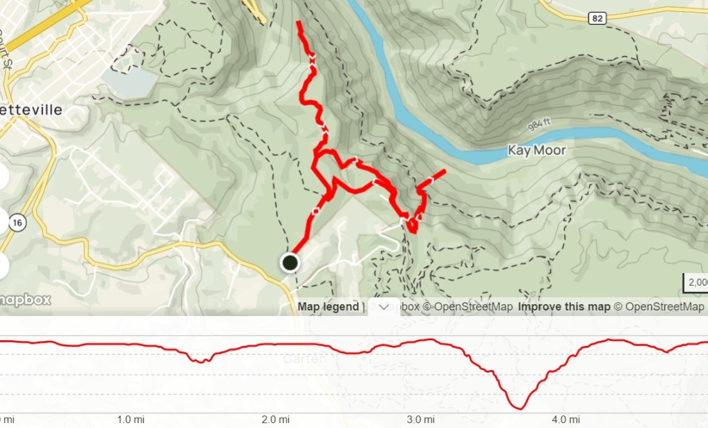
Length: 5.3 miles
Elevation Gain: 1470ft
Difficulty: Difficult
Time: 3-3.5 hours
Trail use: Hiking Only (Long Point open to bikes)
Parking: Large Lot, pit toilets
H&H: 4/5

Long Point Trail is another of the most popular hikes in New River Gorge. It is located on the Fayetteville side of the park, about 5 miles away from the Canyon Rim Visitor Center. Although it has a larger parking lot than Endless Wall, I can still foresee it filling up on super busy days. There are several different trails that can be accessed from this parking lot, including Timber Ridge Trail. 

Since we did a combination of trails to make a larger loop, I’ll talk about the two main trails individually and then recommendations on how to combine them. Truthfully, I wouldn’t necessarily recommend doing these two trails together as the Kaymoor Miners Trail is fairly difficult on its own. But if you’re up for a challenge and have plenty of water, go for it! 

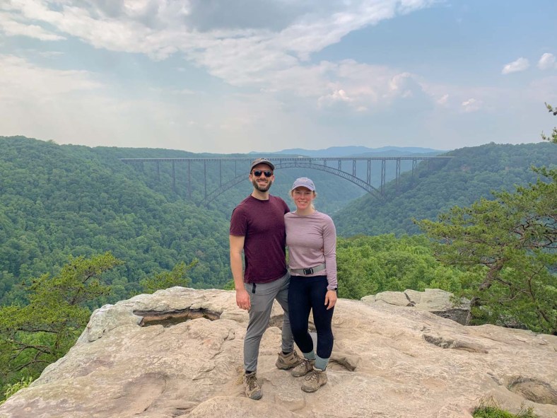
The Long Point Trail is a 3.0 mile out and back trail with little elevation changes and some more technical rocky parts. It is open for hiking, leashed pets and mountain biking but bikers should be aware that the last 0.2 miles of the trail is closed to bikes. Conveniently, there is a bike rack placed so that bikers can still walk out to see the viewpoint. Which you are definitely going to want to see, this is arguably the most incredible view in the entire park. It’s an amazing feeling to walk out of the trees and suddenly be on an outcropping surrounded by so much blue sky and so many trees! 

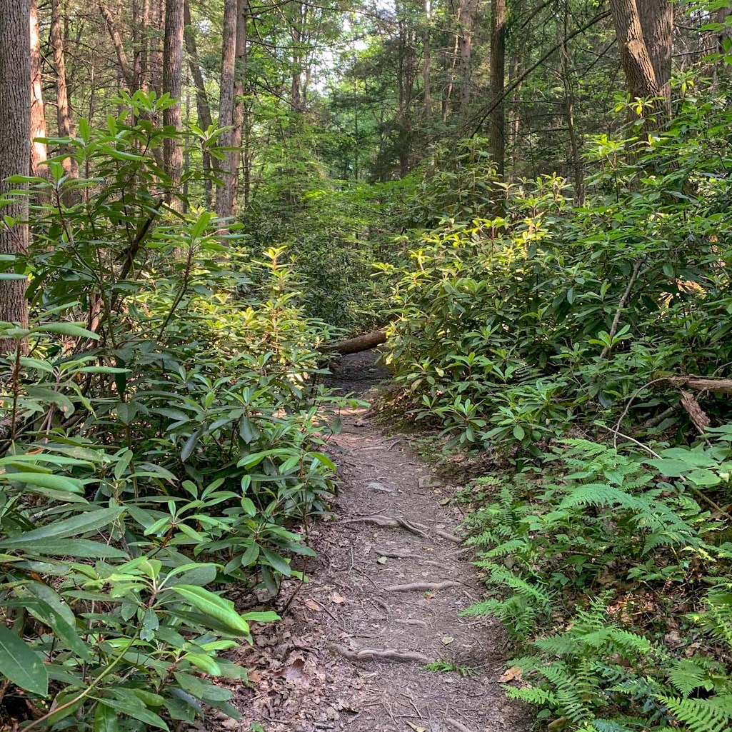
This trail is fairly easy and we encountered many families enjoying the hike. The trail starts out very wide and there are some wildlife viewing platforms that look out over grassy fields. Soon though, the trail dips into the forest. There are plenty of interesting interpretive signs along the route to teach about ecology. Along this trail, you will encounter some offshoots for other trails, but if you are heading to the lookout, you can stay straight. One of the great things about this trail is that you don’t have to hike up a mountainside for the view! In fact, the trail actually slopes downward as it heads towards the view. The most difficult hiking is nearest to the overlook, with some rocky steps that people with ability restrictions might find difficult. However, I still give this trail a moderate difficulty rating. 

Make sure to really take your time at the overlook and see it from all angles! Also please be patient as you may have to wait your turn for a quintessential picture with the bridge in the background. After you’re ready to continue, start back along the Long Point Trail. After about 0.7 miles, you’ll come to a branch in the trail. Staying on the Long Point Trail takes you back to the parking for an out and back of 3.2 miles. However, if you want to continue to the Kaymoor Miners Trail, bear to the left to get on the Butcher Branch Trail which heads down into a valley. You’ll find much more solitude on the section of the trail. Eventually, this trail will end at the Kaymoor parking lot where there are pit toilets but no running water. Continue through the parking lot and the Kaymoor Miners Trailhead will be on the left. 

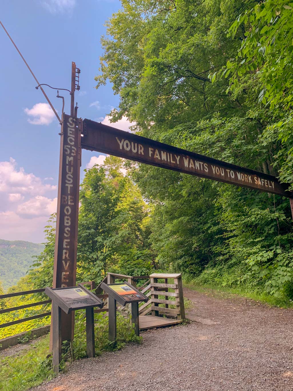
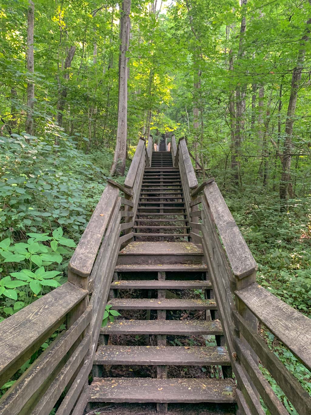
Before heading out on this part of the trail, please don’t let the short distance fool you. This is a strenuous hike with nearly 1000ft of elevation gain and trekking up and down 821 steps. I highly encourage you to check it out because the history is fascinating but please only undertake this if your fitness level is up for it, you have proper footwear, and are carrying enough water. From the trailhead, the path immediately starts downhill. The wooded path is narrow and you will encounter a lot of others on the trail. Remember that hikers coming uphill have the right of way! As you climb down the mountainside, there are some beautiful spots of flowing water. About halfway down, you’ll encounter a larger trail called the Kaymoor Trail which is a long point to point trail that intersects with the Kaymoor Miners trail. This is a great spot to catch your breathe and read up on the history of the spot. From here, you’ll descend down the 821 steps, following along the old mining route to abandoned ruins of the mining site. Please be aware that this area is not maintained by the park service and you should exercise caution while exploring. The official trail ends at the end of the stairs but there are clear community foraged paths around the structures. Personally, I found the building to be rather spooky so I didn’t get too adventurous poking about. A warning, this trail does NOT go all the way to the New River and there is an active railroad at the bottom. Please do not ever walk on active rail lines! 

So now the fun part: getting back up the stairs. Let me tell you, I don’t care how fit you are, this is going to be a challenge. Take as many breaks as you need, there’s no shame! Thankfully, we had this section of the trail to ourselves so no one had to listen to our ragged breathing. Once you get to the top of the stairs, take a nice break because the elevation just keeps climbing until you get back to Kaymoor parking lot. If you only hiked the Kaymoor Miners trail then congrats, you’re done! If you parked at Long Point, I hate to say it but you’ve still got more to go. Head to opposite end of the parking lot and get on the Fayetteville Trail. Take this for 0.6 miles until it meets back up with the Long Point Trail. From there, it’s only 0.4 miles back to the parking lot. Thankfully the section of trail from Kaymoor to Long Point parking lots is fairly flat and easy!

All in all, this loop combines the best viewpoint in the park with the fascinating history of coal mining in Fayetteville. These are must-do hikes while in New River Gorge, but definitely require sturdy footwear and plenty of water and snacks. This is also a hike that I strongly recommend having a change of socks and shoes in the car!

THE BEER: Bridge Brew Works

Address: 335 Nick Rahall Greenway, Fayetteville, WV 25840
Distance from Trail Head: 4.7 miles, 8 mins 
Website: www.bridgebrewworks.com
Food?: BYOF, Food Trucks
Details: Outdoor seating, dog friendly

If you find yourself a little parched after that hike, I’ve got the perfect place for you! Just under 5 miles away, is the small brewery Bridge Brew Works. While they’ve been producing beer since 2010, they were able to open their space to the public in 2018. This is a unique brewery space because it’s entirely outside with a huge covered patio and a large uncovered patio with lawn games and firepits. While we were visiting, they were also working on another covered patio space! Because of the backyard vibe of the brewery, they are only open March thru December. Bridge Brew Works makes a lot of different types of beer, but they specialize in Belgian-style brews while also making seasonal favorites. Their two headliner beers that can be found on tap all season, as well as in local distributors are the Mountain Momma Pale Ale and the Long Point Lager. I love being able to have a beer named after the hike I just did, so the Long Point was a no-brainer choice! We also enjoyed the Mountain Momma and the New River IPA which paired perfected with kicking back in an Adirondack chair next to a firepit. 

I really wish we had more time at this brewery because its laid back charm was right up my alley. This will 100% be on my list for our next trip to Fayetteville!

Our Beer:

  • Mountain Momma – Pale Ale – 5.5%
  • New River – IPA – 6.6%
  • Long Point Lager – Lager – 4.6%

Looking for more Hikes & Hops in New River Gorge? Check out Grandview Rim & Weathered Ground Brewing and Endless Wall & FreeFolk Brewing

New River Gorge: Endless Wall Trail & FreeFolk Brewery

Fayetteville, WV

So excited to finally share the first of many Hikes & Hops guides to New River Gorge! First up is the stunning Endless Wall which is an easy loop not far from the park’s main visitor center. This trail is so full of stunning overlooks that you won’t want to put down your camera. The trail is one of the best places to get a photo of the Gorge. Keep in mind that this is a very popular hike and you’ll want to get there early to get a parking spot. After a day exploring the park, head over to  Freefolk Brewery which has a delicious lineup of beer, a full menu, large indoor and outdoor space, and frequently has live music. What more could you want?

THE HIKE: New River Gorge NP: Endless Wall Trail

Length: 2.9 miles
Elevation Gain: 400ft
Difficulty: Easy to Moderate
Time: 1-1.5 hours
Trail use: Hiking, leashed pets
Parking: Small lot that fills up quickly, pit toilets
H&H: 5/5

New River Gorge is the nation’s newest national park and it’s only about 3.5 hours away from downtown Pittsburgh. It’s a great weekend trip from Ohio, Western PA, and Virginia. Or make it a stop on a road trip to other Eastern national parks, like the Great Smoky Mountains (TN/NC), Shenandoah (VA), or even Congaree (SC)! New River Gorge is a sprawling park that encompasses over 70,000 acres of land along a 53-mile stretch of the New River in West Virginia. The main visitors center (along with the iconic bridge spanning the gorge) can be found in Fayetteville, WV which is a haven for outdoor lovers. Although only designated as a national park in 2021, this area has been protected by federal law since 1978. For many years, it has been a destination spot for outdoor lovers, especially those seeking the thrill of white water rafting or rock climbing. There’s even one day a year where the bridge is closed to traffic and daredevils are allowed to BASE jump into the gorge! 

The most popular area of New River Gorge is the area surrounding the main visitor center, Canyon Rim. This is a great place to start your visit. You can see views of the bridge, get acquainted with the map, chat with the rangers, and, of course, stamp your national park passport! From there, the Endless Wall trailhead parking lot (called Fern Creek parking)  is just a quick 5 minute drive (1.9). However, this is a very popular spot for hiking, so be prepared to share the trail and the parking lot! If you can, try to arrive early to avoid the crowds. There is parking for about 20-25 cars in the main lot and be aware that you cannot park along the road, even if you see people doing it! If the first lot is full, just head down the road about 0.5 mile and there’s another, larger parking lot. It appears on Google Maps as Nuttall Parking lot.  You can start the trail at either lot, just know that you’ll need to do some road walking to complete the loop. Thankfully, the shoulder is very wide and the road isn’t busy. You could also just turn around and do the trail in the opposite direction if road walking doesn’t appeal to you! 

This is an easy to moderate hike that is good for people of all ages. There’s moderate elevation change (~500ft) but it comes gradually. Expect to encounter some minor obstacles on the trail like roots and rocks but there’s no scrambling. Best to leave the stroller in the car though! All the trails in New River Gorge allow leashed pets. 

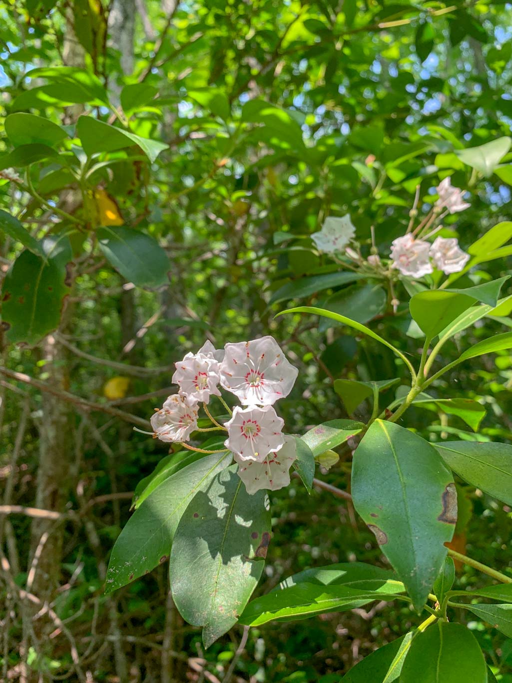
The beginning of the trail leads through dense forests of hemlocks and rhododendrons and mountain laurels which are stunning in the spring. We just missed mountain laurel season, but managed to see a few late bloomers. After a bit, you’ll cross a small bridge to pass over Fern Creek. From here you’ll meet up with the rim of the gorge. The trail is peppered with rocky outcroppings that offer beautiful views of the surrounding area. Even though this trail is popular, it’s likely that you’ll still find a small place to yourself to enjoy the views. If starting at the Fern Creek parking lot, the main overlook is the last one you’ll encounter. There’s a large rocky outcropping where you can see both up and down the river (not quite to the bridge though). Make sure to really take your time here, it’s a spectacular spot! This is a good place to turn around if wanting to head back to the Fern Creek parking lot via the trail or you can continue on for a bit longer to the Nuttall lot and then walk along the road back to your car. The one advantage of completing this as a loop is not going against the crowd back to the parking lot. 

Endless Wall is just the first of many awesome hikes that we did in this area so stay tuned!

THE BEER: Freefolk Brewery

Address: 1690 Court St, Fayetteville, WV 25840
Distance from Trail Head: 5 miles, 9 mins     
Website: http://www.freefolkbrew.com/
Food?: Full Menu 
Details: Outdoor seating, dog friendly outside

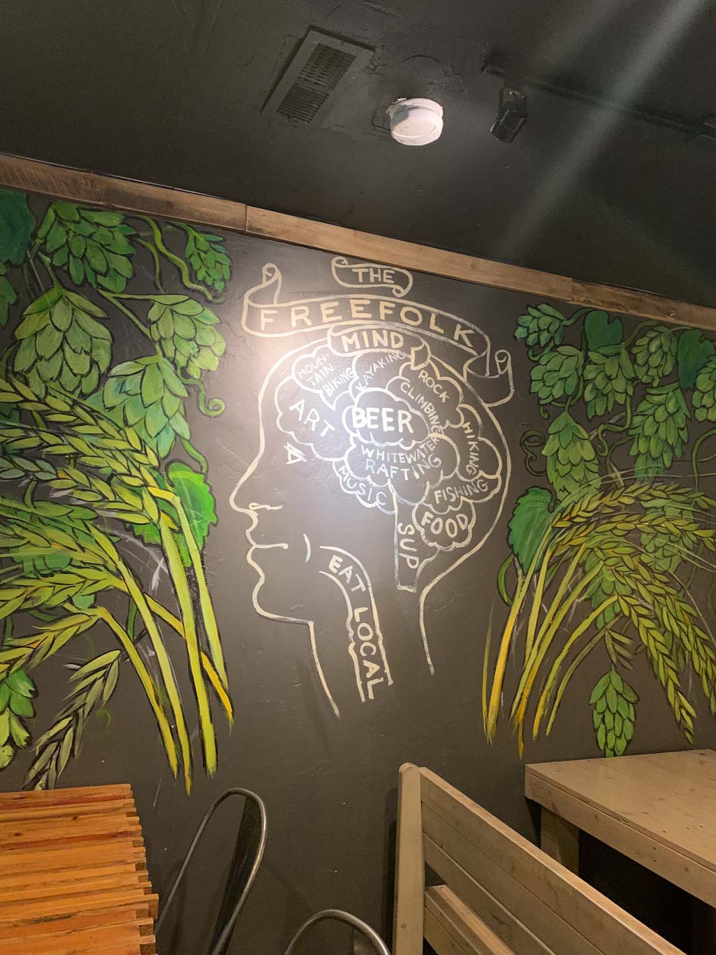
Freefolk is an awesome brewery in Fayetteville, WV less than 10 minutes from the Canyon Rim Visitors Center. They’ve got a large space with indoor and outdoor seating, with stages for live music in both. In addition to a large taplist, they have a small kitchen menu with filling pub treats like gyros and pepperoni rolls. We particularly liked their outdoor space, which seemed like a great place to bring your family and/or pets. The vibe is very laid back and after a long day of hiking, it was honestly hard to get ourselves to leave! Also make sure to check out the wall art around the building, it’s pretty rad. If checking out this brewery, just be aware that the parking lot is across the street!

In addition to the Fayetteville location, Freefolk also opened a larger brewhouse about 12 miles north in Hico, which also has a taproom, although no kitchen here. Some fun stuff about Freefolk: they have a mug club where you get your own handcrafted ceramic Folk stein with a whimsy face on it! I was very tempted….

Our Beer:

  • Orange Oswald – IPA – 5.2%
  • Berry the Hatchet – Wheat Beer – 4.5%
  • Brewing Judo – NEIPA – 6.7%
  • Gorgeous 876 – Pale Ale – 5.4%

Looking for more Hikes & Hops in New River Gorge? Check out Grandview Rim & Weathered Ground Brewing and Long Point & Bridge Brew Works.
Moraine State Park & Union Brothers Brewing

Portersville, PA

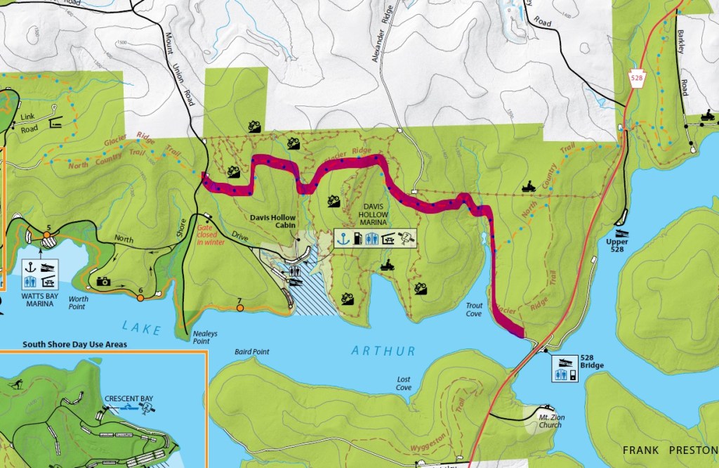
Most people associate Moraine State Park with boating and fishing, but did you know that there’s also nearly 30 miles of hiking and biking trails? Glacier Ridge Trail is popular for backpacking but can also be done as an out and back section, choosing how far you want to go. This particular section starts at the parking lot on Mount Union Road and turns around at the 528 Bridge for just over 7.2 miles. After working up a sweat on this trail, back into Harmony for a refreshing brew at Union Brothers either in their full-kitchen taproom or in their cozy outdoor patio.

THE HIKE: Glacier Ridge Trail (Moraine State Park)

Length: 7.25 miles
Elevation Gain: 1350 ft
Difficulty: Moderate
Time: 3.5 hours
Trail use: Hiking, leashed pets
Parking: Gravel pull off for a few cars on Mt. Union Rd
Parking coordinates: 40.96781939719753, -80.07996200282916
H&H: 5/5

Moraine State Park is located in Portersville, PA only a few miles away from McConnells Mill State, another of my recent treks. Although these two have been affected by a similar geological history, they are rather unique from each other! Moraine is mainly characterized by the 3,000 acre Lake Arthur, which is why it is (justifiably) known for its draw to outdoor water sports and fishing. However, there’s lots of unique history behind that lake and its nearby trails.

History

Moraine State Park gets its name because of the four separate glaciers that reached their northernmost extent just shy of Moraine State Park. Glaciers are huge ice sheets that covered much of the Earth during the Ice Age. Because of the way glaciers move, they trap and move rock and other debris. When they melt and recede, this debris is left behind, often creating ridges known by geologists as moraines. While hiking through this park, you can see evidence of these glacial deposits in the huge boulders and stone that seem to emerge out of nowhere. As I’ve mentioned before, this glacial freeze and thaw cycle is also what created the incredible Slippery Rock Gorge at McConnells Mill! At one point in time, ice dams caused the creation of glacial lakes throughout the region. Although the current Lake Arthur is manmade, it is a replica of the glacial Lake Watt that once dominated the area. 

Because of the unique glacial deposits, settlers to the region found it rich with mineral deposits. The mining industry grew throughout the 1800s until much of the area was depleted of resources and left polluted. For many decades, the area was left completely abandoned. But thanks to the efforts of researcher and naturalist Frank W. Preston (founder of the Western PA Conservancy), who recognized the uniqueness of the land, efforts were made to seal abandoned mains and restore the natural landscape. 

One of my favorite things about this blog is being able to learn the history behind the trails I hike. I’ve lived in Pittsburgh most of my life, and never knew that Moraine wasn’t a person’s name but rather a geological term. Learning more about the geological history of the area, really gives greater depth to enjoying the areas we hike. It’s one thing to hike a trail called Glacier Ridge and another to understand why it’s called that! 

The Trail

Okay, enough waxing poetic about geology (can you tell that I used to study archaeology?). Let’s get into this trail. Glacier Ridge is a 14.8 mile point to point trail that runs through the woods along the northside of Lake Arthur. It’s part of a small section of the 4,800 mile North Country Scenic Trail that runs from North Dakota to Vermont.  Glacier Ridge is popular with backpackers and there are shelters that can be booked through the PA DNR website. Please note that you must have a permit to backpack! For more info about backpacking in Moraine, check out My Trails Are Many for a great overview of her experience. For those just looking to day hike, there are several access points to the Glacier Ridge trail in Moraine: PA 528, Mount Union Road, the bike rental, and McDanels Launch Area. For our trek, we parked at the small gravel pull-off on Mount Union Road which is small, but on a sunny Sunday, we were the only ones there! Be aware that there is also a larger parking lot for the bike trails on Mount Union before you hit this lot but that’s not where I recommend parking! 

Immediately after starting the trail, it dips down to a peaceful pond that would be the perfect secluded fishing spot. Honestly, I could have spend the rest of the day lazing around this pond! From there the trail meanders through the woods, sometimes  crossing over small bridges and heading up rocky inclines. For most of the trail, you’ll be staying on the blue blazes for the NCT/Glacier Ridge Trail. Do not follow any of the signs for the bike trails or the marina! After about 3.5 miles, the North Country trail splits off and continues north but you’ll want to stay on the Glacier Ridge Trail, which is now white blazed. Now, the trail hugs directly next to the lake, so there’s plenty of gorgeous photo opportunities. Finally, the trail hits the PA 528 bridge which is where we decided to turn around. Feel free to continue on if you’ve got the time and stamina! As always, make sure to leave enough daylight to make the return trek. 

Other Things to Do

A trip to Moraine is a great day trip from the city! Aside from hiking, you can also get out on the water. There are 9 public boat docks and engines up to 20 horsepower are allowed. You can also rent pontoons, motorboats, kayaks, canoes, and rowboats. Swimming and fishing are also popular activities at Moraine. If staying on land is more your speed, check out the paved bike trails and also the more intense mountain bike routes. Looking for more to do in Moraine? Check out the PA Department of Natural Resources and the Butler County Tourism site. 

THE BEER: Union Brothers Brewing

Address: 365 Mercer Rd, Harmony, PA 16037
Distance from Trail Head: 18 miles, 22 mins 
Website: http://unionbrothersbrewing.com/
Food?: Full Menu
Details: Outdoor seating; Dog Friendly Outside

Union Brothers Brewing is a fairly recent addition to the thriving Zelienople beer scene. Friends Zachary Waltz and Jeremiah Cain began homebrewing together and perfected their craft for many years before opening a taproom. But once they did, it quickly outgrew the demand for their lineup of sours and hazy IPAs. The team has already expanded once to a larger taproom and greatly expanded their brewing capacity. From the stunning wall art by local graffiti artist Max Gonzales to its physical location across the street from the Steamfitters Union, Union Brothers is a celebration of the region’s industrial past and present. Both brewers are proud members of their local union and felt the name fit! You’ll find yourself right at home at Union Brothers whether it’s in the hip taproom or sitting around picnic tables and fire pits outside. A full food menu caps Union Brothers off as the perfect place to unwind. 

We’ve been to Union Brothers twice now and have had an awesome experience both times. It feels like the perfect neighborhood joint, whether you’re from the area or just passing through. Having an excellent taplist doesn’t hurt either! I’ve heard rumors that Union Brothers is set to expand again soon, having purchased the old nearby Moose Lodge. I’m looking forward to seeing these guys just keep getting bigger and better!

Our Beer:

  • Short Break – Hazy Pale Ale – 4.7%
  • Black Forest Hills – Dark Lager – 6%

Looking for more Hikes & Hops north of Pittsburgh? Check out Wolf Creek Narrows & Big Rail Brewing, McConnells Mill & Shubrew, and North Park & Cinderlands

NCT PA Border & Ill Will Brewing

Columbiana, OH

Sometimes you’ve just gotta get out of town! I love some of the little towns just across the PA border in Ohio and this is the perfect Hike n Hop to do before a day of exploring. This hike starts at Mile 0 of the PA portion of the North Country Scenic Trail and meanders through woods and fields, making for a lovely spring hike. Afterward, you can head into Ohio towards Columbiana and grab a beer at the sprawling Ill Will Brewery. I highly recommend sitting outside. From there, have a lazy day exploring the shops and cafes of downtown Columbiana!

THE HIKE: North Country Trail – PA Border

Length: 5 miles
Elevation Gain: 545 ft
Difficulty: Moderate
Time: 2 hours
Trail use: Hiking, backpacking, leashed pets
Parking: Small trailhead off PA 251. Blink and you’ll miss it!
H&H: 4/5

Somehow, I only learned about the North Country Trail this year! While not as well-known as some of the other multi-state trails, the North Country Trail has a lot to offer! It passes through 8 states, spanning from North Dakota to Vermont. If you’re thinking That’s a lot of miles, you’re right! Nearly 4,800 to be exact. Some fun facts about the trail from the NCT website include that it passes through:

  • 10 national forests
  • 4 NPS areas
  • Over 100 state game lands
  • Along 3 Great Lakes

We are lucky to have some incredible sections of this trail here in PA and I had hiked on them before without even realizing it! In PA, the NCT passes through McConnells Mill State, Cook Forest State Park, and Moraine State Park, as well as through a huge section of Allegheny National Forest. All in all, the trail winds along 265 miles of our great state of PA!

The NCT was established in 1980 by Congressional order as an amendment to the National Trails System Act. While it is administered by the National Park Service and managed by state and local agencies, the trail is primarily built and maintained by volunteers. The North Country Trail Association is a nonprofit with many affiliate chapters who care for individual sections of the massive trail system. When it was created, the NCT linked together several existing trails, so don’t be confused if you see it referred to as multiple names. For example near Cook Forest, the NCT links up to part of the 138-mile Baker trail. 

At mile 0 of the PA section!

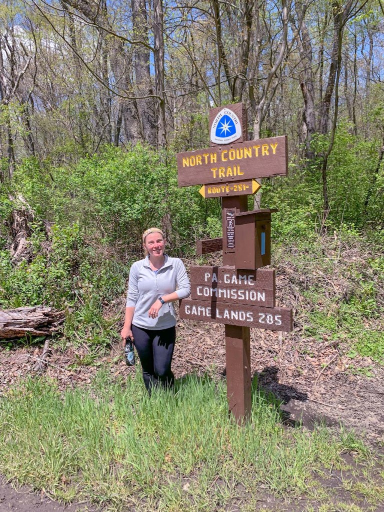
This short out-and-back section of the NCT starts at the PA/OH border. There is no parking right at the border, although you may spot the sign along PA-251 (Blackhawk Rd). The parking lot is a small pull out a bit further down the road on the PA side. We definitely drove right past it and had to backtrack. The parking area is not on Google Maps but if you type in the coordinates: 40.773190, -80.513930, it should get you close enough! Coming from PA, the pull-off will be on your right and if you’ve passed into OH, you’ve gone too far! The parking area is about ΒΌ mile away from the start of the NCT but there is a nice little connector path from the parking lot. Be warned, there are no port-a-potties at the trailhead. Also this trail goes through State Gamelands, so be aware of hunting seasons and wear your orange! 

If you are doing this hike with a group or friend, a great idea would be to bring two cars so you can do a point-to-point hike, leaving your car at the Border parking and picking one of the other parking lots along the trail. This is a great way to see more of the trail and not have to double back! Plus you can decide how far you want to travel. Fun fact: It’s about 35.5 miles from the PA/OH border to Hell’s Hollow in McConnells Mill State Park! Maybe a bit much for a day hike though. 

Since we only had one car, we did a nice little out and back for a total of 5 miles. The turnaround spot is not well-marked nor distinctive, so just keep an eye on your mileage if you’re looking to total around 5 miles. We really enjoyed this hike because although it started on a roadside, you quickly feel lost in the woods. The path meaders up and down hillsides, keeping the elevation interesting. SInce we did this hike in spring, there were lots of delightful wildflowers poking through the underbrush. What a thrill to finally see some green on our hikes again! This trail also broke out onto grassy meadows for some stretches, which was beautiful but also be sure to check for ticks afterward and bring lots of water. Those sunny meadow stretches can get much warmer than the woods! 

One final thing, be very careful pulling back out onto the road after your hike. PA-251 is a fast road and it’s a bit difficult to see around you. 

If you’re making a day of it, after this hike head over to OH and explore Columbiana! 

For more info about the North Country Trail, check out the website here

THE BEER: Ill Will Brewery

Address: 45417 OH-14, Columbiana, OH 44408
Distance from Trail Head: 12.2 miles, 20 mins 
Website: http://www.illwillbrewing.com/
Food?: food trucks, BYOF
Details: Outdoor seating, dog friendly outside

If you live in Pittsburgh and you haven’t been to Columbiana, OH, you are missing out! J and I love finding new little towns to explore and Columbiana is one of our favorites. There really is something for everyone! Hiking (see above), breweries, antiquing, farm markets, plant nurseries, cafes, bakeries, and more! We love to grab a coffee from Generations, a sweet treat from Hogans, and then roam through the many shops and antique stores. You never know what you’ll find! 

Surprisingly for such a small area, they got not one but two awesome breweries! Either one would be a great choice for after your hike (or why not both?) but for this post, I’m going to focus on Ill Will Brewery. This is a fairly new addition to the area and they really live by the idea that bigger is better. Also the brewery has only been around since 2021, their space has grown to include a large taproom and a huge patio. Also onsite are two Airbnbs, an event space, and the future brick and mortar location for the Smokeworks food truck. Seriously this is not a place to miss! For me, the patio is really where this brewery shines. They’ve got firepits, giant lawn games, and honestly just a beautiful sunny view. It’s a great place to watch the sunset! 

Ill Will also makes some pretty interesting beer. Half their taplist is the more traditional, hop-forward brews one would expect. But the other half of the list is where things get fun. They experiment with different smoothie sours and seltzer flavors, some cool and refreshing, others tasting almost like a milkshake. They often have some of the more fruity beer available as a slushie! On a nice hot day, that would really hit the spot. 

Our Beer:

  • No Sleep Til Brooklyn – New Zealand IPA – 7%
  • Ether – NEIPA – 6.5%
  • Instigator – Doppelbock – 9.2%
  • Mean-Mugged – Hard Seltzer – 6.66%

RCT Training Hike #3 – Raccoon Creek State Park

Hookstown, PA

The training continues! This time, we ventured west of Pittsburgh to do a big loop in Raccoon Creek State Park. This is not only one of my favorite parks near home but honestly one of my favorites ever! It really has everything: waterfalls, a lake, wildflower preserve, backpacking shelters, campsite and more. If you haven’t been to Raccoon, you need to go ASAP. Especially since this is prime time for wildflowers!

THE HIKE:Β Raccoon Creek Loop – Heritage, Appaloosa, and Forest trails

Length: 12 miles
Elevation Gain: 1500 ft
Difficulty: Moderate
Time:Β 5 hours
Trail use: Hiking, leashed pets,
Parking: Lot at Park Office
H&H:Β 5/5

For this hike, we did a 12 mile loop starting at the Park Office and traveling along the Heritage, Appaloosa, and Forest trails. Almost immediately, we were able to stop and see Frankfort Mineral Springs Falls, one of the highlights of the park. From the park office, head along the Mineral Springs trail and in just 0.5 miles, you’ll be able to take the mossy steps down to the waterfall. It was so beautiful at this time of year, flowing strongly with the recent rain and spring trilliums along the overlook. With such a view, you might be tempted to think that these are the mineral springs. But actually, the springs can be found on the rock wall, where just a small stream of water shoots out of the rock face, splashing onto a stone. The high iron content of the water stains the rock red and the continual dripping has carved out a natural basin in the stone. What an incredible way to start out the hike!Β 

From there, we traveled along the Heritage Trail, enjoying the emerging spring greenery. There’s just something so thrilling about seeing new growth after the long months of muted winter browns and grays. Well, it’s thrilling until my allergies kick in! Despite how popular this park is, we encountered very few people on the trail which made it feel like we had the woods to ourselves. Since the area around Raccoon is so rural,  you really feel far out in nature on this one! 

At this point, our hike was going fairly normal with some muddy spots, lots of chit chatting and some snackage by mile 5. But then the craziest thing happened to us: we heard meowing! Confused, we started looking around only to find a tiny cat about ten feet up on a tree branch! Almost immediately, he made his way down and started meowing at us. He bounded right over to us and was so friendly but didn’t have a collar. Having never encountered this before, we weren’t quite sure what to do! Being 5 miles into a long hike, we didn’t have cell service and weren’t sure we could carry him back to the office. Funny enough though, he seemed pretty content to hike with us for a while. At times I scooped him up when he started weaving dangerously through my legs. At that point, we knew he had to be a lost cat because he was so friendly and was happy to ride in my arms for a while. Finally we were able to get cell service and call the main office. Yes, someone had been calling about a lost cat! We met the ranger at the nearest access road and he was able to take the cat (now known as Major) back to his mom. Betcha didn’t expect a heartwarming reunion story on this hike!

Hearts full, but also missing Major, we got back to our hike. The rest of the trek was far less eventful although we definitely sludged through a fair amount of mud and the rain had swollen some of the creek which made for damper crossings than we expected. I was very glad to have my trusty raincoat for this outing. When you’re hiking at Raccoon, also keep in mind that the trails have different uses, with some being hiking only while others allow mountain biking and horses. Forest and Heritage trails (the majority of this loop) are hiking only but Appaloosa is an equestrian multi-use trail! 

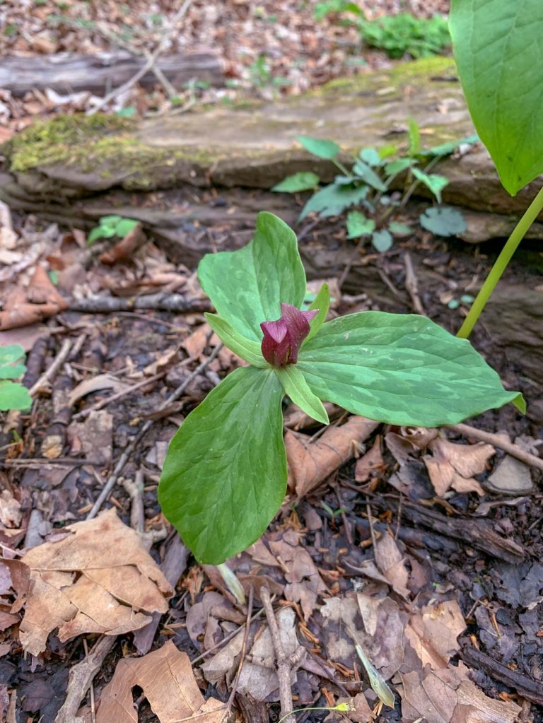
After we finished our main hike, despite being tired and fairly damp from a persistent drizzle, we couldn’t leave without visiting the wildflower preserve. This is one of my favorite spring hikes and I try to visit every year! My suggested route is about 3 miles and starts out on the Jennings trail, passing the log cabin, stays on the Jennings trail until it hits Meadow Trail. From there follow Meadow trail to see the giant sycamores and the bluebells along the creek. Then, you’ll meet back up with the Jennings Trail and this is where you’ll start to see LOTS of wildflowers. There are also some flags and signs letting you know the names of specific varieties. On this trip we saw Virginia bluebells, white and red trilliums, swamp lilies, jack-in-the-pulpit, spring beauties, and so many more. I highly suggest using iNaturalist to track your finds and to learn more about the types of plants you’re seeing!Β 

We didn’t end up doing any “hops” this time around, but if you’d like to make this a true Hike & Hop, head over to Coal Tipple Brewery in Burgettstown. I also wrote a post about it here. They often have food trucks or you can BYOF. If a restaurant is more your speed, I’ve heard good things about the Bavington Roadhouse.Β 

Only a few more training hikes until the big day!Β