Craggy Gardens & Burial Beer Co.

Asheville, NC

Today I want to share two amazing hikes that we did while staying in Asheville, NC. These two short hikes are very close together on the Blue Ridge Parkway, although you do have to drive a short way between trailheads. Definitely go for the views, as you’ll get some incredible sights of the Blue Ridge Mountains and I highly recommend doing the Pinnacle as a sunset hike. Back in Asheville, there’s no shortage of breweries to check out! We suggest pairing it with Burial Beer Company in the Brewery District area of town. Keep your eyes peeled for more hikes from North Carolina in the coming weeks, and don’t worry we’ll be back to hiking in the ‘Burgh asap!

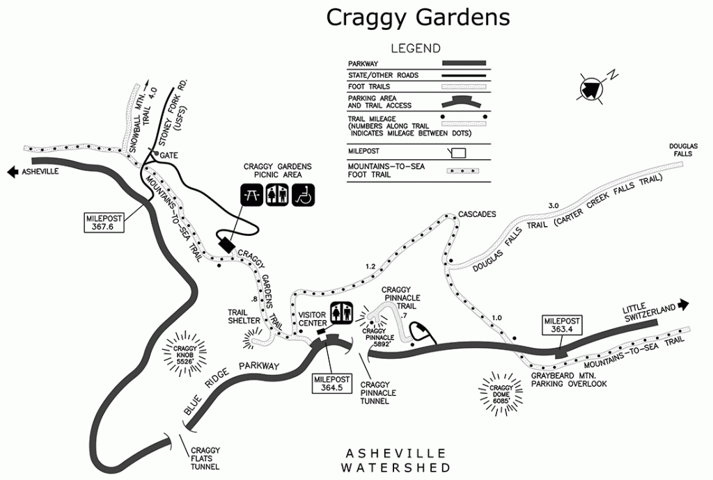
THE HIKE: Craggy Gardens & Pinnacle

Length: 3 miles total
Elevation Gain: 816 ft total
Difficulty: Moderate
Time: 1.5 – 2 hours
Trail use: Hiking, leashed pets
Parking: Large lot at trailhead but fills up quickly
H&H: 5/5

Craggy Gardens and Craggy Pinnacle are actually two different hikes, but they’re so close together that I decided to group them into one! One of the best parts of Asheville, aside from the 29 breweries and world class food, is the proximity to the Blue Ridge Parkway. This meandering road is known for its stunning beauty as it climbs through the Blue Ridge Mountains. It runs for 469 miles, linking Shenandoah National Park and the Great Smoky Mountains. All along the Parkway there are scenic pull offs and hiking paths to explore. 

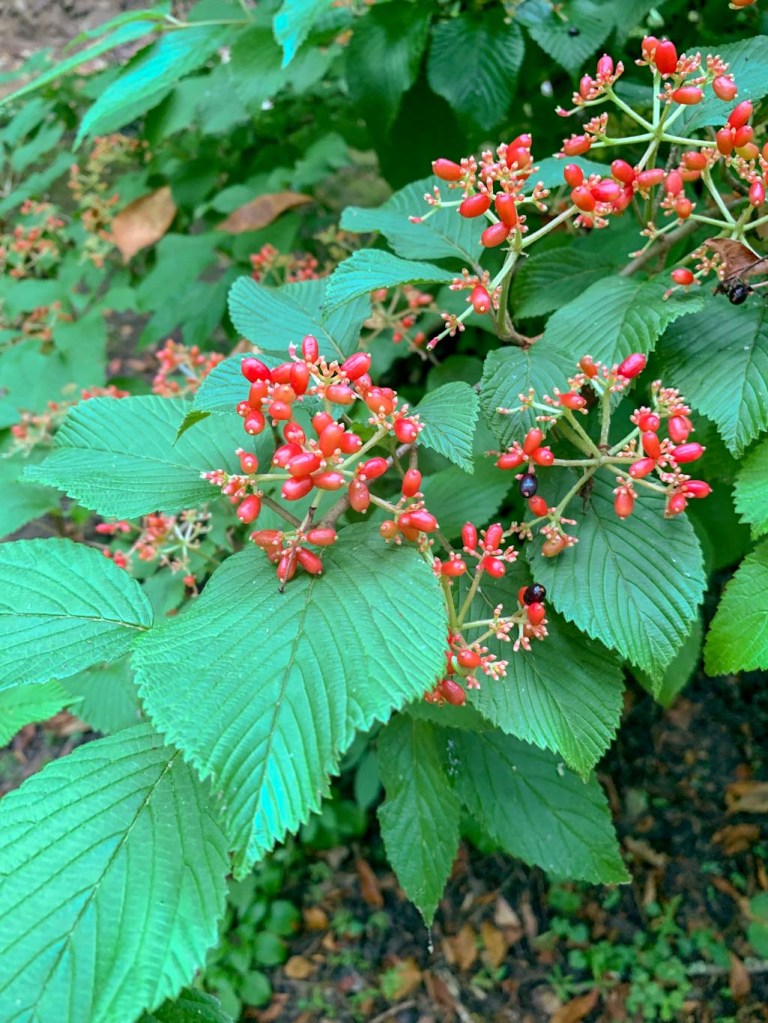
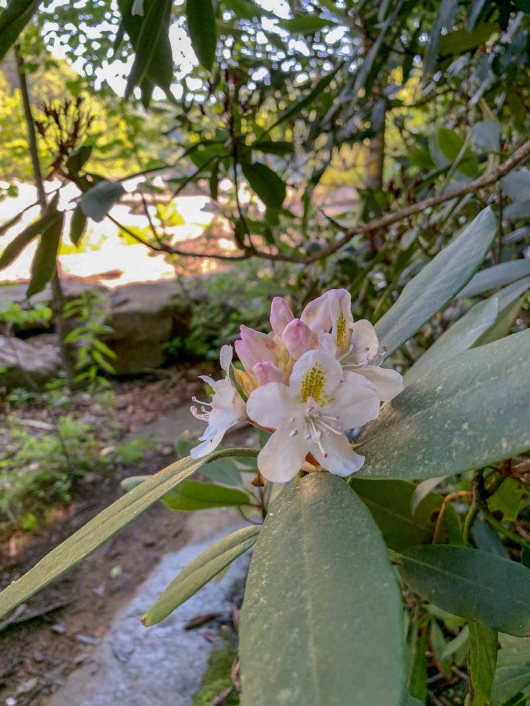
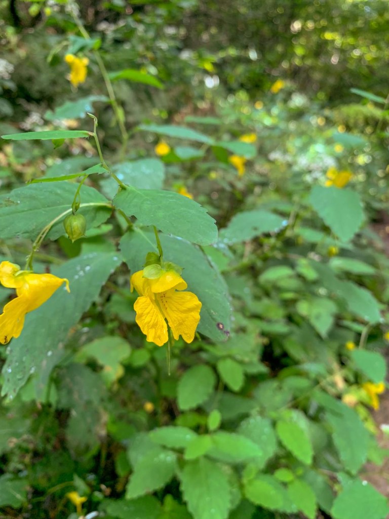
The Craggy Mountains are situated in a particularly high elevation area of the Blue Ridge Mountains. In fact the highest point in the Appalachian and the highest point in eastern North America is only a few miles away! Because of this, they have a unique environment in which catawba rhododendrons flourish. Although we were too late this year, visitors flock to this area in June to see the pink and purple blooms at their peak. The Craggies are only about 30 minutes away from Asheville so this is a great place to check out if you’re staying in town. 

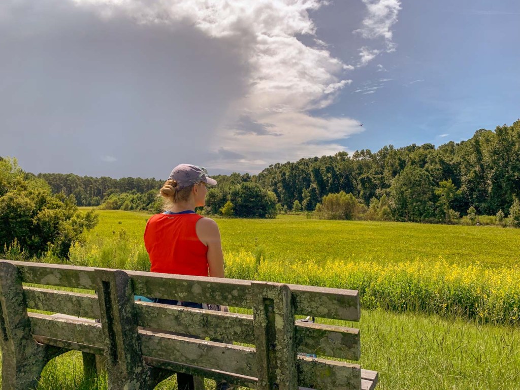
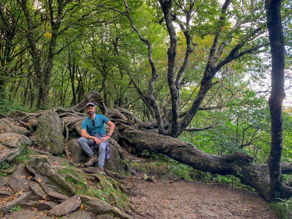
We did this hike our first evening in town! After leaving Hilton Head, we drove 5 hours to Asheville and wanted to do a sunset hike to cap off the day. Craggy Gardens area was constantly mentioned as a great place for views along the Blue Ridge Parkway so we went for it! First, we did the Craggy Gardens loop which was 1.9 miles out and back. You can park either at the Gardens picnic area or at the visitor center for this hike! I’d suggest parking at the picnic area so you build up to the viewpoint at the visitor center. We did the opposite and while the hike was still lovely, it didn’t have the same “wow” factor! 

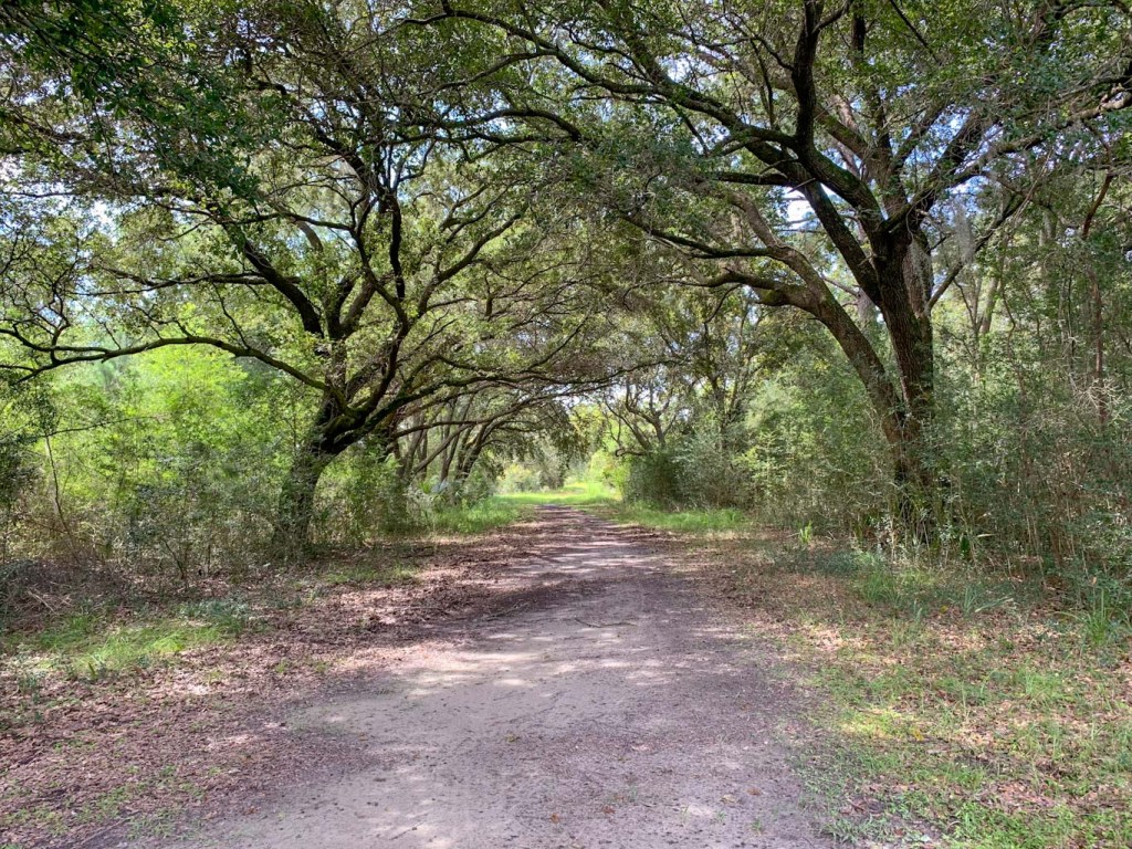
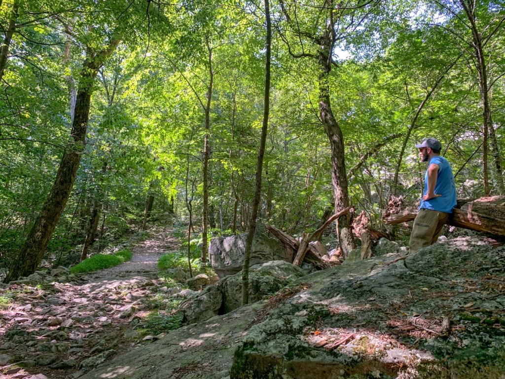
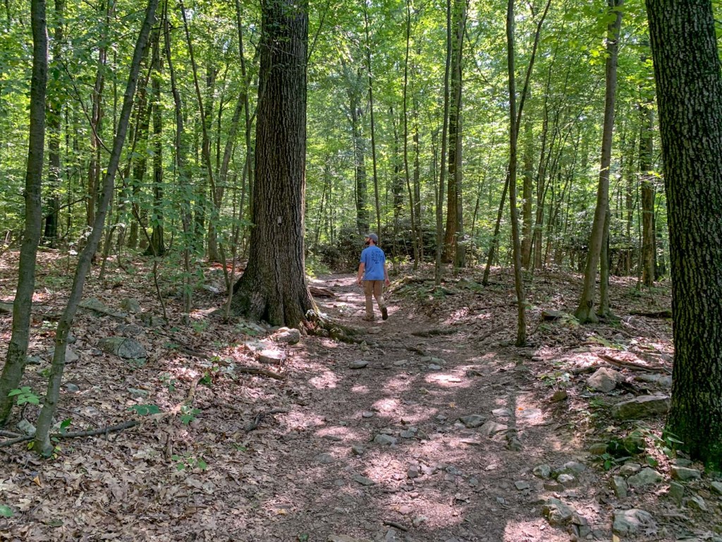
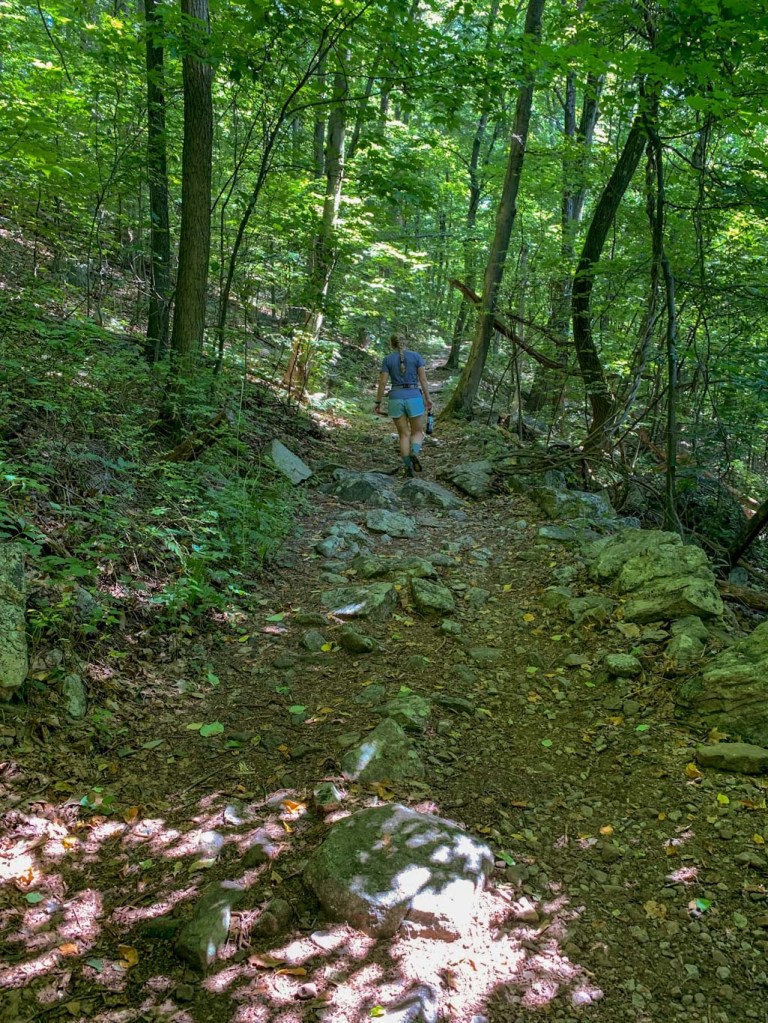
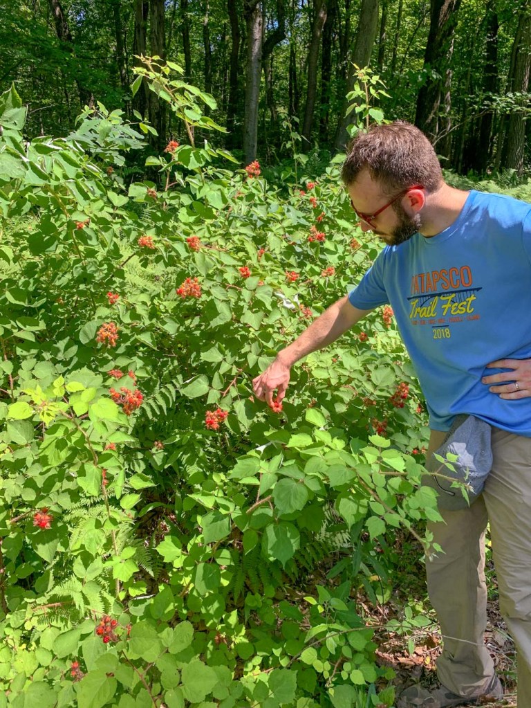
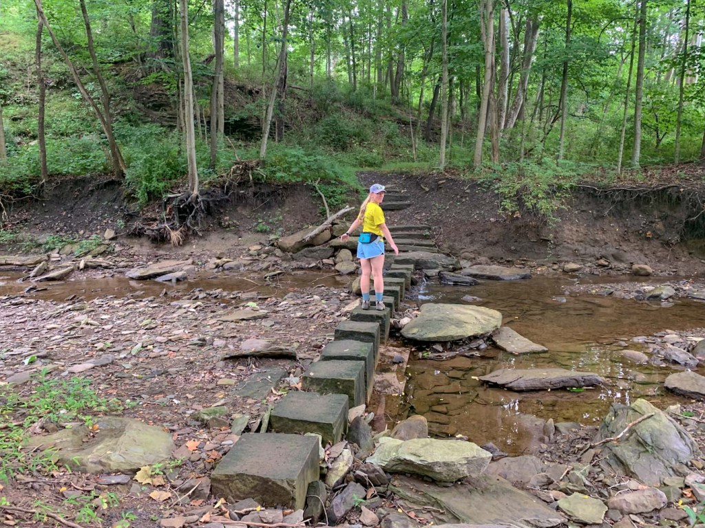
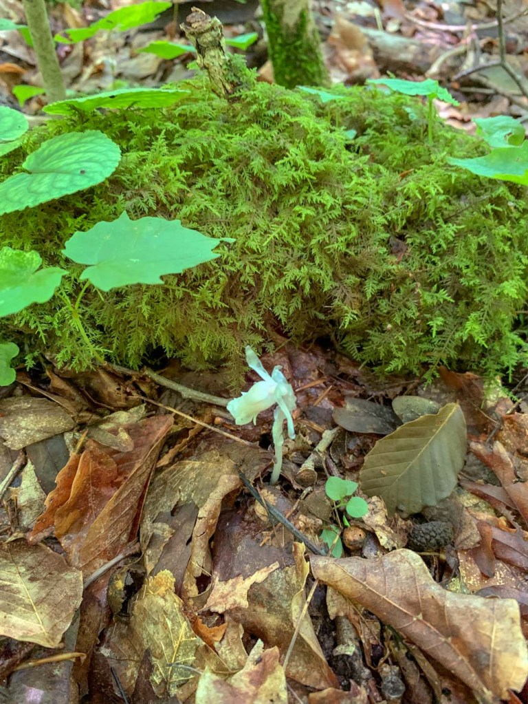
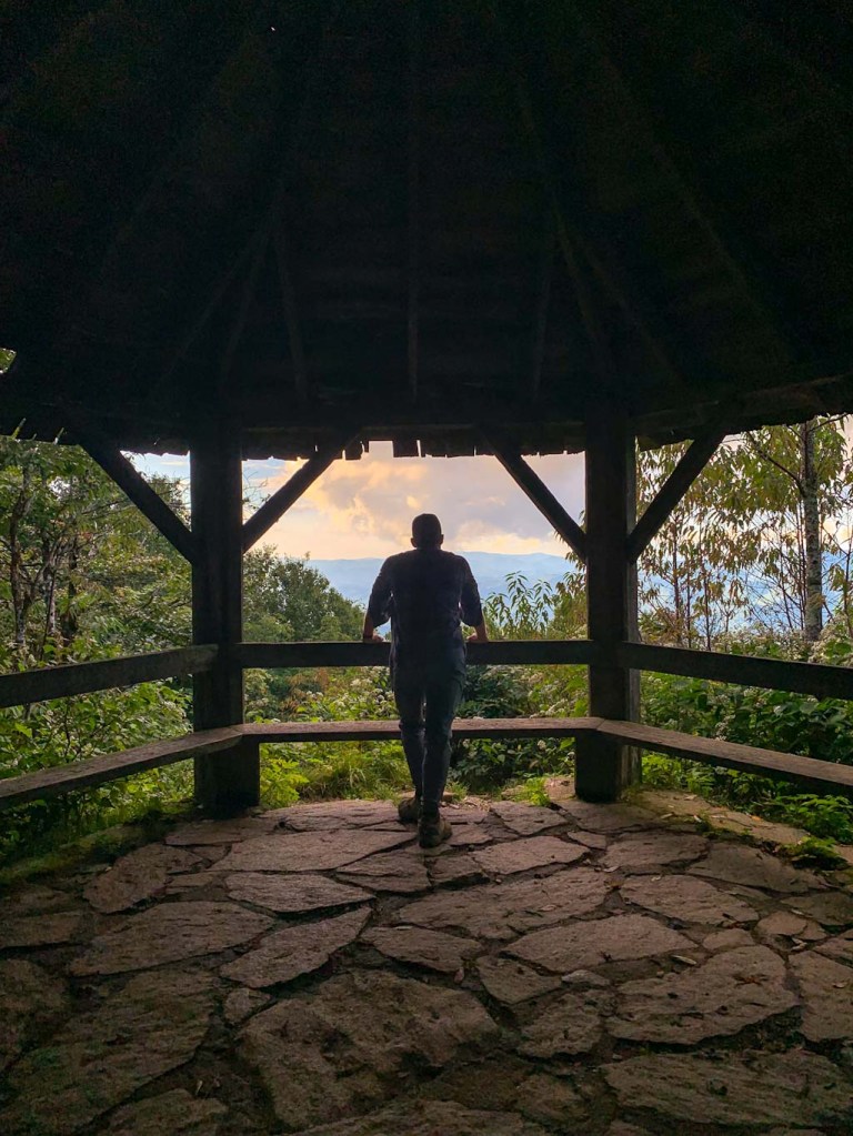
When doing this hike, make sure to wear sturdy shoes and maybe even bring hiking poles! The high elevation causes a lot of condensation so even when it’s not raining, the trails can be quite damp. BUT this also means SO MUCH GREEN. We had a blast on all of our hikes around Asheville hunting for wildflowers and mushrooms and we were not disappointed! Along the Craggy Gardens trail, you’ll also encounter some shelters for backpackers and a delightful gazebo that looks out over the mountains. We also walked through an interesting area called a bald. These areas of unexpectedly little vegetation are common in the Southern Appalachians but no one knows their origin. Unlike an Alpine zone where the lack of tall vegetation is expected, these are environments that could support large hardwoods, but don’t for some reason. It’s so odd to be deep in the woods and then suddenly spill out on a large open area! 

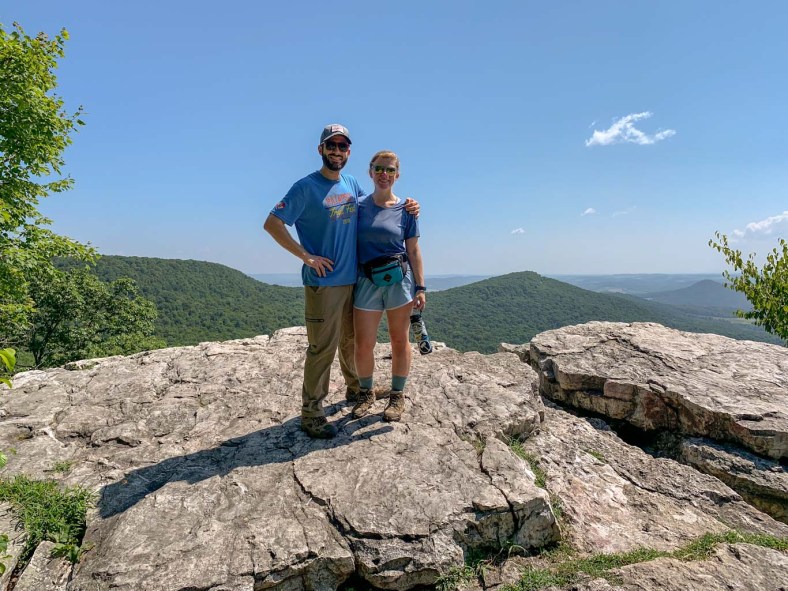
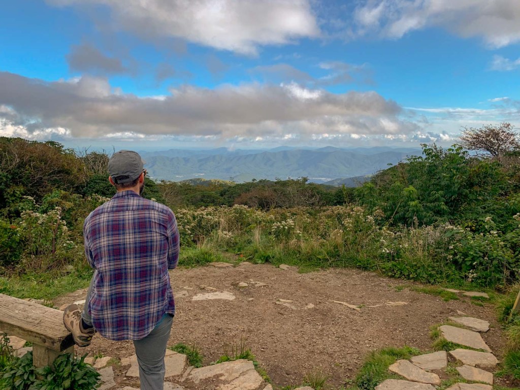
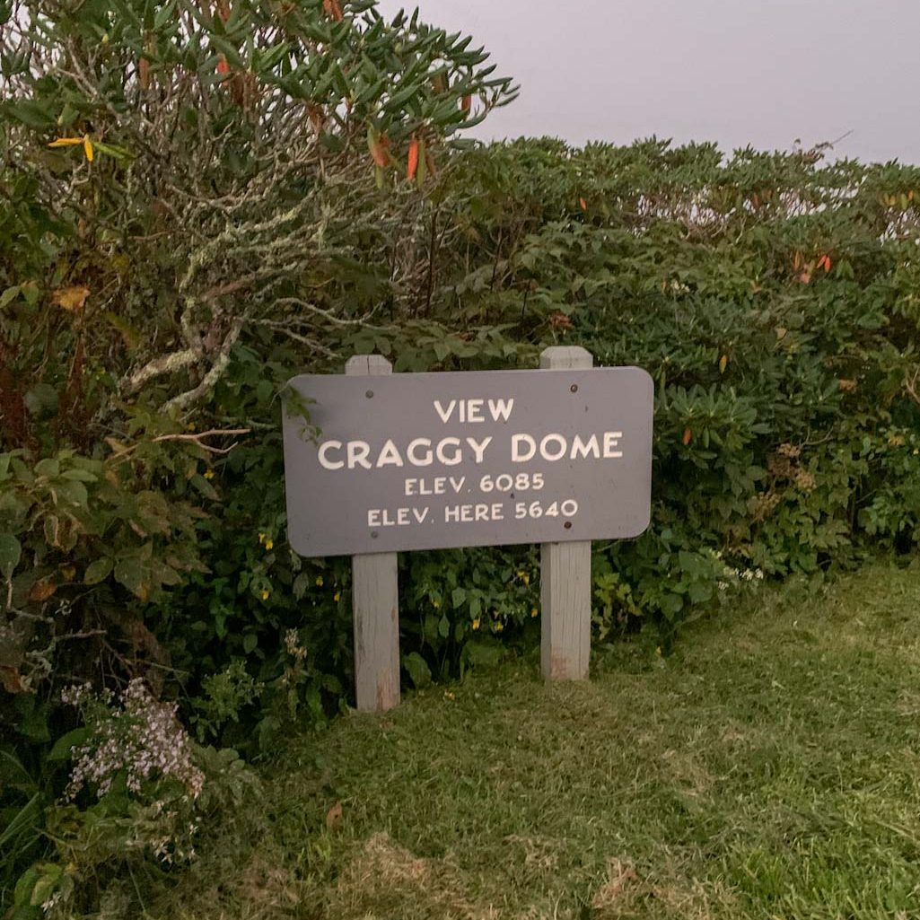
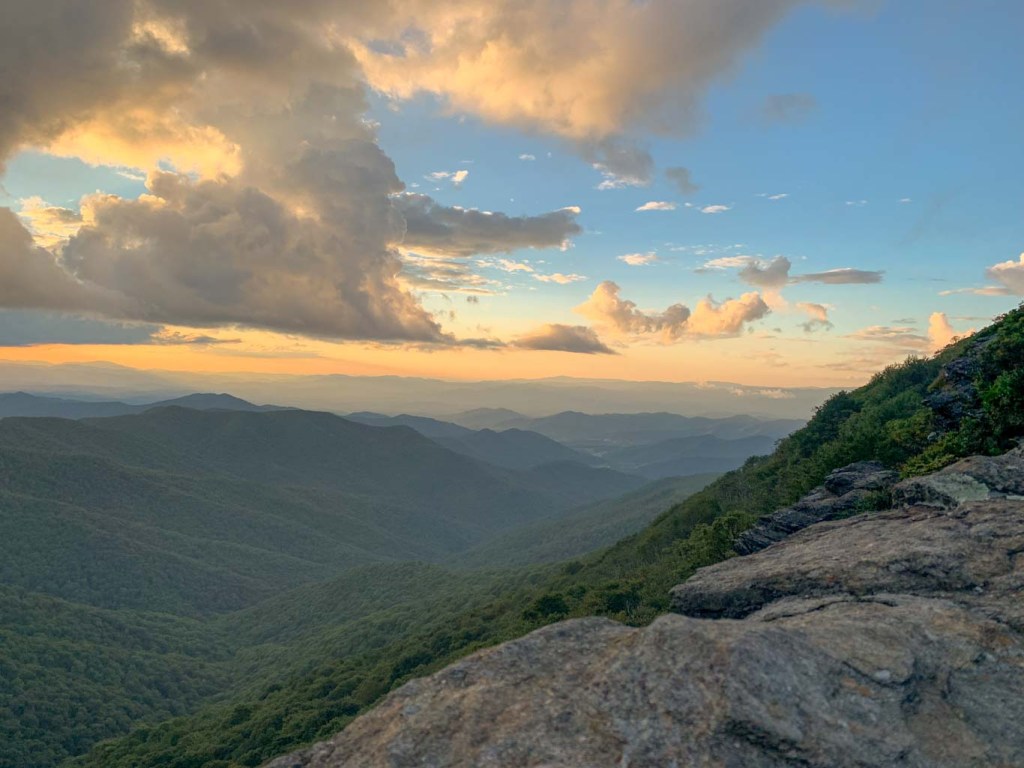
After you finish up at Craggy Gardens, it’s time to get back in the car and drive the few miles up the road to the Craggy Pinnacles. Try to time this part just right to get there well before sundown so you can catch the whole experience! Craggy Pinnacle is a quick 1 mile out and back but be prepared to spend some time here! Oh and the hike up to the Pinnacle is pretty steep. We definitely had to stop and catch our breath a few times! And at 5860ft in elevation, you might notice a slight difficulty in getting a lungful. As you near the top of the pinnacle, there are several scenic viewpoints to check out. First, head to the upper viewpoint which offers 360 degree views of the area! There’s a large stone structure that can accommodate several hikers, so you’ll have plenty of room to take in the views. The evening we went, it got a bit crowded up there so we went to the lower viewpoint and had the spot nearly to ourselves. Guys, I cannot say enough about how incredible watching the sunset here was. We took so many pictures, but nothing quite captures the intense colors and the swirling mist as the sun sunk behind the mountains. If you only get one hike in Asheville, make it this one. Oh and bring a sweatshirt, it gets chilly up on the ridge! After the sunset, carefully make your way back down to the parking lot. We were able to see pretty well in the dusk but bring a headlight or flashlight if you’re concerned about visibility! 

I cannot say enough good things about this hike! And if you ever go while the Catawba rhododendrons are blooming please send me a picture! 

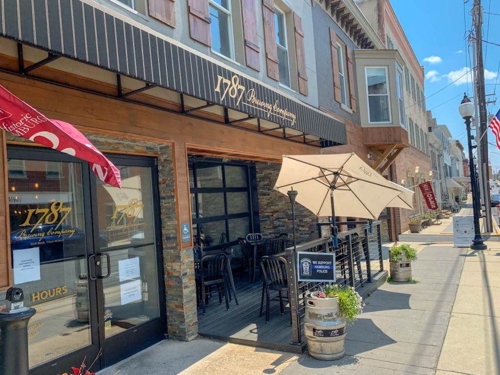
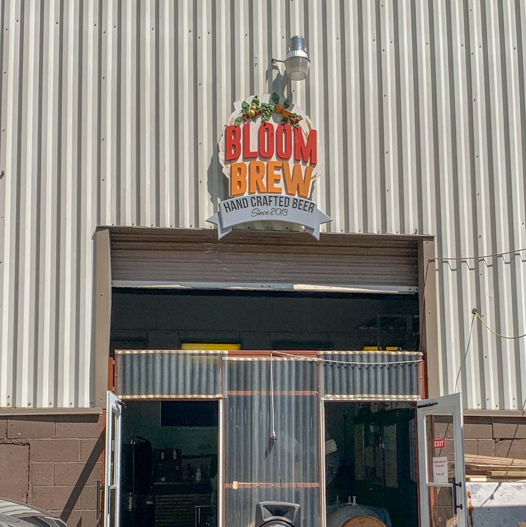
THE BEER: Burial Beer Company

Address: 40 Collier Ave, Asheville, NC 28801
Distance from Trail Head: 20.8 mi, 38 mins   
Website: http://www.burialbeer.com/
Food?: Full Menu
Details: Outdoor seating, dog friendly
H&H Rating: 5/5

Okay okay, you can probably tell that we didn’t go to this brewery after our hike. BUT who says you can’t hop then hike?? We had some time to kill before checking into our AirBnb for the weekend so we decided to check out the famed Asheville breweries before heading for a hike. Not sure I would recommend this method but hey we were on vacation! I had heard a lot of good things about Burial Beer and even our Airbnb host said it was their favorite in the area. So naturally, it was at the top of my (long) list of Asheville musts. Honestly it’s so difficult to decide where to go around here cause there’s just too many options and frankly I just can’t drink that much beer. We eventually had to just let go of wanting to try as many places as we could and just enjoy the moment. Hence, Burial Beer. 

The Burial story started when some beer-minded friends decided to start their own brewery after years of homebrewing and beer blogging in the Seattle area. Eventually, they found Asheville and decided the artsy, small-town vibe was the perfect fit. They started Burial Beer Co in 2013 with a modest system. Within a year, they already needed to expand to accommodate demand! Within a few years, their following grew so much that they were able to purchase an old forestry site used by the Civilian Conservation Corps (CCC) in the 40s and turn it into a huge production facility, office and a taproom & restaurant. Today, Burial also has locations in Raleigh and Charlotte. Talk about exponential growth! 

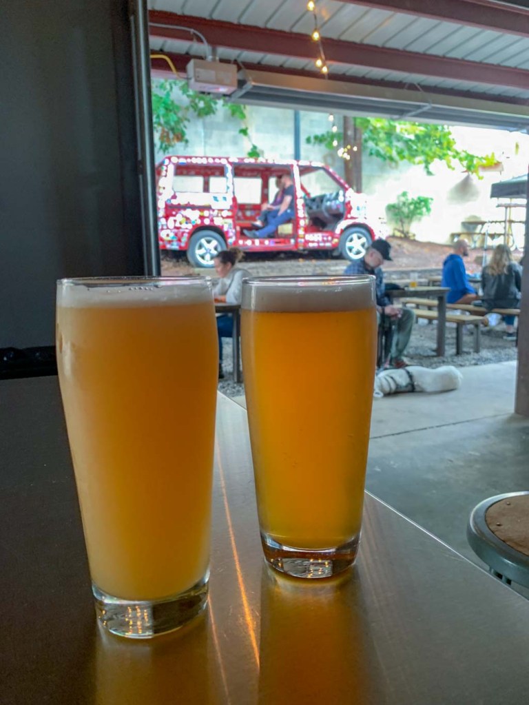
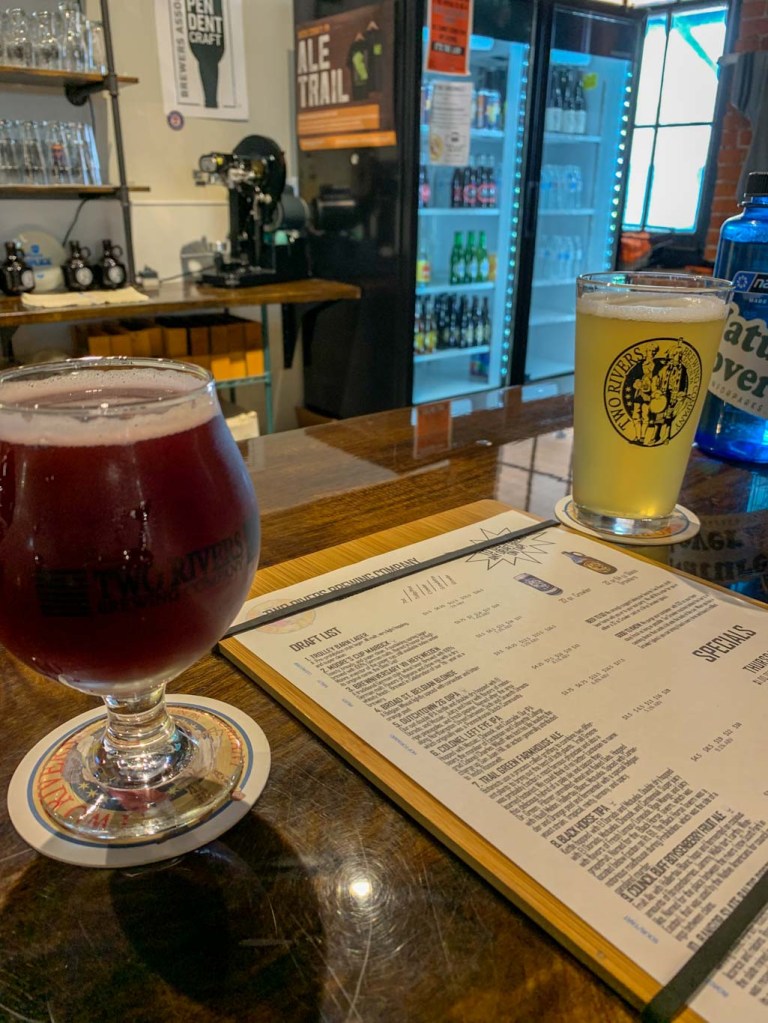
We visited their OG location in the South Slopes of Asheville. This was such a cool space with the indoor taproom giving some spooky crypt-like vibes and the outside patio feeling like a cookout party. I loved the red van sitting out back and learned it was actually the van that the founders drove cross-country in to start the business in Asheville! How cool! This location also has a full kitchen so no doggos inside but it seemed like they were welcome in the outside space. We really like the beer here, everything was delicious! And the names were cracking us up. As could be expected from the brewery name, they lean in pretty hard with the heavy metal atmosphere so all the beer names were so over the top. Personally, I’m not sure if they’re just pretentious or poking good natured fun, but we chose to interpret them as humorous. 

Our Beer:

  • Culture Keepers – Festbier – 5.8%
  • To Be Free of Clear Meaning and Willing Comprehension – IPA – 7%
  • Portrayals of Ephemeral Beings – Pale Ale – 5.8%
  • Currents of Radiance – Kolsch – 4.7%

SUM UP: Craggy Gardens and Pinnacle are must-do hikes when visiting Asheville. Both hikes are short and beginner friendly, although there are some steep inclines and potentially slippery rocks. Try to time the Pinnacle hike to be there for sunset, it was an incredible experience. Both of these hikes are along the Blue Ridge Parkway only about a mile apart, but be aware that the two trails do not cross so you will have to drive between the trail heads. These are popular trails so you might encounter some trail traffic. Make sure to pack layers as the temperatures on the Ridge can be vastly different than in town. Afterward, there is no shortage of awesome breweries to checkout. We went to Burial Beer Co for some delicious beer in some heavy metal digs. 

Pinckney Island NWR & Side Hustle Beer Co.

Hilton Head Island, SC

Even on vacation, there are Hikes & Hops to be had! J and I made the long haul down to South Carolina for a week of relaxing at Hilton Head. But if you’re like me and need other things to do than just soaking up the sun, there are several hiking areas in and around Hilton Head Island. Since it’s so close to the shore, this hike was a completely different type of terrain for us. At Pinckney Island, expect to meander past saltwater marshes, ponds, beaches and more. This is a place to take it slow and let nature speak for itself. Bring plenty of water and be prepared for lots of bugs! I also highly recommend doing a kayaking tour on your visit to HHI!

THE HIKE: Pinckney Island National Wildlife Refuge

Length: 4.1 miles
Elevation Gain: 30 ft
Difficulty: Easy
Time: 1.5 hours
Trail use: Hiking, Biking, No pets
Parking: Large lot at trailhead
H&H: 4/5

Pinckney Island National Wildlife Refuge is managed and maintained by the U.S. Fish & Wildlife Service and is a protected natural area. It was established in 1975 on land that was once a revolutionary war veteran’s plantation. The entire refuge is over 4,000 acres and includes several islands, although Pinckney is the largest and the only one accessible by the public. The Refuge offers a unique environment for a wide range of wildlife. Expect to see salt marshes, forests, brushland, and freshwater ponds. The truly captivating part of Pinckney Island is the sheer amount of wildlife that call it home. There’s a huge population of wading birds, especially egrets, ibis, and heron, as well as eagles, osprey, and hawks. If you’re lucky, you might spy a pod of dolphins! As you’re walking, keep your eyes peeled for reptiles like alligators and snakes. 

Although the refuge is open to the public, keep in mind that the Pinckney Island NWR is primarily a nature and wildlife preserve. Its main goal is maintaining an area of wildlife conservation, especially in a region of high coastal development. Pinckney Island is just one of seven protected refuges that make up the Savannah Coastal Refuges Complex. 

Accessing Pinckney Island NWR is easy from either Hilton Head Island or Bluffton on the mainland. There’s only one entrance right off 278 (Wm Hilton Pkwy) which leads to a large parking lot. Be aware that there are no bathroom facilities on the island so plan accordingly! Although we decided to walk the trails, the wide gravel and mown paths are great for biking as well. Biking is probably the best way to see the entirety of the island’s nearly 14 miles of trails. However, do remember that this is South Carolina so it’s likely to be hot, extremely humid, and very buggy. Please bring plenty of water! 

We went on a pretty muggy day so we didn’t make it quite as far as we hoped. When first leaving the parking lot, there’s only one main road to take. This is a wide gravel path that is fairly busy with cyclists and families. This road leads to the Ibis Pond where, true to its name, there are hundreds of wading birds. After this pond, there are a few directions you can go and you will likely leave the crowds behind! We didn’t see another person until we came back to this main road. 

My biggest complaint about this hiking area was the mown grass paths. When we went, the grass was quite high and it made me pretty uncomfortable despite my long pants. I was probably overreacting, but I didn’t like the idea of not being able to see critters in the long grass. So we did our best to keep to the gravel paths when possible. Despite the paths being quite flat, I was surprised how quickly we tired out. The heat and humidity is no joke! We wanted to make it to Shell Point Beach, but the distance was quite a bit further than I realized and we eventually turned around. Next time, I’d like to bring our bikes and try to see more of the island! 

Tiny crab!

THE BEER: Side Hustle Beer Co.

*Side Hustle Beer is now located at The Bank near Coligny Beach*

Address: 144 Arrow Rd Unit A, Hilton Head Island, SC 29928
Distance from Trail Head: 9 miles, 13 mins 
Website: http://www.sidehustlebeerco.com/
Food?: BYOF, Occasional Food Trucks
Details: Outdoor seating only, pets welcome
H&H Rating: 5/5

Side Hustle Beer Company is South Carolina’s smallest brewery! It’s so small in fact, that they don’t have an indoor seating area. It’s just a small counter where you can get draft pours and cans to go and then enjoy your draft on the outdoor patio. Honestly, with how gross and sweaty we were after the hike, it was probably for the best that we sat outside! 

As its name implies, Side Hustle is a small venture between friends who decided to start a small side venture to bring good craft beer to Hilton Head. And man are they succeeding! We were pleasantly surprised by how good the beer was here! Everything was refreshing and well made, I couldn’t believe that it came from such a new and tiny company. I particularly loved the Porch Pineapple, it was probably the best summer beer I’ve had in a long time!  We also loved the atmosphere. The patio was full of plants and games and it was delightful to see people swinging by on their bikes to pick up a six-pack. It definitely had the feel of a local favorite. 

Upon researching for this blog post, I learned that Side Hustle has been acquired by a larger branding company that also owns some local restaurants and the popular Burnt Church Distillery. I hope that this is a good move for the business! They recently announced that they will be moving to a larger facility with indoor seating, a beer garden, and several dining options. I wish them all the best!

Our Beer:

  • Point Break – NEIPA – 7%
  • Porch Pineapple – Wheat Beer – 5.8%
  • Rocket Emoji – Double IPA – 8.3%
  • …And There’s Your BFF – Peach Sour – 6%
  • South Island – Pilsner – 5.1%
  • Refraction – NEIPA – 7.6%

SUM UP: Pinckney Island is a federally protected wildlife refuge located on the South Carolina coast between Bluffton and Hilton Head. It is open to the public for hiking, biking, fishing, and wildlife viewing. Be aware of the hot and humid climate as you’re preparing for a visit here. There’s no bathroom facilities but make sure to bring plenty of water and try to stay hydrated. I also recommend long pants and bug spray as the area can get quite buggy. Most of all, remember that it is the wildlife’s home and you’re just visiting! After your hike, head onto Hilton Head Island to visit Side Hustle Beer Co. This is a small neighborhood venture that offers up some of the best beer in the region! Bring a picnic or order some take out and hang out on the patio for a while! You won’t be disappointed.

Sunrise at Sea Pines
Our Eco-Kayak Tour! We saw lots of birds and oysters!

Pulpit Rock & 1787 Brewing Company

Hamburg, PA

For this Hike n Hop combo, we trekked all the way out to central PA to tackle a section of the Appalachian Trail! This was our first time on the AT in Pennsylvania and it really showed us why it has the nickname “Rocksylvania”. The descent on this small section in Hamburg, PA was really rocky but the view from the high point at Pulpit Rock was completely worth the sweat! If you have time, definitely turn this into a longer loop by staying on the AT and going to the next lookout point, Pinnacle Rock. After this heart-pumping hike, it’s only a quick car ride to the quaint town of Hamburg where you have a plethora of spots to grab a pint and a snack!

THE HIKE: Pulpit Rock Loop via Appalachian Trail

Length: 4 miles
Elevation Gain: 900ft
Difficulty: Moderate
Time:  1.5-2 hours
Trail use: Hiking, Leashed Pets
Parking: Large gravel lot at trailhead
H&H: 3/5

Now that we live in Pittsburgh, a trek on the Appalachian Trail is a bit more of an undertaking! The AT runs for almost 230 miles in PA, from the Mason-Dixon Line to the New Jersey border. The PA section is affectionately called Rocksylvania for its extremely rocky terrain in central PA.

Sadly, getting onto the AT is now a bit more than a day trip for us! So while traveling out to Eastern PA to visit friends, we decided to squeeze in a small hike along the way! We stopped in Hamburg to tackle a tiny portion of the AT that leads to a gorgeous overlook. 

The trail starts at the Hamburg Reservoir where there is plenty of parking on a gravel lot. No bathrooms though! A couple of reviews on AllTrails mentioned that the lot can fill up early on weekends so keep that in mind! First, follow a gravel road for a bit before hitting the white blazes signaling the Appalachian Trail. This gravel road is a bit of a drag as it is fairly sunny and not too interesting. But we absolutely loved the sections along the AT. As much as I appreciate a quiet walk in the woods, I just love scrambling over rocks and having elevation changes to keep things interesting. Clocking in around 900ft in elevation, the first half of this hike is not for the faint of heart. There’s a lot of switchbacks and rocky inclines so hiking boots are highly recommended and even trekking poles if you’d like the extra support. The view point is completely worth the sweat and black gnats though. The rock is small, but it is just incredible how far you can see. I just wish it hadn’t been so scorching the day we visited! We could barely stand in the sun for more than a few moments. This would be an absolutely stunning view in the fall. 

Just behind the Pulpit Rock overlook are three observatories maintained by the Lehigh Valley Amatuers Astronomical Society. A few of the members were doing maintenance and J had a great time chatting astronomy with them! Unfortunately, this was the last enjoyable part of the hike. The entire rest of the path followed a steep gravel road down the hillside. It was so hard on our knees that we started walking backwards! I would have much rather done an out and back and come back along the AT or continued along to Pinnacle rock. Just make sure you have the energy and supplies for a 10 miler if you choose to continue on! The only positive was the abundance of wild raspberries on the hillside that made for a great snack.

Overall, this trail was definitely still worth it for the incredible overlook. Just be sure to have plenty of water especially in the summer, as the rocky incline will definitely have you sweating! We were glad we made time on our drive out to stop for this hike.

THE BEER: 1787 Brewing Company

Address: 43 S Fourth St, Hamburg, PA 19526
Distance from Trail Head:  3.2 mi, 7 mins
Website: http://1787brewingcompany.com/
Food?: Full Menu
Details: Outdoor seating but no pets
H&H Rating: 3/5

Despite being a pretty small town, Hamburg boasts not one but two brewpubs! Since we had limited time, we flipped a coin and ended up at 1787 Brewing Company. This brewery has been around since 2018 and gets its name from the year that the town of Hamburg was founded. The owner is born and raised in the area and this brewery is a loving nod to his roots. All of the beer names come from local places and people, making this a truly local pub. 1787 Brewing Co. is located right on the main drag in Hamburg and seemed to be a popular hangout. It had a great atmosphere with bar seating in front and more restaurant-style, family-friendly tables in back. There were also some tables out front along the street but it was too damn hot to even think of being outside any longer! As a courtesy to the other diners, we took a spot at the bar far away from everyone else (a hike in 90F definitely doesn’t leave you smelling rosy). 

Thankfully, this bar offered flights so we were able to have a nice sampling of their wares. We tried several of their IPAs and one sour. This was a great pub to relax after a hike and their beer was fairly refreshing. We didn’t end up getting food, but everything looked pretty tasty! Overall, I’m glad we stopped and got to chat with the exceptionally nice bartender who offered some local hike suggestions and well as a good chat about the beer scene in Pittsburgh.

Our Beer:

  • Blue Rocks – Hazy IPA – 7% 
  • Aptitude IPA – American IPA – 6.8%
  • Everlong – Session IPA – 4.2%
  • Let’s Gose – Grapefruit Gose – 4%

SUM UP: Pulpit Rock is a stunning overlook on the Appalachian Trail in Central Pennsylvania. Although the ascent is steep and very rocky, this is a great hike for those wanting to experience the AT without undertaking a huge backpacking trip. The viewpoint is just over 2 miles from the trailhead! Do the incline and rocky terrain, we thought this was moderately challenging. We’d suggest coming back down along the AT as the loop from AllTrails takes you down a gravel road that is unpleasant. Afterward check out one of the brewpubs in Hamburg and give yourself a pack on the back for tackling Rocksylvania!

Fox Chapel Trails & Old Thunder Brewing

Blawnox, PA

Guys, I can’t believe the trail network around Fox Chapel and O’Hara Township! There’s so much going on but honestly not a lot of good info out there about it. We were confused about what trails were open to the public and which needed a permit to access. SO we started at the O’Hara community park and just worked our way up! This is a great way to check out this area because you can go as long as you want and you don’t have to worry about getting the permit for the Fox Chapel trails. Plus the community park is so close to Old Thunder Brewing in Blawnox which is definitely worth a visit. They’ve got delicious beers in a very cool old post office building. I’ve got your next hiking day planned out!

THE HIKE: O’Hara Community Park & Salamander Trail

Length: 5 miles
Elevation Gain: 200ft
Difficulty: Easy
Time: 2 hours
Trail use: Hiking, No Pets
Parking: Large lot at community park
H&H: 3/5

This hiking outing is perfect for anyone that needs some time outdoors but doesn’t have the energy or time for a big excursion. Somedays you just need a flat, easy path and this is a pretty good one! Although there are many interwoven trails in the Fox Chapel trail system, I knew that some required permit access. However, it wasn’t very clear from information available online which parking areas were permit-only. IT seems that permits are obtained easily enough by going to the public library to get one, but that does require some advance planning especially if hiking on a day when the library is closed! It also appears that the permits are free, you just need to fill out a form prior to your hike. If anyone has any further info about hiking in Fox Chapel, please let me know! 

Entrance to the Salamander Trail

Because of the confusing permits, we decided to start our hike at the O’Hara Community Park which is a lovely park with playgrounds, sports courts, and a paved walking trail. This is the trail we started on and it’s great for all abilities. You follow the paved path along the small creek and start heading out of the park. The paved trail ends and you head towards the treeline where there is a sign for the Salamander trail. This is a natural wooded path and probably more like the trails you’re used to walking. It runs along a creek for a delightful babbling to accompany your trek. Just remember your bug spray, this area can get a bit buggy! There’s a small loop on this section of the trail so we took the high road on the way out and the lower creekside on the way back. 

As you’re hiking along, be aware that the trail crosses over the road a few times. BE very careful on these crossings! After the Salamander Trail, the trail meanders along a road towards towards McCahill Park. This was probably my least favorite section, as I’m not a big fan of hiking along the road. Thankfully, the road was quiet and very few cars drove past. Eventually it turns back into the woods at Scott Park where it continues along the creek. This was a great spot with some benches to sit and have our lunch! Finally we followed the trail to the Riding Meadow Park which was where we decided to turn around. If you like longer hikes, it’s very easy to cross the road here and continue to Riding Meadow. There are a lot more trail systems in this area that will eventually lead all the way to the Audubon Society’s Beechwood Farms. Just make sure to leave enough energy to make it back to your car! 

It’s hard for me to rate this trail because on one hand I enjoyed all of the wooded areas where it was quiet and peaceful. However, I wasn’t a huge fan of the sections along the road and the final connecting trail to Riding Meadow was pretty overgrown. I always check for ticks after hiking, but I was especially careful this time! This felt more like a nature walk than a hike, which is totally fine as long as that’s what you’re in for! And I do wish the Fox Chapel areas were more accessible. It makes me sad when access to nature is blocked so only certain people can enjoy it. 

Just another quick note about these trails. You might have noticed that I omitted the name of the initial trail in O’Hara Park. This trail contains a word that First Peoples consider derogatory and offensive. There are several places that use this word that First Peoples have been advocating for a name change. In fact, a very popular resort in Lake Tahoe recently changed its name to Palisades Tahoe in acknowledgement of the racist and offensive origins of its original name. I hope that eventually this small trail in O’Hara will understand the harmful connotations of its name and make a change! 

THE BEER: Old Thunder Brewing

Address: 340 Freeport Rd, Blawnox, PA 15238
Distance from Trail Head: 2 miles, 6 mins 
Website: Oldthunderbrewing.com
Food?: BYOF & Food Trucks
Details: Outdoor seating but no pets
H&H Rating: 5/5

Okay so Old Thunder Brewing seriously blew me away! As you guys know, I go to a lot of breweries. I’ve been to the good, the bad, and everything in between. But I knew as soon as we pulled up to this venue that it was going to be something good! The Old Thunder Brewing taproom has been open for just over a year, but you wouldn’t know it by walking in! It’s in a converted post office building that has been lovingly updated while keeping much of the original features. It has a huge indoor taproom complete with bar seating and tables, as well as a patio space out front. I think my favorite feature was the original postmaster’s safe that they left on the wall!

We started out with a flight here because after viewing the menu, we knew we wanted to try a little of everything. Old Thunder offers a nice mix of Pale ales/ IPAs along with some traditional styles like their headliner 340 Lager. I think my favorite by far was the False Kingdom which, luckily for me, is another of their headliners! I’ll definitely be keeping an eye out for this one at my local beer store! 

Old Thunder doesn’t have their own kitchen but they keep an updated list of food trucks on their website and encourage visitors to patronize other local shops by ordering takeout. This brewery also prides itself on being a family friendly place and there were lots of well-behaved kiddos when we went! Overall, I was super impressed with Old Thunder Brewing. It’s not often that you get both really good beer and a super cool building!

Our Beer:

  • False Kingdom – IPA – 6.8%
  • Reasonable Voices – Pilsner – 4.8%
  • 340 Lager – Helles – 4.8% 
  • Big Blox – DIPA – 8%
  • Featherweight Queen – Stout – 4.5%
  • Character Development #1 – Barleywine – 9.5%
  • Steps Ascending – Pale Ale – 5.2%

SUM UP: For this hike, we headed out to the Fox Chapel area to explore the long trail system. Our hike started at the O’Hara Community Park and meandered all the way to the Riding Meadow Park. This is a good trail system for nature walks and you can add as much or as little distance as wanted. Be aware that some areas of the trail require a permit to park. Afterwards, head over to Freeport Road to check out Old Thunder Brewing in Blawnox. You’ll get to have top-quality beer in a converted historic post office. All in all, a great hiking excursion!

Ohioyle State Park & Bloom Brew

Ohiopyle, PA

Ever since we moved back to Pittsburgh, Ohiopyle has been at the top of hiking wishlist. Only about an hour and half south of Pittsburgh, it’s a perfect day time for these long summer days! Just be sure to get there early as it can get pretty busy. Afterward, as you’re heading back to the Burgh, stop by Bloom Brew in West Newtown for a refreshing pint. Being right on the Yough River with a kayak launch and steps away from the GAP trail, Bloom Brew is an outdoorsy dream!

THE HIKE: Ohiopyle Great Gorge Trail

Length: 6.5 miles
Elevation Gain: 955ft
Difficulty: Moderate
Time:  2.5-3 hours
Trail use: Hiking, Leashed Pets
Parking: Park by natural slides; Go early!
H&H: 4/5

Ohiopyle State Park covers over 20,000 acres of land in the Laurel Highlands region of Pennsylvania. Its converging rivers and rocky landscape make it a popular destination for hikers and rafting enthusiasts. In fact, the Pennsylvania Department of Natural Resources estimates that over 1.4 million people visit this park a year! The main draw of the park is the mighty Youghiogheny River that has carved through the landscape, creating areas of plummeting water and deep gorges. 

The name Ohiopyle comes from a Lenapi word meaning “to turn white”, in reference to the foamy water as it cascades over the rocks. In prehistoric times, the area was settled by the Monongahela tribes who disappeared before extended contact with Europeans. As colonists began to settle along the eastern coast, other tribes like the Lenapi, Shawnee, and Seneca peoples were forced further inland to areas like Ohiopyle. Eventually even these people were forced off the land by the French and Indian War. 

After the war and the following Whiskey Rebellion, industry moved into the Ohiopyle region and trades like lumbering became a major production, followed by mining, tanning, and other smaller industries. With the rise of railroads, Ohiopyle became accessible to tourists, and soon became a popular destination for Pittsburgh travelers, prompting the building of hotels and other attractions. Eventually, the Western Pennsylvania Conservancy purchased the land and allowed the trees and land to regenerate. In the mid 1960s, it was sold to the state and has been maintained as a state park ever since! 

There’s no shortage of things to do in Ohiopyle and you definitely won’t be able to see it all in one day! For our day visit, we wanted to do as much as possible so we took a long hiking loop that hit most of the major sights. Following the Great Gorge Loop trail from Alltrails, we parked at the Natural Water Slides parking area which was still fairly empty at 10am on a beautiful Saturday. We left the slides to some more prepared families in bathing suits and hiking along the waters following the yellow blazes. I loved how this trail immediately plunks you in another world full of raging waters and rock scrambles. After heading under the bridge, the trail will meet up with the Youghiogheny River where I highly encourage you to wander out on the rocks to take in the view and watch some rafters taking on the rapids. This first section of trail was probably my favorite. I loved following along the river and then clambering up the rocky path to head towards the famous Cucumber Falls. This waterfall was well worth the hype and we scrambled all the way to the top and even behind the falls! There’s also a parking lot at the top with stairs down for those with limited abilities. 

The rest of the hike follows the Great Gorge Trail along quiet wooded trails until it takes a sharp turn up. On this section of trail, we never saw another person and definitely got our workout on the incline! We were a bit disappointed though because the midpoint (turn around) spot was just a confluence of several trails. With all of the incline, we were hoping for a viewpoint! If you do this trail, I would skip the incline and turn around where the trail forks to head to the campground. 

At this point, we added a bit to this route so that we weren’t just backtracking. We got on the Great Allegheny Passage and took the bridge over to the Ferncliff Peninsula. From there we meandered through the trails on the peninsula, coming back on the Ferncliff Trail which borders the river and offers fantastic views of the waterfalls and rapids. This area is very popular though so be sure to be mindful of other hikers! Finally, we walked through the town which would be a great time to stop for lunch either at a restaurant or to have a picnic along the river. There’s plenty of space to relax or take a dip in the water! We also checked out the Visitor’s Center which has some great exhibits about the wildlife and geology of the area. From there, we walked on the sidewalk back to our car. For a big loop of 6.5 miles, we got to see a lot of highlights in Ohiopyle. There’s still plenty left to explore and we’ll definitely be back! 

THE BEER: Bloom Brew

Address: 100 Riverside Dr Suite A, West Newton, PA 15089
Distance from Trail Head: 43 mi, 55 mins 
Website: https://bloombrew.beer/
Food?: BYOF & Food Trucks
Details: Outdoor seating & dog friendly & Kayak Launch!
H&H Rating: 5/5

So guys. There is a much closer brewery to Ohiopyle. It’s brand new and it’s called Yough River Brewing and it’s been on my list for a while since it’s one of the only brewery taprooms in the area! But. It’s good to check a business’s hours before driving 30 minutes out of the way! Sadly for us, they were giving their employees the weekend of July 4th off so we had to come up with Plan B. That just means that we’ll have to come back! 

March 2025 Update – We made it to Yough River Brewing! I highly recommend the spot, it’s right in Connellsville along the GAP Trail. The taproom spills out onto a covered patio with firepits and games. They have a great line up of beers and cocktails and frequently have food trucks. Make sure to check it out on your next Ohiopyle trip!

We decided instead to check out Bloom Brew in West Newton. It was a bit of a drive but it was heading back towards Pittsburgh. Bloom Brew is located behind the Fire Department and has a large outdoor only seating area with covered picnic tables. The day we were there, they had live music and a food truck so we were set! Probably the coolest thing about Bloom Brew is that because they’re right on the Yough River, there’s a kayak/canoe launch onsite! I don’t know how many breweries can say that they’re kayak friendly! 

Bloom Brew has been around since 2014 and by now they really know what they’re doing! They specialize in barrel-aged sours, but offer a wide selection on their taplist. I couldn’t believe that they had 24 different taps! Through local partnerships, they also offer gluten-free beer, cider, mead and wine, so there’s really something for everyone! And you cannot beat this location, I could have spent all day lounging on the banks of the river, enjoying a cold brew. The winner of the day was the Hoptimus Pine which was a hazy DIPA with a perfect balance of hops and sweetness. That 8.5% is a real kicker though! 

Kayak Launch at Bloom Brew! Right on Yough River

Our Beer:

  • Hoptimus Pine – DIPA – 8.5%
  • Raspberry Wheat – Wheat Beer – 4.5%
  • Shweat – Pineapple Habanero Fruit Beer – 6.6%
  • YRT Sabra – IPA – 5.6% 

SUM UP: Ohiopyle is a very popular spot for outdoor enthusiasts of all types. The winding Youghiogheny is highly sought out by white water rafter and kayakers and the Great Allegheny Passage, a 150 mile bike trail, runs through the park. There are 79 miles of trails for all levels of hikers! We combined the Great Gorge Trail with the Ferncliff Peninsula for a “greatest hits” of Ohiopyle. Afterwards, grab a bite to eat in town or stop at Bloom Brew on your way back towards Pittsburgh. If you still haven’t gotten enough outdoors, you can put in your kayak right at the Brewery and spend some more time on the Yough!

Looking for more adventures in Pennsylvania and beyond? Check out my new book: Beer Hiking Pennsylvania and New Jersey

Updated March 13, 2025