New River Gorge: Long Point/Kaymoor Miners & Bridge Brew Works

Fayetteville, WV

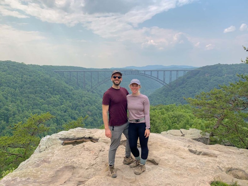
Another must-do hike in New River River Gorge is the Long Point Trail. This trail gives you incredible views of the gorge and huge bridge spanning it. For an extra challenge, add on the Kaymoor Miners Trail for some serious elevation gain and a history lesson of the industry in Fayetteville. Afterwards, you’ve definitely earned a pint at Bridge Brew Works where you can enjoy a Belgian-style brew in their rustic, yet rustic outdoor biergarten.

THE HIKE: Long Point to Kaymoor Miners Trail
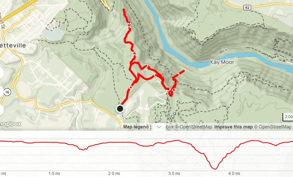
Length: 5.3 miles
Elevation Gain: 1470ft
Difficulty: Difficult
Time: 3-3.5 hours
Trail use: Hiking Only (Long Point open to bikes)
Parking: Large Lot, pit toilets
H&H: 4/5

Long Point Trail is another of the most popular hikes in New River Gorge. It is located on the Fayetteville side of the park, about 5 miles away from the Canyon Rim Visitor Center. Although it has a larger parking lot than Endless Wall, I can still foresee it filling up on super busy days. There are several different trails that can be accessed from this parking lot, including Timber Ridge Trail. 

Since we did a combination of trails to make a larger loop, I’ll talk about the two main trails individually and then recommendations on how to combine them. Truthfully, I wouldn’t necessarily recommend doing these two trails together as the Kaymoor Miners Trail is fairly difficult on its own. But if you’re up for a challenge and have plenty of water, go for it! 

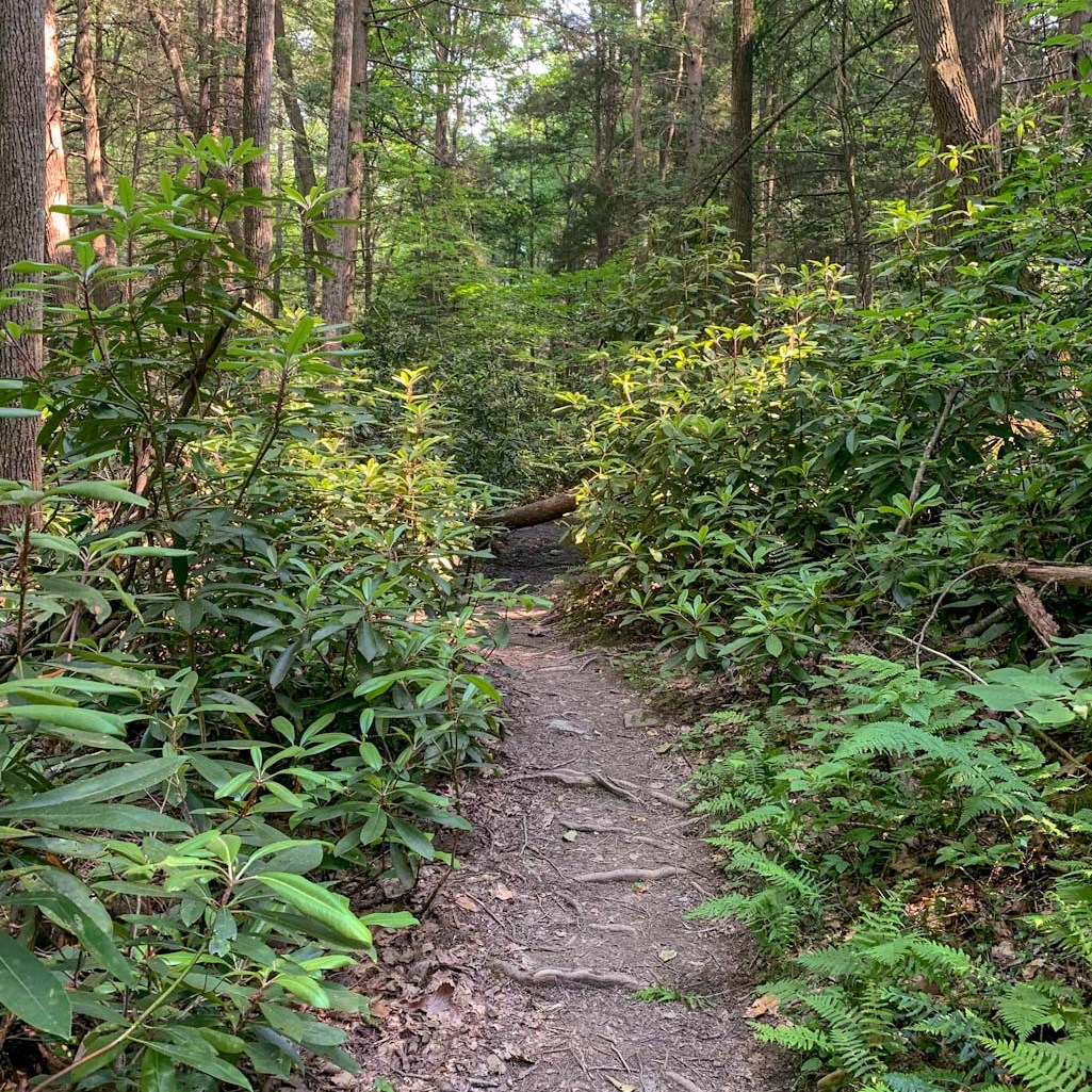
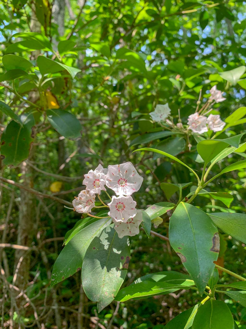
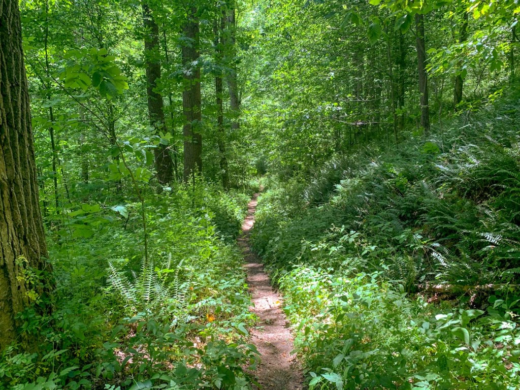
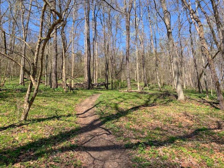
The Long Point Trail is a 3.0 mile out and back trail with little elevation changes and some more technical rocky parts. It is open for hiking, leashed pets and mountain biking but bikers should be aware that the last 0.2 miles of the trail is closed to bikes. Conveniently, there is a bike rack placed so that bikers can still walk out to see the viewpoint. Which you are definitely going to want to see, this is arguably the most incredible view in the entire park. It’s an amazing feeling to walk out of the trees and suddenly be on an outcropping surrounded by so much blue sky and so many trees! 

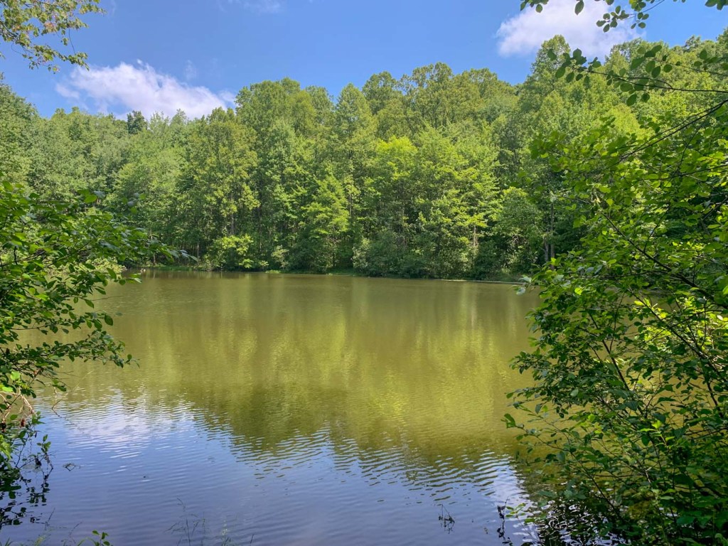
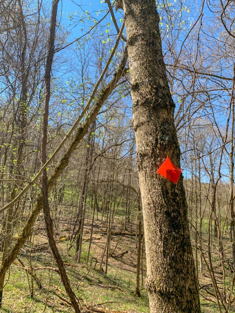
This trail is fairly easy and we encountered many families enjoying the hike. The trail starts out very wide and there are some wildlife viewing platforms that look out over grassy fields. Soon though, the trail dips into the forest. There are plenty of interesting interpretive signs along the route to teach about ecology. Along this trail, you will encounter some offshoots for other trails, but if you are heading to the lookout, you can stay straight. One of the great things about this trail is that you don’t have to hike up a mountainside for the view! In fact, the trail actually slopes downward as it heads towards the view. The most difficult hiking is nearest to the overlook, with some rocky steps that people with ability restrictions might find difficult. However, I still give this trail a moderate difficulty rating. 

Make sure to really take your time at the overlook and see it from all angles! Also please be patient as you may have to wait your turn for a quintessential picture with the bridge in the background. After you’re ready to continue, start back along the Long Point Trail. After about 0.7 miles, you’ll come to a branch in the trail. Staying on the Long Point Trail takes you back to the parking for an out and back of 3.2 miles. However, if you want to continue to the Kaymoor Miners Trail, bear to the left to get on the Butcher Branch Trail which heads down into a valley. You’ll find much more solitude on the section of the trail. Eventually, this trail will end at the Kaymoor parking lot where there are pit toilets but no running water. Continue through the parking lot and the Kaymoor Miners Trailhead will be on the left. 

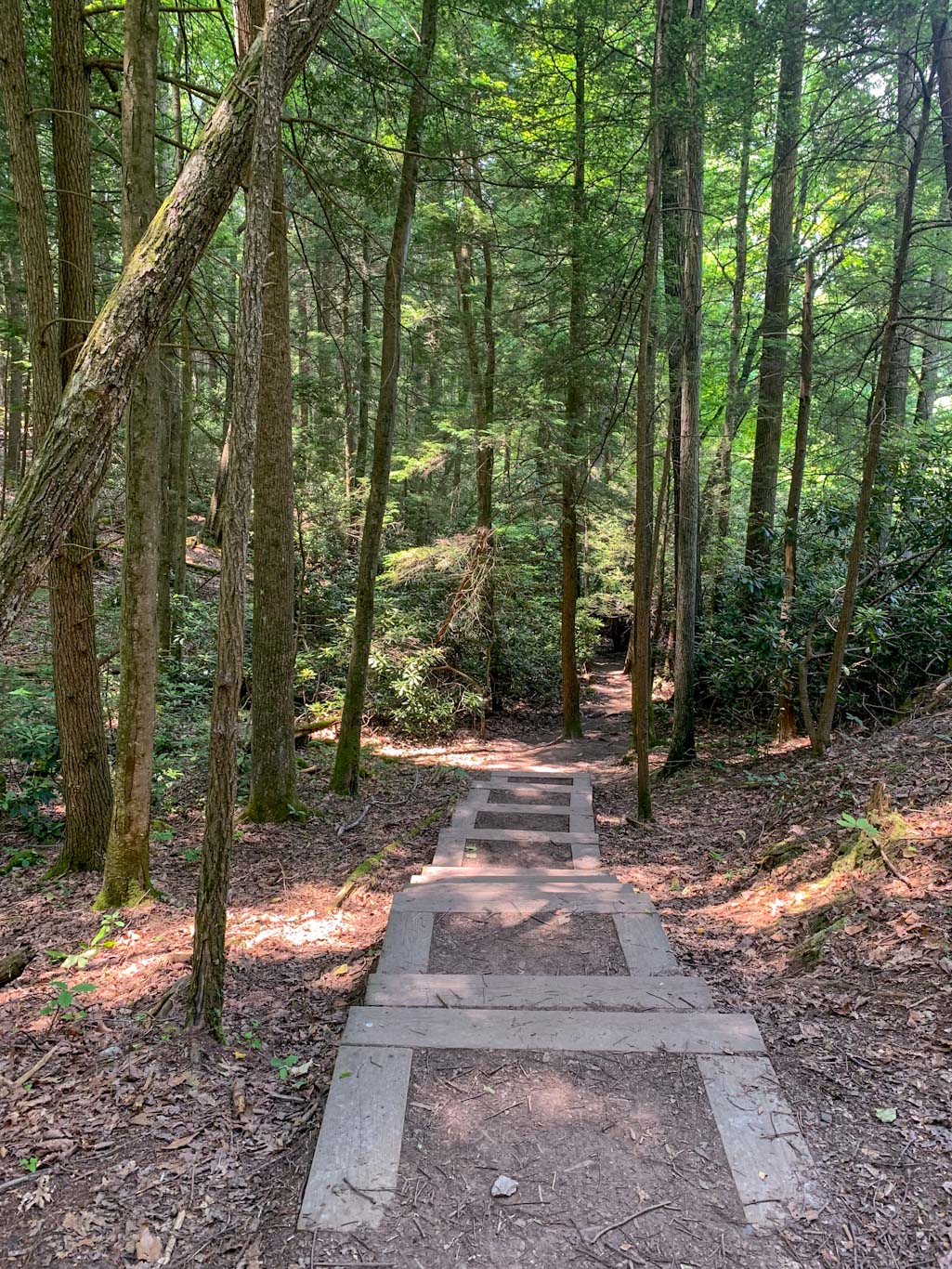
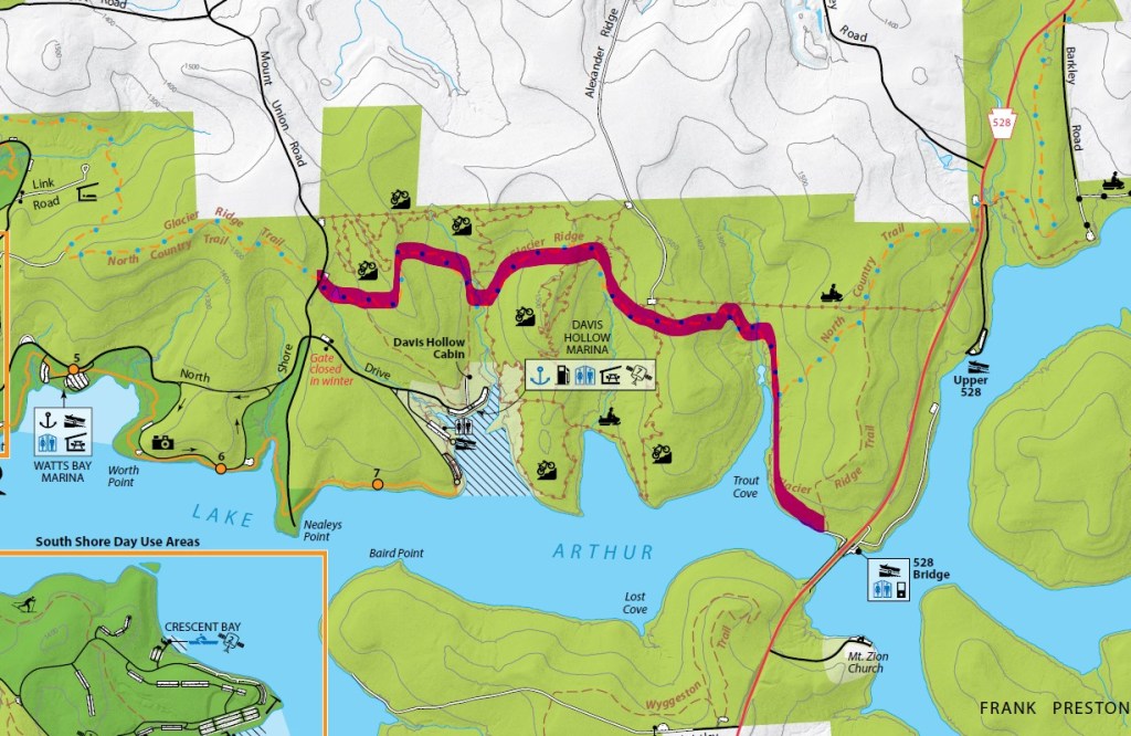
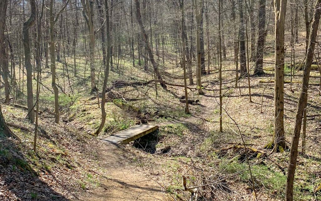
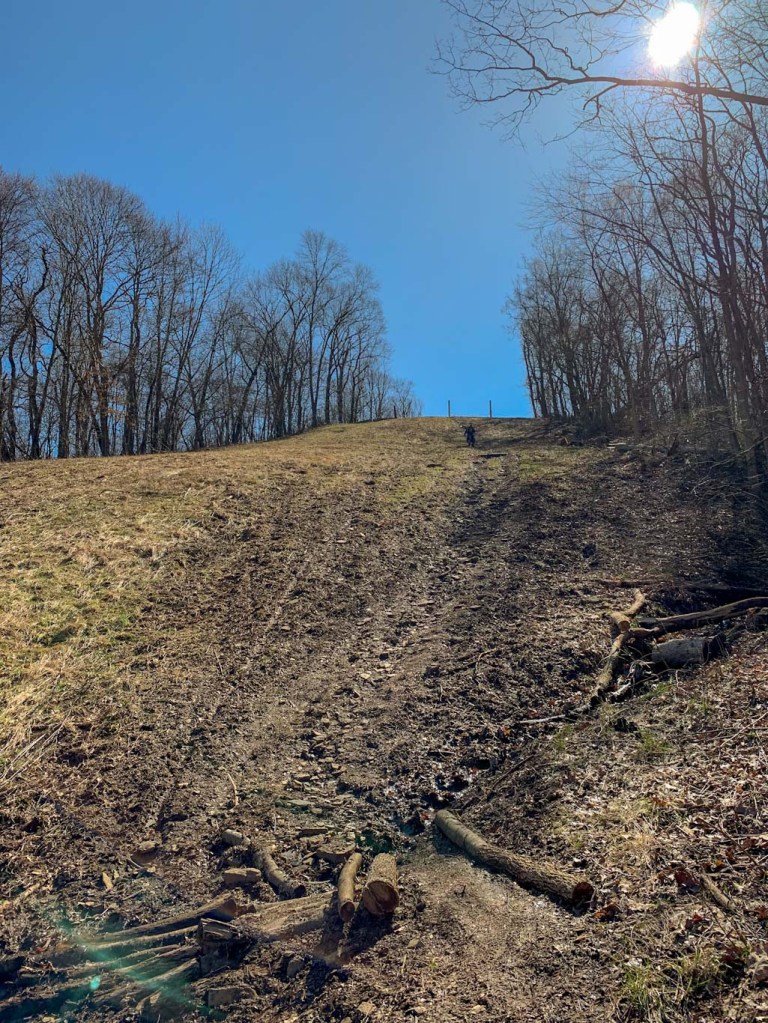
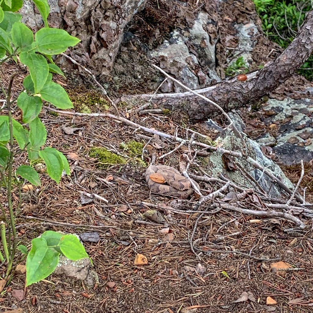
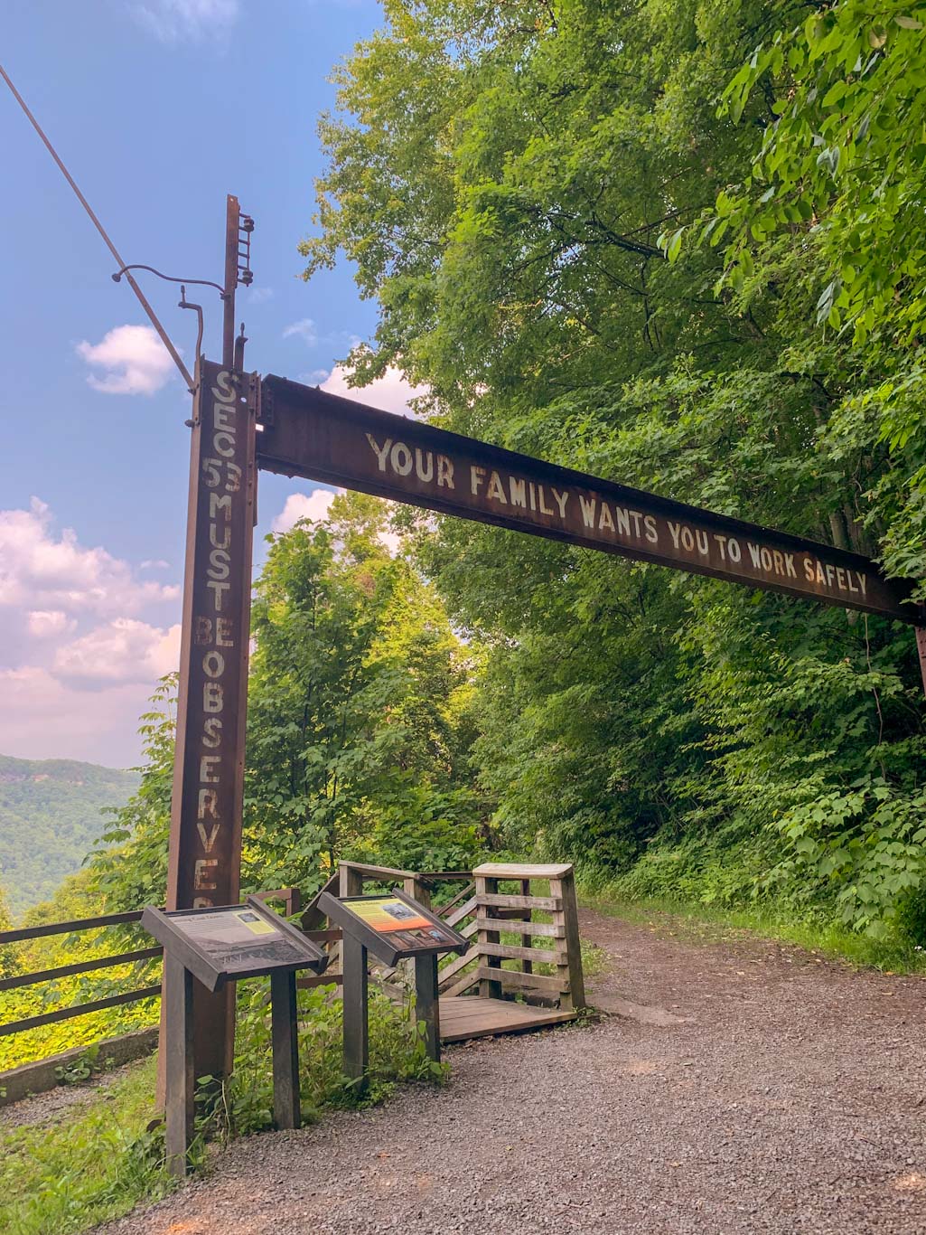
Before heading out on this part of the trail, please don’t let the short distance fool you. This is a strenuous hike with nearly 1000ft of elevation gain and trekking up and down 821 steps. I highly encourage you to check it out because the history is fascinating but please only undertake this if your fitness level is up for it, you have proper footwear, and are carrying enough water. From the trailhead, the path immediately starts downhill. The wooded path is narrow and you will encounter a lot of others on the trail. Remember that hikers coming uphill have the right of way! As you climb down the mountainside, there are some beautiful spots of flowing water. About halfway down, you’ll encounter a larger trail called the Kaymoor Trail which is a long point to point trail that intersects with the Kaymoor Miners trail. This is a great spot to catch your breathe and read up on the history of the spot. From here, you’ll descend down the 821 steps, following along the old mining route to abandoned ruins of the mining site. Please be aware that this area is not maintained by the park service and you should exercise caution while exploring. The official trail ends at the end of the stairs but there are clear community foraged paths around the structures. Personally, I found the building to be rather spooky so I didn’t get too adventurous poking about. A warning, this trail does NOT go all the way to the New River and there is an active railroad at the bottom. Please do not ever walk on active rail lines! 

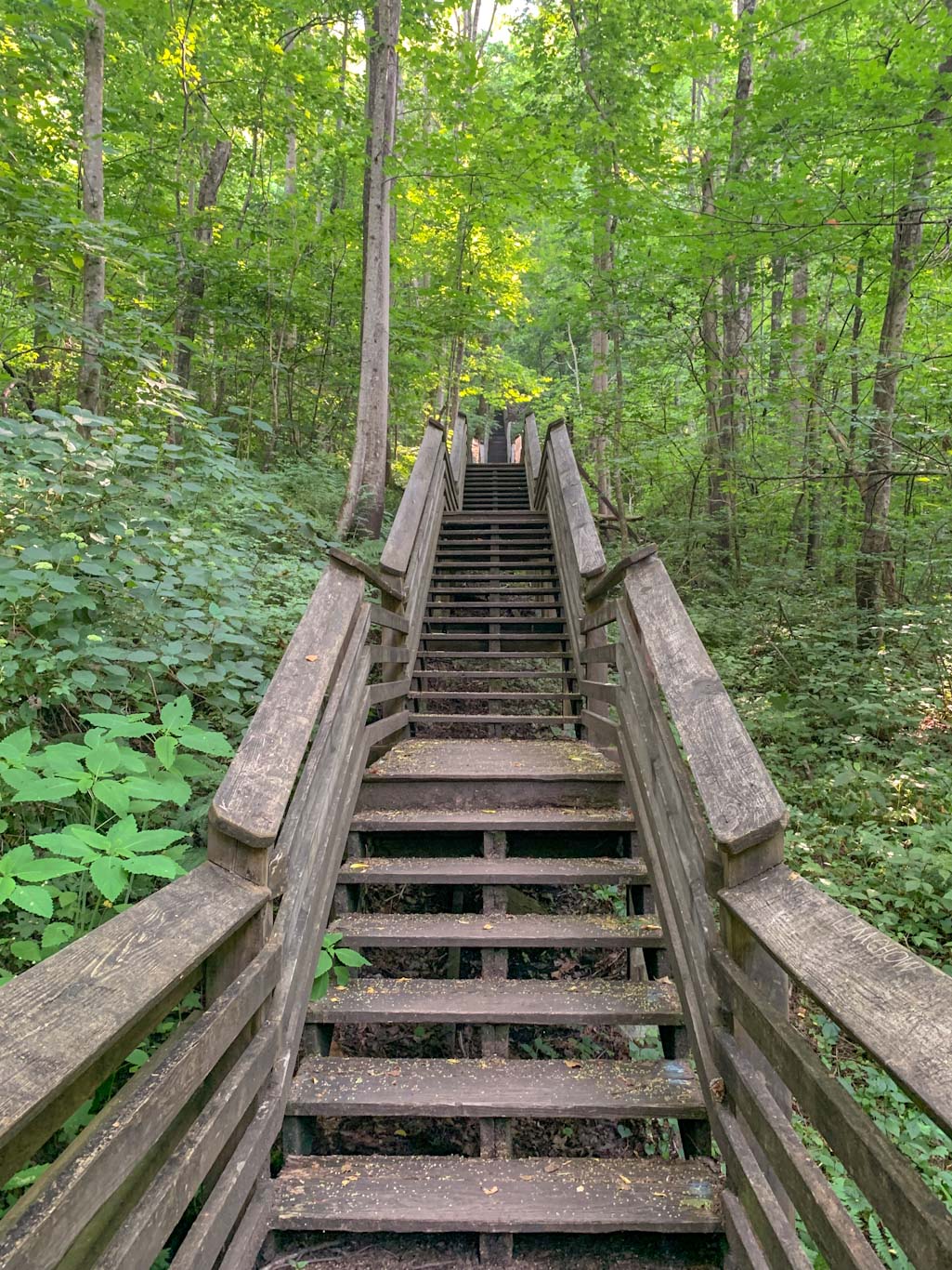
So now the fun part: getting back up the stairs. Let me tell you, I don’t care how fit you are, this is going to be a challenge. Take as many breaks as you need, there’s no shame! Thankfully, we had this section of the trail to ourselves so no one had to listen to our ragged breathing. Once you get to the top of the stairs, take a nice break because the elevation just keeps climbing until you get back to Kaymoor parking lot. If you only hiked the Kaymoor Miners trail then congrats, you’re done! If you parked at Long Point, I hate to say it but you’ve still got more to go. Head to opposite end of the parking lot and get on the Fayetteville Trail. Take this for 0.6 miles until it meets back up with the Long Point Trail. From there, it’s only 0.4 miles back to the parking lot. Thankfully the section of trail from Kaymoor to Long Point parking lots is fairly flat and easy!

All in all, this loop combines the best viewpoint in the park with the fascinating history of coal mining in Fayetteville. These are must-do hikes while in New River Gorge, but definitely require sturdy footwear and plenty of water and snacks. This is also a hike that I strongly recommend having a change of socks and shoes in the car!

THE BEER: Bridge Brew Works

Address: 335 Nick Rahall Greenway, Fayetteville, WV 25840
Distance from Trail Head: 4.7 miles, 8 mins 
Website: www.bridgebrewworks.com
Food?: BYOF, Food Trucks
Details: Outdoor seating, dog friendly

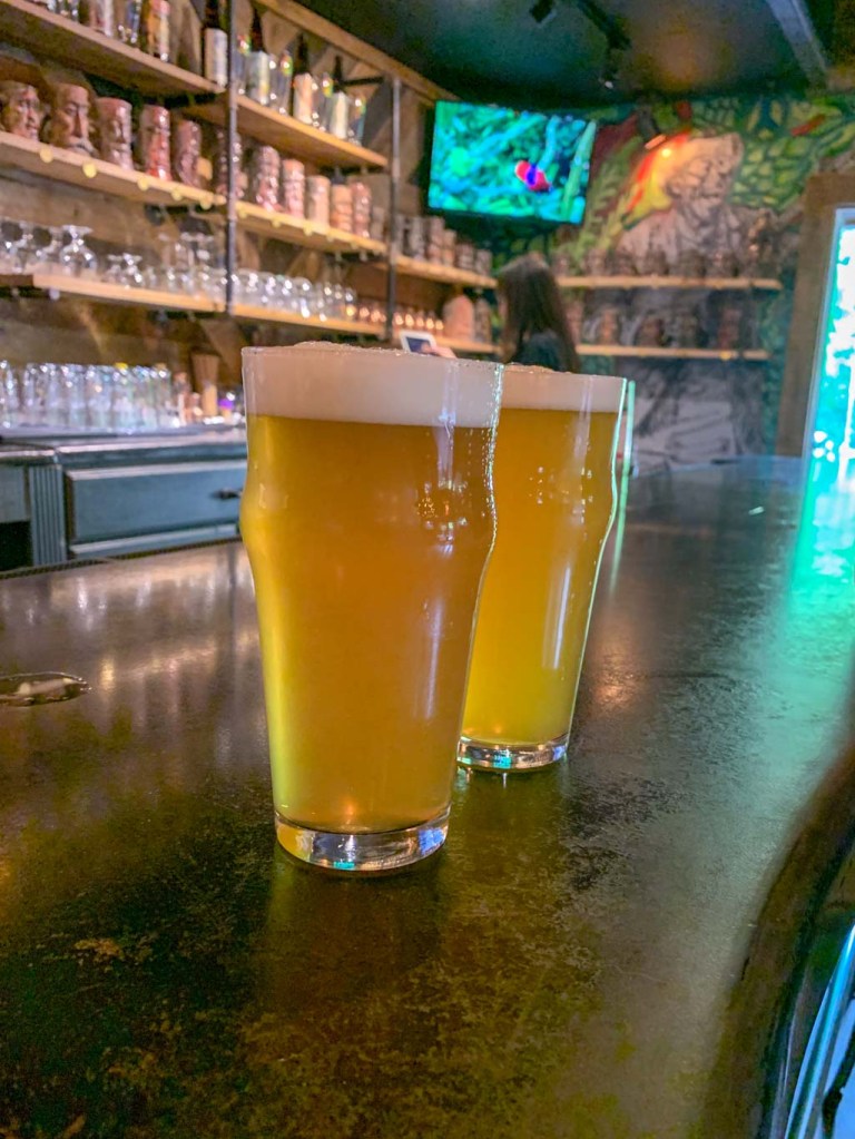
If you find yourself a little parched after that hike, I’ve got the perfect place for you! Just under 5 miles away, is the small brewery Bridge Brew Works. While they’ve been producing beer since 2010, they were able to open their space to the public in 2018. This is a unique brewery space because it’s entirely outside with a huge covered patio and a large uncovered patio with lawn games and firepits. While we were visiting, they were also working on another covered patio space! Because of the backyard vibe of the brewery, they are only open March thru December. Bridge Brew Works makes a lot of different types of beer, but they specialize in Belgian-style brews while also making seasonal favorites. Their two headliner beers that can be found on tap all season, as well as in local distributors are the Mountain Momma Pale Ale and the Long Point Lager. I love being able to have a beer named after the hike I just did, so the Long Point was a no-brainer choice! We also enjoyed the Mountain Momma and the New River IPA which paired perfected with kicking back in an Adirondack chair next to a firepit. 

I really wish we had more time at this brewery because its laid back charm was right up my alley. This will 100% be on my list for our next trip to Fayetteville!

Our Beer:

  • Mountain Momma – Pale Ale – 5.5%
  • New River – IPA – 6.6%
  • Long Point Lager – Lager – 4.6%

Looking for more Hikes & Hops in New River Gorge? Check out Grandview Rim & Weathered Ground Brewing and Endless Wall & FreeFolk Brewing

New River Gorge: Endless Wall Trail & FreeFolk Brewery

Fayetteville, WV

So excited to finally share the first of many Hikes & Hops guides to New River Gorge! First up is the stunning Endless Wall which is an easy loop not far from the park’s main visitor center. This trail is so full of stunning overlooks that you won’t want to put down your camera. The trail is one of the best places to get a photo of the Gorge. Keep in mind that this is a very popular hike and you’ll want to get there early to get a parking spot. After a day exploring the park, head over to  Freefolk Brewery which has a delicious lineup of beer, a full menu, large indoor and outdoor space, and frequently has live music. What more could you want?

THE HIKE: New River Gorge NP: Endless Wall Trail

Length: 2.9 miles
Elevation Gain: 400ft
Difficulty: Easy to Moderate
Time: 1-1.5 hours
Trail use: Hiking, leashed pets
Parking: Small lot that fills up quickly, pit toilets
H&H: 5/5

New River Gorge is the nation’s newest national park and it’s only about 3.5 hours away from downtown Pittsburgh. It’s a great weekend trip from Ohio, Western PA, and Virginia. Or make it a stop on a road trip to other Eastern national parks, like the Great Smoky Mountains (TN/NC), Shenandoah (VA), or even Congaree (SC)! New River Gorge is a sprawling park that encompasses over 70,000 acres of land along a 53-mile stretch of the New River in West Virginia. The main visitors center (along with the iconic bridge spanning the gorge) can be found in Fayetteville, WV which is a haven for outdoor lovers. Although only designated as a national park in 2021, this area has been protected by federal law since 1978. For many years, it has been a destination spot for outdoor lovers, especially those seeking the thrill of white water rafting or rock climbing. There’s even one day a year where the bridge is closed to traffic and daredevils are allowed to BASE jump into the gorge! 

The most popular area of New River Gorge is the area surrounding the main visitor center, Canyon Rim. This is a great place to start your visit. You can see views of the bridge, get acquainted with the map, chat with the rangers, and, of course, stamp your national park passport! From there, the Endless Wall trailhead parking lot (called Fern Creek parking)  is just a quick 5 minute drive (1.9). However, this is a very popular spot for hiking, so be prepared to share the trail and the parking lot! If you can, try to arrive early to avoid the crowds. There is parking for about 20-25 cars in the main lot and be aware that you cannot park along the road, even if you see people doing it! If the first lot is full, just head down the road about 0.5 mile and there’s another, larger parking lot. It appears on Google Maps as Nuttall Parking lot.  You can start the trail at either lot, just know that you’ll need to do some road walking to complete the loop. Thankfully, the shoulder is very wide and the road isn’t busy. You could also just turn around and do the trail in the opposite direction if road walking doesn’t appeal to you! 

This is an easy to moderate hike that is good for people of all ages. There’s moderate elevation change (~500ft) but it comes gradually. Expect to encounter some minor obstacles on the trail like roots and rocks but there’s no scrambling. Best to leave the stroller in the car though! All the trails in New River Gorge allow leashed pets. 

The beginning of the trail leads through dense forests of hemlocks and rhododendrons and mountain laurels which are stunning in the spring. We just missed mountain laurel season, but managed to see a few late bloomers. After a bit, you’ll cross a small bridge to pass over Fern Creek. From here you’ll meet up with the rim of the gorge. The trail is peppered with rocky outcroppings that offer beautiful views of the surrounding area. Even though this trail is popular, it’s likely that you’ll still find a small place to yourself to enjoy the views. If starting at the Fern Creek parking lot, the main overlook is the last one you’ll encounter. There’s a large rocky outcropping where you can see both up and down the river (not quite to the bridge though). Make sure to really take your time here, it’s a spectacular spot! This is a good place to turn around if wanting to head back to the Fern Creek parking lot via the trail or you can continue on for a bit longer to the Nuttall lot and then walk along the road back to your car. The one advantage of completing this as a loop is not going against the crowd back to the parking lot. 

Endless Wall is just the first of many awesome hikes that we did in this area so stay tuned!

THE BEER: Freefolk Brewery

Address: 1690 Court St, Fayetteville, WV 25840
Distance from Trail Head: 5 miles, 9 mins     
Website: http://www.freefolkbrew.com/
Food?: Full Menu 
Details: Outdoor seating, dog friendly outside

Freefolk is an awesome brewery in Fayetteville, WV less than 10 minutes from the Canyon Rim Visitors Center. They’ve got a large space with indoor and outdoor seating, with stages for live music in both. In addition to a large taplist, they have a small kitchen menu with filling pub treats like gyros and pepperoni rolls. We particularly liked their outdoor space, which seemed like a great place to bring your family and/or pets. The vibe is very laid back and after a long day of hiking, it was honestly hard to get ourselves to leave! Also make sure to check out the wall art around the building, it’s pretty rad. If checking out this brewery, just be aware that the parking lot is across the street!

In addition to the Fayetteville location, Freefolk also opened a larger brewhouse about 12 miles north in Hico, which also has a taproom, although no kitchen here. Some fun stuff about Freefolk: they have a mug club where you get your own handcrafted ceramic Folk stein with a whimsy face on it! I was very tempted….

Our Beer:

  • Orange Oswald – IPA – 5.2%
  • Berry the Hatchet – Wheat Beer – 4.5%
  • Brewing Judo – NEIPA – 6.7%
  • Gorgeous 876 – Pale Ale – 5.4%

Looking for more Hikes & Hops in New River Gorge? Check out Grandview Rim & Weathered Ground Brewing and Long Point & Bridge Brew Works.

Moraine State Park & Union Brothers Brewing

Portersville, PA

Most people associate Moraine State Park with boating and fishing, but did you know that there’s also nearly 30 miles of hiking and biking trails? Glacier Ridge Trail is popular for backpacking but can also be done as an out and back section, choosing how far you want to go. This particular section starts at the parking lot on Mount Union Road and turns around at the 528 Bridge for just over 7.2 miles. After working up a sweat on this trail, back into Harmony for a refreshing brew at Union Brothers either in their full-kitchen taproom or in their cozy outdoor patio.

THE HIKE: Glacier Ridge Trail (Moraine State Park)

Length: 7.25 miles
Elevation Gain: 1350 ft
Difficulty: Moderate
Time: 3.5 hours
Trail use: Hiking, leashed pets
Parking: Gravel pull off for a few cars on Mt. Union Rd
Parking coordinates: 40.96781939719753, -80.07996200282916
H&H: 5/5

Moraine State Park is located in Portersville, PA only a few miles away from McConnells Mill State, another of my recent treks. Although these two have been affected by a similar geological history, they are rather unique from each other! Moraine is mainly characterized by the 3,000 acre Lake Arthur, which is why it is (justifiably) known for its draw to outdoor water sports and fishing. However, there’s lots of unique history behind that lake and its nearby trails.

History

Moraine State Park gets its name because of the four separate glaciers that reached their northernmost extent just shy of Moraine State Park. Glaciers are huge ice sheets that covered much of the Earth during the Ice Age. Because of the way glaciers move, they trap and move rock and other debris. When they melt and recede, this debris is left behind, often creating ridges known by geologists as moraines. While hiking through this park, you can see evidence of these glacial deposits in the huge boulders and stone that seem to emerge out of nowhere. As I’ve mentioned before, this glacial freeze and thaw cycle is also what created the incredible Slippery Rock Gorge at McConnells Mill! At one point in time, ice dams caused the creation of glacial lakes throughout the region. Although the current Lake Arthur is manmade, it is a replica of the glacial Lake Watt that once dominated the area. 

Because of the unique glacial deposits, settlers to the region found it rich with mineral deposits. The mining industry grew throughout the 1800s until much of the area was depleted of resources and left polluted. For many decades, the area was left completely abandoned. But thanks to the efforts of researcher and naturalist Frank W. Preston (founder of the Western PA Conservancy), who recognized the uniqueness of the land, efforts were made to seal abandoned mains and restore the natural landscape. 

One of my favorite things about this blog is being able to learn the history behind the trails I hike. I’ve lived in Pittsburgh most of my life, and never knew that Moraine wasn’t a person’s name but rather a geological term. Learning more about the geological history of the area, really gives greater depth to enjoying the areas we hike. It’s one thing to hike a trail called Glacier Ridge and another to understand why it’s called that! 

The Trail

Okay, enough waxing poetic about geology (can you tell that I used to study archaeology?). Let’s get into this trail. Glacier Ridge is a 14.8 mile point to point trail that runs through the woods along the northside of Lake Arthur. It’s part of a small section of the 4,800 mile North Country Scenic Trail that runs from North Dakota to Vermont.  Glacier Ridge is popular with backpackers and there are shelters that can be booked through the PA DNR website. Please note that you must have a permit to backpack! For more info about backpacking in Moraine, check out My Trails Are Many for a great overview of her experience. For those just looking to day hike, there are several access points to the Glacier Ridge trail in Moraine: PA 528, Mount Union Road, the bike rental, and McDanels Launch Area. For our trek, we parked at the small gravel pull-off on Mount Union Road which is small, but on a sunny Sunday, we were the only ones there! Be aware that there is also a larger parking lot for the bike trails on Mount Union before you hit this lot but that’s not where I recommend parking! 

Immediately after starting the trail, it dips down to a peaceful pond that would be the perfect secluded fishing spot. Honestly, I could have spend the rest of the day lazing around this pond! From there the trail meanders through the woods, sometimes  crossing over small bridges and heading up rocky inclines. For most of the trail, you’ll be staying on the blue blazes for the NCT/Glacier Ridge Trail. Do not follow any of the signs for the bike trails or the marina! After about 3.5 miles, the North Country trail splits off and continues north but you’ll want to stay on the Glacier Ridge Trail, which is now white blazed. Now, the trail hugs directly next to the lake, so there’s plenty of gorgeous photo opportunities. Finally, the trail hits the PA 528 bridge which is where we decided to turn around. Feel free to continue on if you’ve got the time and stamina! As always, make sure to leave enough daylight to make the return trek. 

Other Things to Do

A trip to Moraine is a great day trip from the city! Aside from hiking, you can also get out on the water. There are 9 public boat docks and engines up to 20 horsepower are allowed. You can also rent pontoons, motorboats, kayaks, canoes, and rowboats. Swimming and fishing are also popular activities at Moraine. If staying on land is more your speed, check out the paved bike trails and also the more intense mountain bike routes. Looking for more to do in Moraine? Check out the PA Department of Natural Resources and the Butler County Tourism site. 

THE BEER: Union Brothers Brewing

Address: 365 Mercer Rd, Harmony, PA 16037
Distance from Trail Head: 18 miles, 22 mins 
Website: http://unionbrothersbrewing.com/
Food?: Full Menu
Details: Outdoor seating; Dog Friendly Outside

Union Brothers Brewing is a fairly recent addition to the thriving Zelienople beer scene. Friends Zachary Waltz and Jeremiah Cain began homebrewing together and perfected their craft for many years before opening a taproom. But once they did, it quickly outgrew the demand for their lineup of sours and hazy IPAs. The team has already expanded once to a larger taproom and greatly expanded their brewing capacity. From the stunning wall art by local graffiti artist Max Gonzales to its physical location across the street from the Steamfitters Union, Union Brothers is a celebration of the region’s industrial past and present. Both brewers are proud members of their local union and felt the name fit! You’ll find yourself right at home at Union Brothers whether it’s in the hip taproom or sitting around picnic tables and fire pits outside. A full food menu caps Union Brothers off as the perfect place to unwind. 

We’ve been to Union Brothers twice now and have had an awesome experience both times. It feels like the perfect neighborhood joint, whether you’re from the area or just passing through. Having an excellent taplist doesn’t hurt either! I’ve heard rumors that Union Brothers is set to expand again soon, having purchased the old nearby Moose Lodge. I’m looking forward to seeing these guys just keep getting bigger and better!

Our Beer:

  • Short Break – Hazy Pale Ale – 4.7%
  • Black Forest Hills – Dark Lager – 6%

Looking for more Hikes & Hops north of Pittsburgh? Check out Wolf Creek Narrows & Big Rail Brewing, McConnells Mill & Shubrew, and North Park & Cinderlands

Mingo Creek County Park & Mondays Brewing Co

Washington County, PA

If you’re ever craving some hiking in Washington County, look no further than Mingo Creek County Park. This huge park is perfect for all sorts of outdoor activities and is a popular place for gathering in the summer. Our early spring visit was full of wildflowers, families playing in the creek and tons of people using the paved trail. The natural trail can be a bit harder to find but if you check out the blog post, I’ll show you how to find the elusive Orange trail at Mingo!

THE HIKE: Mingo Creek – Orange Trail

Orange Blaze!

Length: 7.1 miles
Elevation Gain: 700 ft
Difficulty: Moderate
Time: 2.5-3 hours
Trail use: Hiking, leashed pets, horses, bikers
Parking: Large lot throughout park
H&H: 5/5

Mingo Creek County Park is located in Washington County and is managed by the county’s Parks and Recreation division. The park is probably best known for its two red, covered bridges situated about 1.5 miles apart along the Mingo Creek. This park is the perfect oasis no matter what your outdoors activities may be! There’s plenty of creek for fishing and splashing around, lots of pavilions to rent and space to have a picnic. There’s a 3-mile paved walking trail, numerous playgrounds, and even an observatory! But for us, we were on the hunt for the hiking trails. Now I have read on a number of blogs and trail sites that this trail is difficult to find and completely overgrown. I’m here to say that you shouldn’t go by everything you read! 

Now, I will say, the signage for the trails is not great. It’s very clear where the paved trail is, but you have to keep your eyes peeled for the natural trail. There are no signs and the trail blazes are very small. We park at coordinates: 40.200415039419916, -80.02756796434414 because I caught a glimpse of a trail going off into the woods. This trail eventually met up with the orange trail and then we had a lovely hike. HOWEVER, if I were to go back, I would suggest parking at The West Entrance (40.1931395787859, -80.05565122282385). The orange trail goes into the woods before the parking area, by the trail sign posting! Now keep in mind that I did this hike in the early spring so it is very likely that others’ experiences of overgrown paths and difficult trail entrances can be the case as the summer wears on! Another potential deterrent for some hikers is the fact that it is a mixed use trail, one of the uses being equestrian. I’ve found some equestrian trails to really suffer from mud but thankfully this one wasn’t too. 

Okay now some really good things about this trail! SO many wildflowers! I was thrilled to find Dutchman’s Breeches, trillium, Virginia bluebells, and so many more. This trail was also very secluded and we only saw a few other hikers on a beautiful Sunday afternoon. Finally, I liked that the trail offered some incline changes and was a great workout. Someday I’d like to come back and complete the whole 12-mile perimeter loop! And the absolute best part of this trail? Dipping your sore feet into the refreshing stream at the end. This is an ideal hike to pack a picnic to have beside the creek at the end! 

Overall, despite some of the negative reviews I had seen, I thought Mingo Creek County Park was absolutely delightful and one of my favorite hikes of the year so far. I know that we’ll be back!

THE BEER: Monday’s Brewing Co.

Address: 1055 Waterdam Plaza Dr, Peters Township, PA 15317
Distance from Trail Head: 8.3 miles, 15 mins 
Website: https://mondays.beer/
Food?: Light snacks, BYOF
Details: small outdoor patio, dog friendly outside

So what makes this Peters township brewery unique? I think you can probably guess from the name! Monday’s Brewing is always open on Monday, a day that most breweries are closed. In fact, they offer special deals for service industry workers on Monday, since that is the day a lot of bars and restaurants are closed! 

Mondays Brewing Co. is located on Route 19 in Peters Township. They’re in a small storefront that has indoor and outdoor seating. Typically you can find 12 taps, sometimes featuring other local craft beers or beverages. When we visited, they had one guest tap, Arsenal cider, Apis mead and the rest all in house brews. They also have a small cocktail list for anyone that’s not a beer drinker! Mondays like to showcase a wide variety of brews so odds are you’ll find a new favorite on the list!

This one has been on my list for a while and I’m so glad we were finally able to squeeze in a visit! I’m always glad to have another place in the South Hills to find good beer.

Our Beer:

  • Pink Boots – NEIPA – 6.5%
  • Tangled Aggression – Red Ale – 6.8%
  • Haze Agitated – NEIPA – 6.8%
  • Plaza Beer – Mexican Lager – 5.3%

Looking for more adventures in Pennsylvania and beyond? Check out my new book: Beer Hiking Pennsylvania and New Jersey

RCT: Springdale to Emmerling Park & Leaning Cask Brewing

Springdale, PA

Big News and Big Hills! I’ll be tackling the Homestead Challenge aka the Half Rachel Carson Trail Challenge. That means in June, I’ll be hiking 19 miles in one day. Am I crazy? Maybe! Thankfully, the weather is getting nicer and I’m able to get out for some training hikes! The first section I tackled was the starting point of the half challenge at Springdale High School, close to the Rachel Carson Homestead. A big shout out to Tory from MyTrailsAreMany for getting me out on the trail to start training! This hike is a point to point (one way) hike which is best done with two cars. You’ll trek just under 9 miles and gain 1,365ft in elevation! This hike isn’t for the faint of heart but is a great way to get a taste of the RCT

THE HIKE: RCT – Springdale to Emmerling

Length: 8.8 miles
Elevation Gain: 1,365 ft
Difficulty: Challenging
Time: 3.5 hours
Trail use: Hiking, leashed pets
Parking: Large lots at either endpoint. Bring two cars to do Point-to-Point
H&H: 4/5

Training for the RCT Challenge is best done by tackling large sections of the trail. It’s best to do it with a partner or group so that you can carpool to the trailhead and leave another car at the endpoint. If going solo, just be aware that you’ll have to double back on yourself a lot! 

My friend Tory from MyTrailsAreMany, reached out about wanting to start training together. She did the Homestead Challenge last year and is going for the Full Challenge this year. Talk about hiking goals! Tory suggested this section of the RCT from Springdale to Emmerling Park because it had some big hills and was the first section of the Homestead Challenge. This was the perfect intro to the Challenge for me because it was the longest hike I’d done so far this year and the hills were NO JOKE. It definitely helped me set a baseline of where I need to improve! J and I were so grateful to have Tory as our guide and time keeper too. 

So, as I mentioned, this trail section starts at Springdale High School parking lot, right next to the baseball field. From there, head down Marion Ave where you’ll pass the original home of Rachel Carson. It’s undergoing some renovations right now, but hopefully will be back open soon. Continue to the end of Marion Ave where you’ll see a tree line and finally head into the woods. Always keep your eyes peeled for the yellow RCT blaze. You should almost always be able to see the next blaze from where you are. Be aware that at many spots along the trail there are intersecting paths and it can be easy to get off course. Let the yellow blazes guide you! 

This section will lead you through woods, along some streets, through a couple streams, and up and down several big hills. Expect to have some wet feet along the way and remember that undignified butt scooting is always an option on those hills! Lots of water and plenty of snacks are a must for these hikes. 

If you’re interested in doing the Homestead Challenge (19 miles) or the Full Challenge (36 miles), there’s still time to enter! You can find the registration page here. If you’re already signed up for the challenge and are looking to start training, the RCT Conservancy has a number of orientation hikes and training hikes coming up or find a friend (like me!) to hike with! 

How do you prepare for long hikes? Got any leg strengthening exercises to share with me?

THE BEER: The Leaning Cask Brewing Co.

Address: 850 Pittsburgh St, Springdale, PA 15144
Distance from Trail Head: 0.5 miles, 2 mins
Website: https://www.leaningcaskbrewing.com/
Food?: BYOF, Food Trucks
Details: Outdoor seating, dog friendly

The best thing about leaving our car at Springdale for this hike? Leaning Cask Brewery is only 0.2 miles away! I’ve had my eye on Leaning Cask for ages but it always seemed so far out of the way. Thankfully this hike was the perfect reason to stop. Although I still feel bad for the amount of mud (and probable stank) that we left at the bar. Anyone else ever feel bad for going somewhere after a particularly muddy hike? I really need to start bringing a change of shoes! 

Anyway, Leaning Cask is a great post-hike spot because they’ve got a large outdoor seating area as well as frequent food trucks on the weekend. They’ve also got an awesome taplist with so many different beer types, as well as some local wine. Also, true to their name, they’ve got some beer on cask! 

Cask ale – Also known as Real Ale, Cask Beer goes through a final fermentation in a cask or barrel. It features a slight carbonation and is served unfiltered at β€œcask temperature” (around 55F).

The Leaning Cask has been bringing an English pub flair to Springdale since 2016. The owners found themselves heavily influenced by English pub culture and wanted to bring that warmth to their brewpub in PA. You’ll also notice that the two are big dog lovers, as evidenced by many of their beer names. Hence, the pub is friendly to well-behaved and leashed doggos. 

Our Beer:

  • Goldendoodle – Golden Ale – 4.2%
  • Um…That’s On Fire – American IPA – 5.6%
  • Celestial Canine – NEIPA – 6%
  • Pedigree: Blood Orange & Cranberry – Fruited Sour – 6.8%
Photo cred: MyTrailsAreMany

Also be sure to check out https://mytrailsaremany.com/ for hiking planning guides, tips and gear, and more!