Jennings Environmental Center & Missing Links Brewery

Butler County, PA

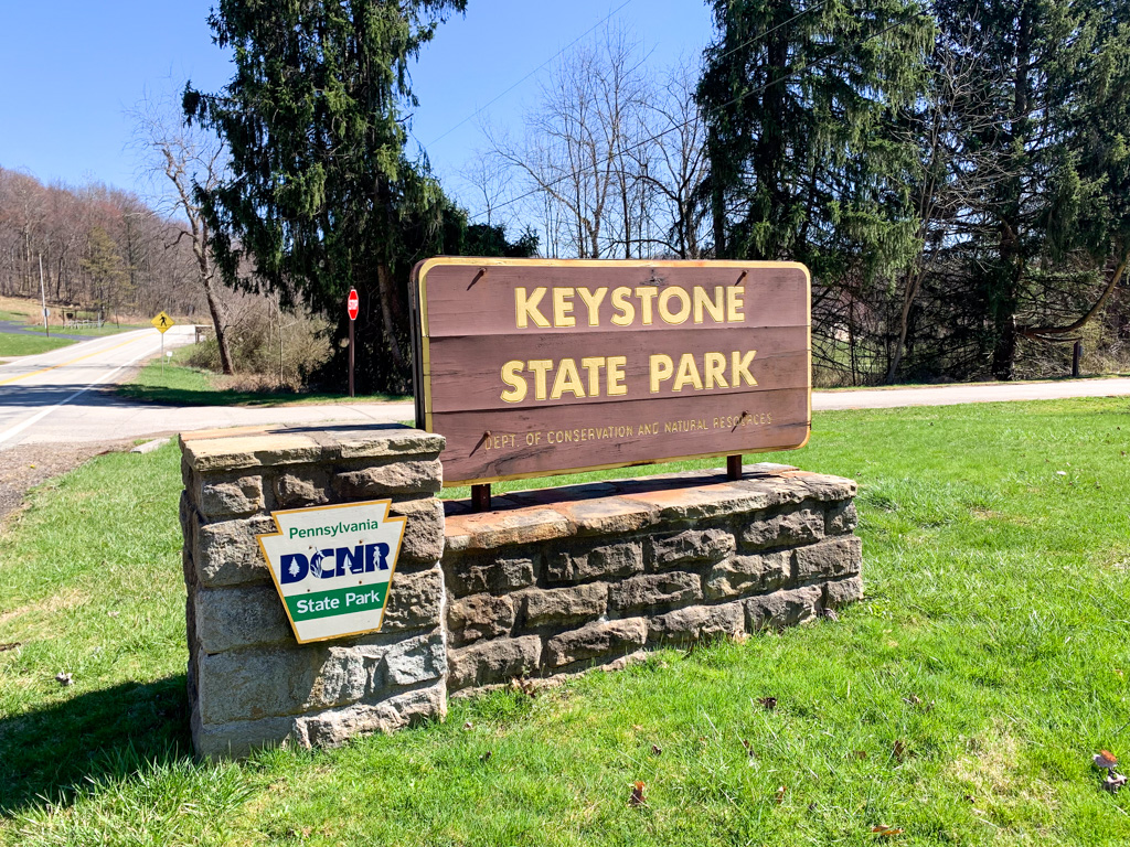
A family Hikes & Hops outing is quickly being a favorite tradition! Over the summer, we visited Jennings Environmental Center in Butler County with my parents. Sharing a border with Moraine State Park, this quaint center is often overlooked by its more showy neighbors. But this nature center is worth a visit in its own right! The park boasts miles of trails through both wooded and prairie ecosystems and is entirely dedicated to nature education. The park also protects the endangered massasuaga rattlesnake One mile of the North County Trail also passes through the park. This is a fantastic park for all hiking abilities!

THE HIKE: Jennings Environmental Center

Length: 5 miles (connect to NCT for more)
Elevation Gain: 300 ft
Difficulty: Easy
Time: 2 hours
Trail use: Hiking, Leashed pets
Parking: Ample parking at Center

This park is one of four environmental education centers managed by the Pennsylvania State Parks system. It’s slightly different from other state parks because its primary purpose is to educate the community about the local environment. The park also offers 5 miles of hiking trails and connects to the North Country Scenic Trail, as well as cross country skiing in the winter. Be aware that certain areas are open to hunting during the season.

Access and Parking: Jennings Environmental Center is free to visit! Park near the office and classrooms, use coordinates 41.00869377322245, -80.00326119251952

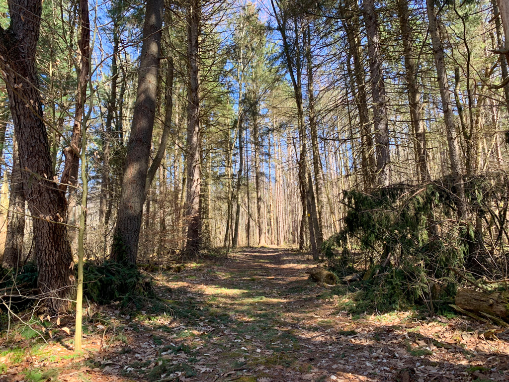
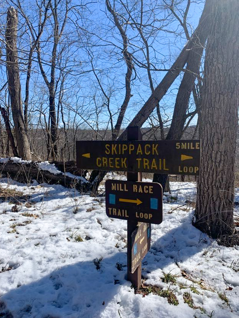
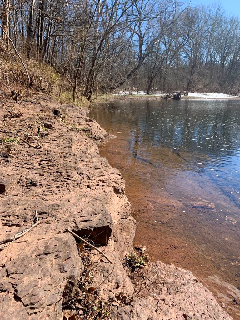
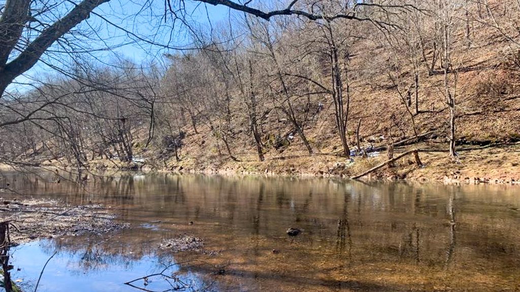
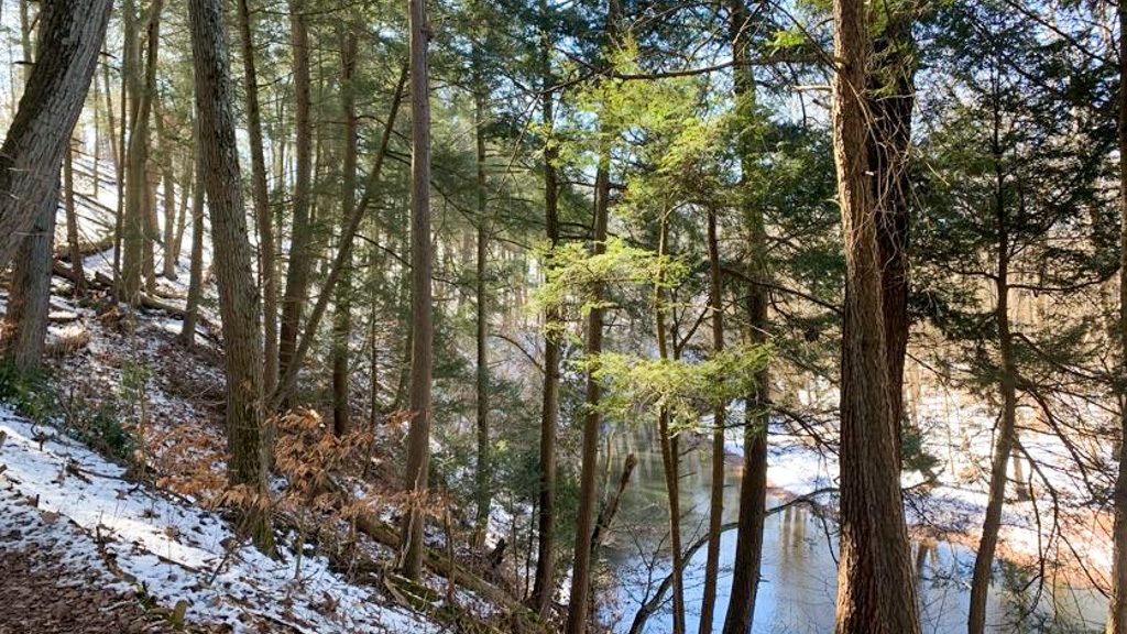
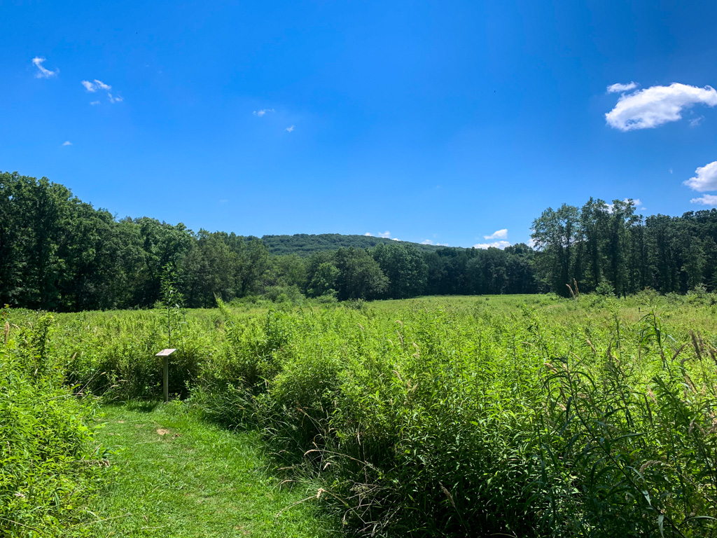
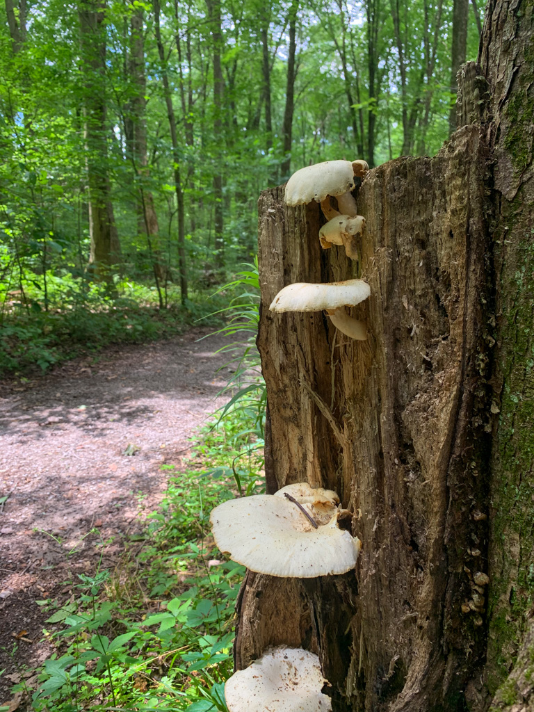
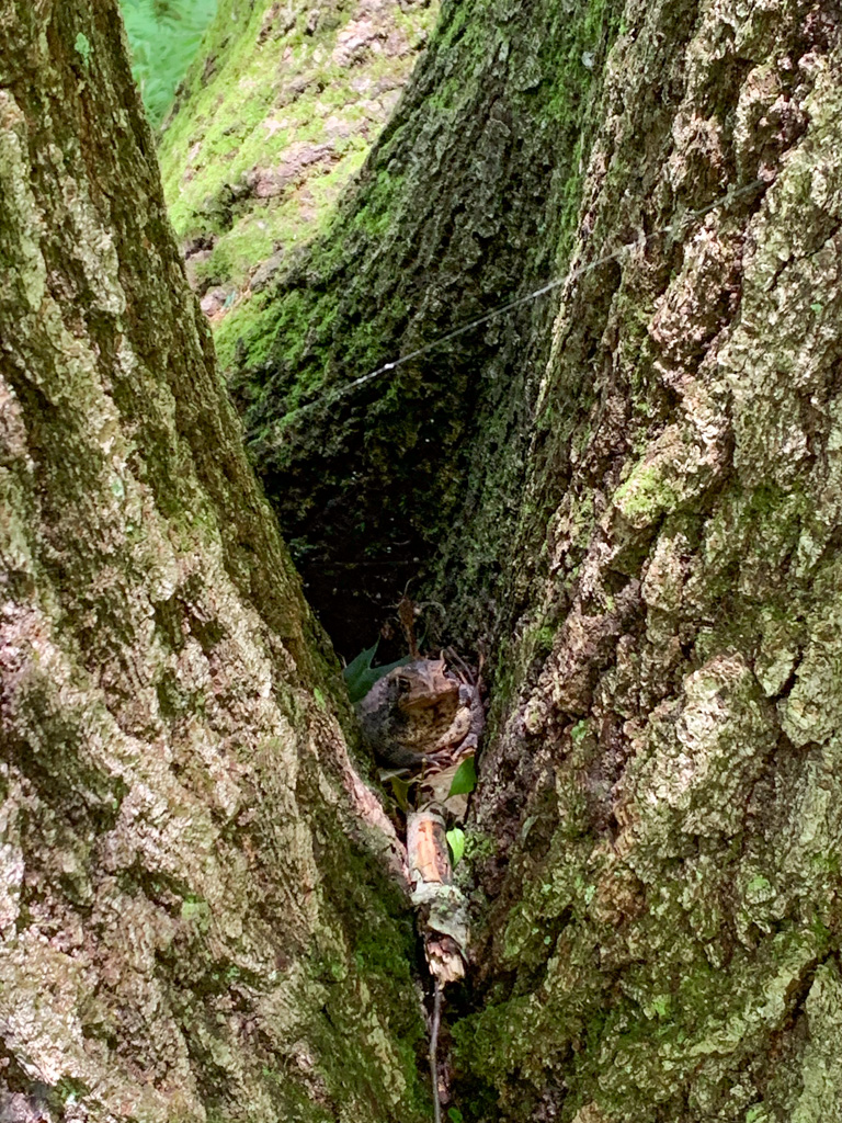
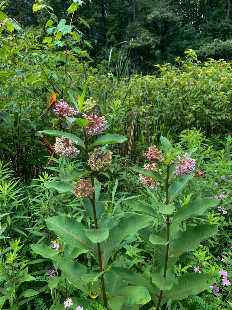
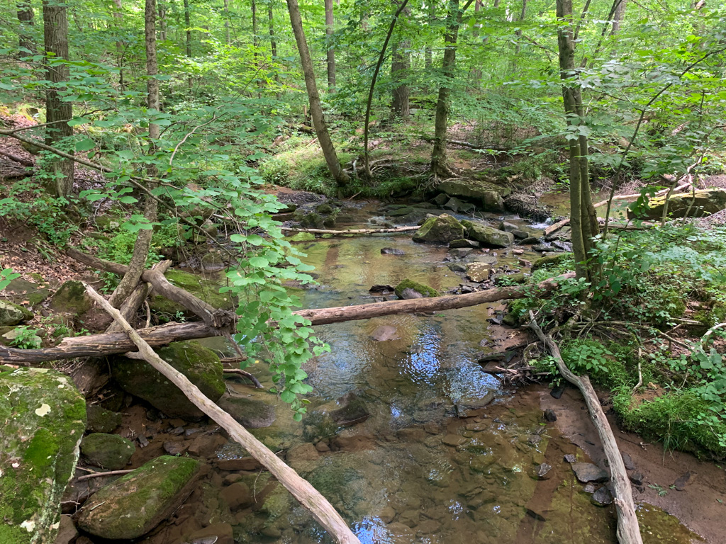
The Route: This route follows several of the main trails at Jennings to make a nice 5 miles figure 8 of the park. It starts at the park office where there are bathroom and educational displays. Begin the trek on the Whispering Woods Trail and head towards the wetland area. After a quick jaunt through the woods, you’ll encounter a large gazebo with interpretive signs about wetlands and the mining past of the region. from here, weave through some of the unmarked trails through the waterways where you may spot turtles hiding in the water and butterflies fluttering to the flowers. After exploring, return to the gazebo and take the North Country Trail (blue and yellow blazes) into the woods. Follow the trail until it reaches a trail junction. Now, you can take the Black Cherry Trail as it leaves the NCT and heads up the hill. This is the steepest part of your journey! This trail passes through peaceful woods and large glacial boulders. About a mile into your journey, pass another trail junction where you will get on the Ridge Trail. Be aware that this trail passes into hunting lands, which are clearly noted with signs along the way. The Ridge Trail then meets back up with the North Country Trail as it heads back towards the Park Office. You’ll cross a small bridge which crosses over a peaceful waterway. Now on the Old Elm Trail you’ll loop back to the park office. You’ve just finished your first loop!

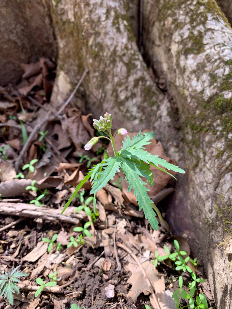
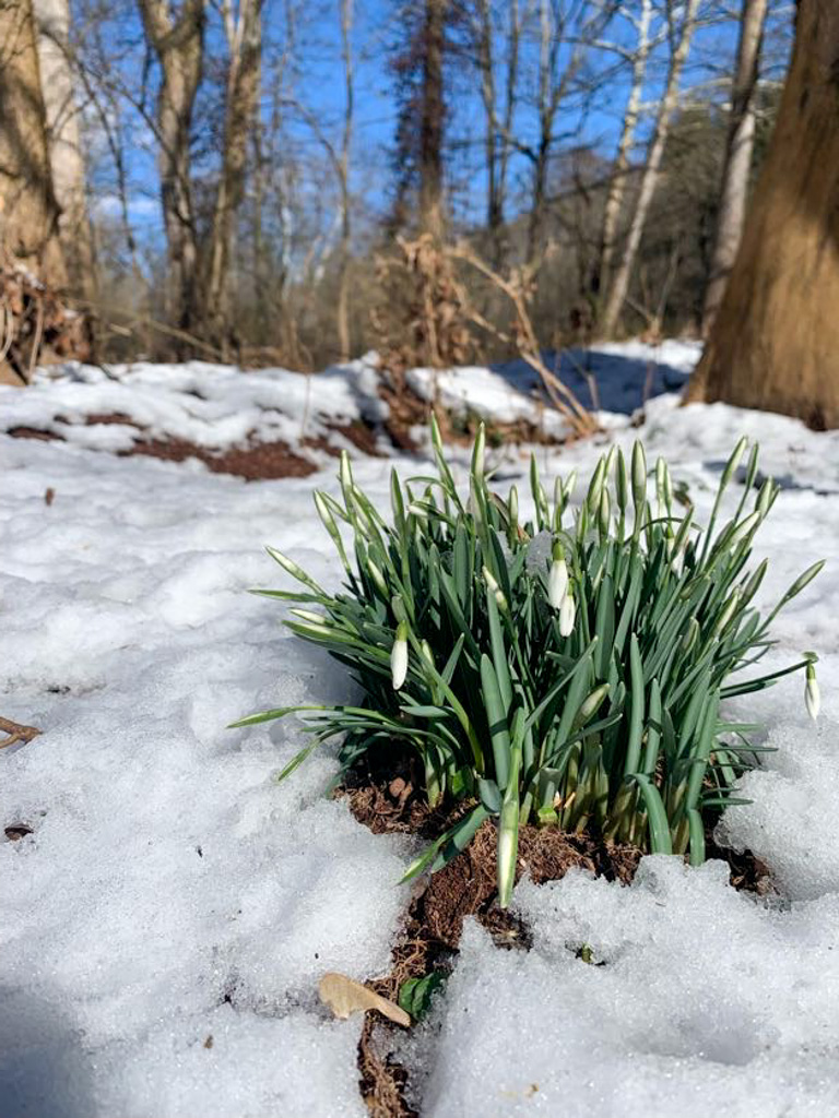
Now, if you’re still looking for more, you’ll carefully cross over PA 528 to the other half of the park. There’s additional parking and bathrooms on this side. There are many intersecting trails that can make small or large loops, depending on how much you want to tackle. We took the Maassuaga Trail and connected that to the larger Oakwoods Trail. This route passes through some lowlands where the ground can get quite muddy. Some of the trails were closed due to beaver activity leading to washed out trails. After a nice meander through the park, we ended our journey by walking through the park’s most unique feature: a prairie ecosystem. The Prairie Loop skirts around a wide open meadow with tall native grasses and flowers. The trails are wide, mown paths, and it is vital to the health of the ecosystem that you remain only on these paths. This area is also home to the reclusive, yet venomous massuaga rattlesnake so it’s best to keep an eye out for this slithering friend. If hiking in the late summer, you will be treated to sights of the amazing Blazing Star praire flower with its distinctive purple spire. After taking the Prairie Loop, follow the Blazing Star Trail back towards the road and cross over to the parking lot to complete your journey.

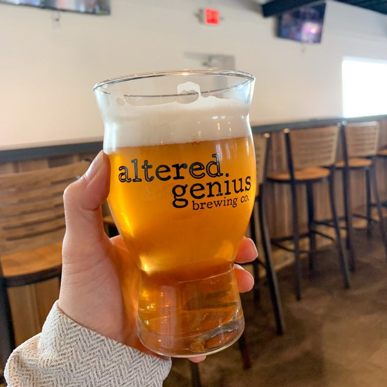
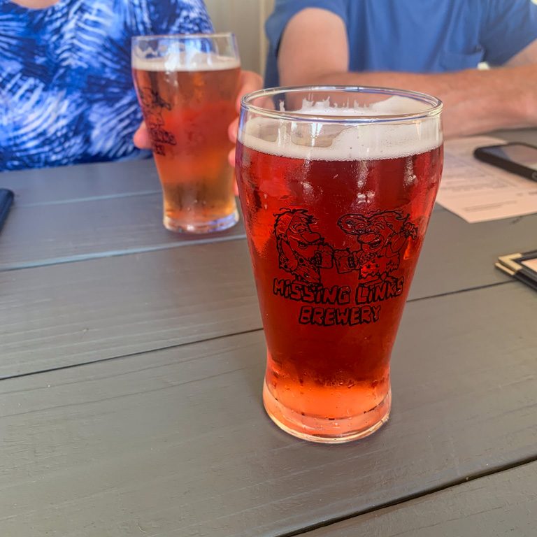
THE BEER: Missing Links Brewery

Address: 891 Evans City Rd #9209, Renfrew, PA 16053
Distance from Trail Head: 13 miles, 20 mins 
Website: http://www.missinglinksbrewery.com
Food?: Full Menu
Details: Outdoor seating, dog friendly outside

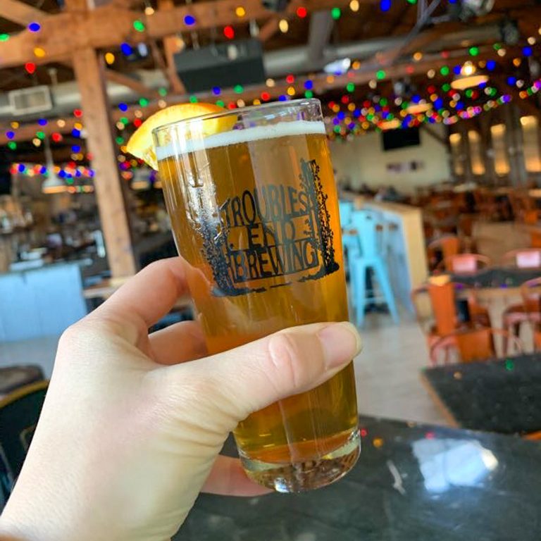
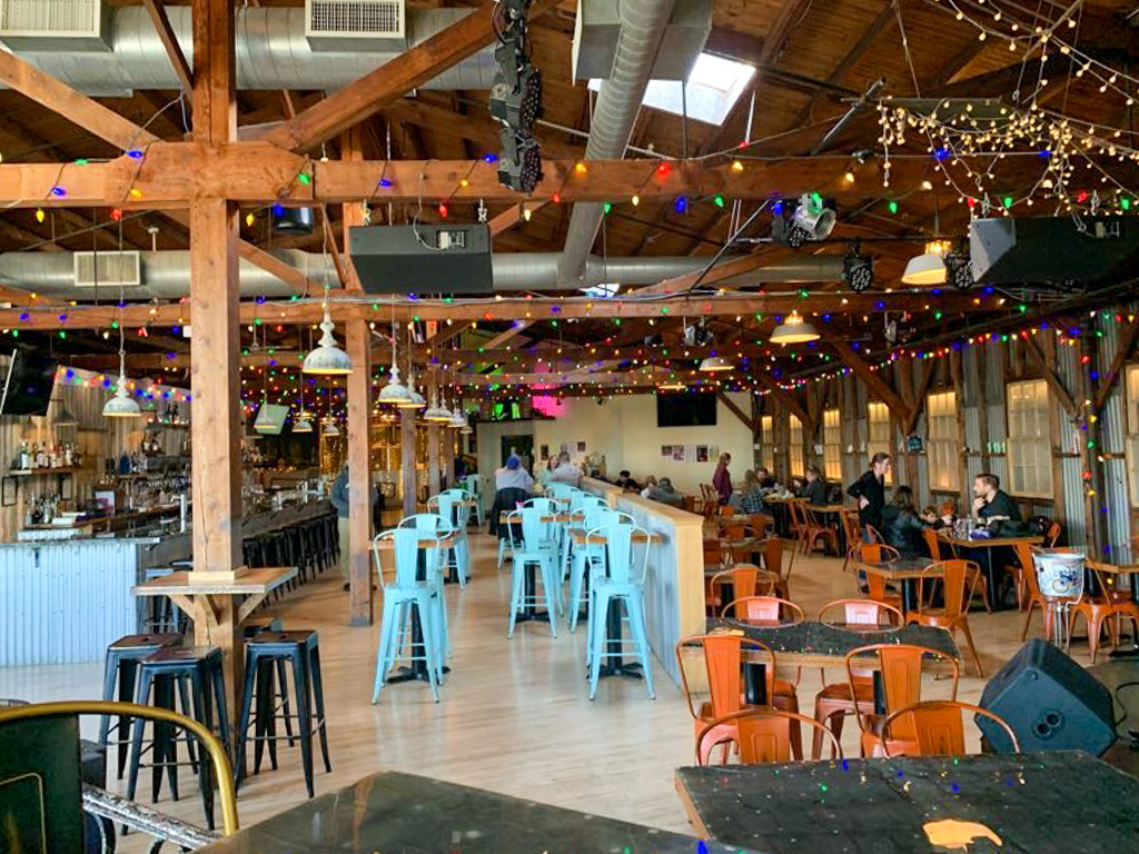
Missing Links Brewery is located in Evans City right next to the Butler Farm Market. They offer a full line-up of house made beer as well as a complete kitchen menu of tasty grub. There’s a large outdoor porch for pup-friendly dining and the entire space is family-friendly. With a comical logo of the owners as caveman, Missing Links like to riff on this with their beer names, like Bedrock IPA, Dinoweizen Wheat Beer, and Bigfoot ESB. With a kitchen menu of pub classic like pizza and sandwiches, this place is sure to be your missing link between a hike and a delicious brew!

Our Beer:

  • Oatmeal Stout – stout – 5.8%
  • Razzmatazz IPA – Raspberry hazy IPA – 5.1%
  • Tropical Mist IPA – NEIPA – 6.4%
  • Paradise Ale – Wheat Beer – 4.9%
  • Strawberry Rhubarb Sour – Sour – 4.7%
  • Blood Orange – Fruit Beer – 5.1%

Looking for more Hikes & Hops in Butler County? Check out Moraine SP & Union Brothers Brewing, McConnells Mill & ShuBrew, or Wolf Creek Narrows & Big Rail Brewing.

Coopers Rock State Forest & Screech Owl Brewing

Bruceton Mills, PA

Just over the Pennsylvania border is a land of soaring vistas and rocky crevices. Coopers Rock State Park in West Virginia offers over 50 miles of hiking trails, rocking climbing and bouldering, historical sites, and access to the Cheat River for rafting. This route loops through some park highlights and ends at the iconic Coopers Rock overlook. Afterward, head to Screech Owl Brewing for a large line-up of craft beer and a delicious full kitchen menu.

THE HIKE: Cooper’s Rock Loop

Length: 8 miles
Elevation Gain: 1,160 ft
Difficulty: Challenging
Time:  4 hours
Trail use: Hiking, leashed pets

Coopers Rock State Forest spans nearly 13,000 acres in West Virginia, making it the state’s largest state forest. It’s just 13 miles from Morgantown and is a great day trip from SW Pennsylvania. The park is popular for its wealth of outdoor activities. The forest is named for the series of rocks that jut out above the Cheat River. Legend has it that a barrel maker (known as a cooper) hid among these rocks after running from the law and continued his barrel-making from the shelter of the woods.

Access and Parking: Cooper’s Rock State Forest is free to visit! Park near the main overlook, use coordinates 39.63807011575319, -79.81564713061613.

The Route: There are miles and miles of trails in Coopers Rock from challenging wooded trails to wide gravel paths. This route makes a wide loop of the park to hit some of the major highlights: Raven Rock, Henry Clay Furnace, Rock City, and the stunning Coopers Rock Overlook.

Begin your trek at the main parking lot for the park by the main overlook, but don’t head there quite yet! We’ll end the trek with a dramatic view. Instead, head into the woods to the right following the signs for climbing access. This trail, while not always super well-marked, leads past huge sandstone boulders that are popular for climbers. It’s very impressive to see folks free-climbing and bouldering across the ancient stones.

After one mile, the access trail reaches a junction with the Raven Rocks Trail. Turn right to start an out-and-back 2-mile trail to an overlook. The way is wide and you’re likely to encounter others on this popular trail. You’ll follow the wide yet rocky path downhill among a sea of green ferns. After 0.75 miles, it starts to ascend upwards and you’ll find yourself suddenly open huge rocks with power lines stretching across. You’ll pass under the powerlines and reach Raven Rock overlook. The wide rock offers expansive views of the Cheat River Gorge below. Although the power lines stretch out from the rocks, there’s plenty to see without the visual obstruction.

The view from Cooper’s Rock Overlook

After enjoying the vista, continue back along the Raven Rock Trail until it reaches the main park access road. Carefully cross the road and get onto the Roadside Trail heading to the right. Follow this for a half mile before reaching a trail junction. Bear to the left and follow the unmarked trail as it skirts around the small pond. Just before the trail heads back into the trees, turn left to get on the Clay Run Trail. The beginning of this trail is open and gravelly and frankly not too interesting. But after 0.5 miles, the tree cover returns and the trail becomes peacefully wooded once again.

At 5.5 miles into the journey, you’ll emerge onto another trail junction. Turn right to cross the stream and visit the Henry Clay Furnace, the first iron blast furnace in West Virginia. The pyramid structure stands tall at the juncture of the left and rock forks of Clay Run. After exploring, cross back over the bridge and take the Rhododendron Trail up the hill to the right. After a half mile of a steady uphill climb, turn right on the Bench Trail. In only 0.2 miles, Bench becomes Ridge, and then in a few hundred feet, turn left to get on Rock City Trail. This was by far my favorite trail in the park. Suddenly, the trail dips down into a rock crevice and you feel like you’ve entered another world. Tall cliffs rise up on either side and spindle rhododendron bushes twist out of corners. The way becomes quite rocky and steep, but the views are so beautiful, you almost don’t notice the effort! This section of the trail is only 0.3 miles and then you’ll continue on the Rattlesnake Trail to the right which follows along the cliffside as you slowly ascend toward your final goal: Coopers Rock Overlook.

At 7.5 miles, the trail lets out onto a flat wooded area not far from the parking lot. Follow the trail signs for the overlook. You’ll emerge onto a huge rock face lined with a wood fence. It looks out over the river gorge and is stunning at any time of the year. After enjoying the view, follow the trail back to the parking lot. Bonus – a West Virginia swing is nestled between two pavilions!

THE BEER: Screech Owl Brewing

Address: 2323 Ralph Livengood Rd Rd, Bruceton Mills, WV 26525
Distance from Trail Head:  15 miles, 22 mins 
Website: http://screechowlbrewing.com/
Food?: Full Kitchen Menu (Spent Grain Cafe)
Details: Indoor and outdoor seating, kid playground

Spent Grain Brewing is Preston County’s first brewery. It grew from a newly discovered passion of Roger Jameson. After retiring from a long career of truck-driving, Roger began brewing beer and quickly discovered a love for the craft. He and his wife Crista built a small brewery in their garage in 2015. Since then, Screech Owl Brewing has become far more than they ever could have imagined! With a full restaurant and brewery, the family-run business has grown into a community staple. You’ll catch Roger and Krista greeting guests while their son Jameson mans the grills and daughter-in-law Kristin minds the kegs.

And if delicious beer wasn’t enough, the restaurant features homemade bread made from the spent grains from the brewing process.

Our Beer:

  • Muddy Creek Ale – Blonde/Pale Ale – 6.2%
  • Class IV Zinger – IPA – 5.9%
  • Wild & Wonderful Strawberry Ale – Fruit Ale – 6.2%
  • Hoo’s Your Daddy – IPA – 6.4%

Looking for more Hikes & Hops in West Virginia? Check out Grandview Rim to Turkey Spur & Weathered Ground Brewery, Long Point Trail & Bridge Brew Works, or Endless Wall & Free Folk

Keystone SP & Yellow Bridge Brewing

Delmont, PA

Looking for a day trip less than an hour from Pittsburgh? Look no further than Keystone State Park. This Laurel Highlands gem has a lake beach, hiking trails, kayak & SUP rentals, fishing, and more! You can even turn it into a weekend trip by renting a campsite or yurt. After a day at the lake, visit Yellow Bridge Brewing for a brew in the quaint taproom.

THE HIKE: Davis Run, McCune, and Lakeside Loop

Length: 5 miles
Elevation Gain: 393 ft
Difficulty: Easy
Time:  2 hours
Trail use: Hiking, leashed pets
Parking: large lot at beach

The 1,200 acre Keystone State Park is the perfect day trip or weekend destination. The centerpiece is the large Keystone Lake that’s open for various water activities, including swimming, fishing, and boating. There are also 8-miles of trail ranging from easy to more moderately difficult.

It’s hard to believe while enjoying the beauty of Keystone State Park, but the waters actually have their origins in the former bustling steel industry of southwestern PA. The Keystone Coal and Coke company dammed the meeting of the Davis and McCune runs to create a lake that would supply water to their coke ovens. In 1945, the Keystone Company sold the area to the state which sealed off the mines. Today the park is a beautiful spot for recreation.

Where to Park: There are several large parking lots at Keystone but not all of them are connected. For this hike, park at the Beach parking lot for access to the trailhead. If renting kayaks or only doing the Lake Loop, park at the lot off Slag Road. *As of July 2024, there is not access within the park from the beach to the boat launch. You must go outside of the park to access Slag Road.

The Route: This route combines several of the trails for a 5-mile loop that includes wetlands and ends around the lake. From the beach parking lot, head toward Keystone Park Road. You’ll start out on the Davis Run trail which actually begins across the street, opposite from the lake. The road is not very busy but still cross with care. Get on the Davis Run Trail marked with blue diamonds. Our route combines the Davis Run Trail (blue diamond), McCune Trail (yellow diamond), and Strawcutter Trail (green diamond) for just under three miles before crossing back over the road. These trails are intersecting so there’s plenty of opportunity to lengthen or shorten your outing. During the first half of the hike, you’ll pass by marshes so keep an eye for wetland species like skunk cabbage in the early spring. The trails abound with ephemeral wildflowers in the early spring. These trails also loop through hardwood forests and then through tall pine trees. At the end of the wetland loop, cross back over the road to complete the 2 miles Lakeside Loop (no blaze). The section around the lake is a wide flat path that is a great option for strollers or those with mobility issues. Add on the 0.3-mile Pine Trail (no blaze) for a short trek off the Lakeside loop into the towering pines. The Lakeside Loop also passes by the lakeside campground and then crosses the dam. To the right is the boat launch and kayak rental. Cross through the parking lot to pick up the trail again. Along the north side of the lake, you’ll pass by several pavilions and picnic tables which are perfect for a post-hike snack. Complete your hike by following the trail back to the beach parking area.

THE BEER: Yellow Bridge Brewing

Address: 2266 PA-66, Delmont, PA 15626
Distance from Trail Head: 12 miles, 17 mins 
Website: https://yellowbridgebrewing.com/
Food?: in-house Pizza
Details: Indoor seating, bar games

Yellow Bridge Brewing opened in 2016 by two brothers who decided to take their homebrewing to the next level. Today, there are two locations: Delmont and Greensburg. You can usually find a range of 10 homemade brews on tap along with local wines and ciders. Yellow Bridge has a main line up of 6 core beers that are made pretty consistantly and then peppers in more unique seasonal and one-off barrels. The original Delmont location is off PS-66 which can make the parking lot a wee bit difficult to get into but trust me it’s worth it! The inside is a wide open with tables and the bar on one side and the other open to the brewing equipment.

I’m not usually one for the heavy IPAs but Sebastian, the Double IPA was definitely a favorite. It was smooth with a tropical aroma and went down a little too easy for 8%! Thankfully the in-house pizza menu has some tasty offerings.

Our Beer:

  • Sebastian – Double IPA – 8%
  • London Porter – Porter – 5%
  • Little Dude – 5.4%
  • YB Lager – 4.8%

Settler’s Cabin & Altered Genius Trailside

Imperial, PA

Head out to Settler’s Cabin park, one of the nine Allegheny County Parks, for a Springtime hike! See the modest waterfall, hike through freshly emerging wildflowers, and enjoy meandering through hemlock and pine groves. This park is beautiful all year round but is particularly lovely in the early spring. Afterward, check out Altered Genius’ new Trailside taproom right along the Montour Trail in Imperial!

THE HIKE: Settler’s Cabin South Loop

Length: 4 miles
Elevation Gain: 400 ft
Difficulty: Moderate
Time: 1.5 hours
Trail use: Biking, hiking, leashed pets
Parking: Park at Tomahawk Shelter

Settler’s Cabin Park is one of the many parks managed and maintained by Allegheny County. The large park boasts not only miles of wooded trail, but also large pavilions, a wave pool, playgrounds, tennis courts, and a hockey rink. There really is something for everyone! I grew up going to this park for birthday and graduation parties, but never knew that there were so many trails here too! 

The park gets its name from a historic log cabin located onsite which archaeologists helped to date to 1780. The various pavilions are also named for the Native peoples that once lived in this area including the Algonquian, Seneca, Cayuga, and Chippewa. Prior to the land being purchased by the County in 1971, this area was an active coal mine. Thankfully, efforts are continually being made to reclaim and reforest the area, as well as to mitigate some of the residual mine drainage in some of the creeks. Because of its history, the land can support a unique variety of native flora in its more acidic soil. Settler’s Cabin is particularly known for its beautiful displays of wildflowers in the Spring and Fall. 

There’s over 10 miles of trails at this park but we chose to stick with a smaller loop that included the waterfall (my favorite spot) and a new section of the red trail that we hadn’t tackled before. This time of year, there were tiny flowers poking through the ground on a sunny March afternoon.

Settler’s Cabin is a fairly large park, so I’d recommend having a route picked out from AllTrails or use the County Park’s app to follow the trails as you can easily end up making it further away than expected. On this trek, I wanted to see where the planned connector to the Panhandle rail trail will be at the southwestern corner of the park. Eventually this connector trail will allow access from the park to South Park and all the way to the Great Allegheny Passage!

Where to park: This hike starts at the Tomahawk shelter where there is a large parking lot and portapotty. If there’s an event here, you can also park at the nearby playground or the dog park. 

The Route: From the Tomahawk shelter, the trail starts at the tree line where there is a kiosk with a map and trail alerts. Head into the woods on the blue trail. The trail goes downhill through hemlock trees, then turn left where the blue trail splits from the red. Stay on the blue trail for about a half mile. Then follow the trail signs for the Green/Waterfall Trail. This trail is a wide, well maintained path that switchbacks down the hillside. The trail lets out at a small creek and there is a spur trail to the right to see the waterfall. This waterfall is only 4-ft and is by no means the most impressive falls in western PA but it’s still worth a visit and is a great place to sit and enjoy nature. From here, follow along the Green trail as it meanders along the creek bed. This is a prime section for spotting wildflowers! Just over a mile, the Green Trail turns right and heads up a steep section of hillside. This is the steepest hill that you’ll climb on the Trek. At the top of the hill, turn left onto the Red trail to continue along the quieter southern portion of the park. At about 2.3 miles, there is a trail intersection where heading to the left continues along the Red Trail and crosses over the paved Panhandle connector. Instead, turn right and get on the Yellow Trail. Follow the yellow trail for about a half mile, then turn right on the wide gravel path. Alltrails labels this as the purple trail but we didn’t see any blazes. Continue slightly uphill on this path until it intersections with another portion of the red trail. Turn left and continue along the Red Trail until it meets back up with the Blue Trail and the Tomahawk Shelter parking lot. 

THE BEER: Altered Genius Trailside

Address: 258 Main St, Imperial, PA 15126
Distance from Trail Head: 14 mins, 6.3 miles
Website: www.alteredgeniusbrewing.com
Food?: BYOF, Food Trucks
Details: Outdoor seating, Potentially dog friendly outside

Altered Genius has been crafting unique beers and delicious foods in Ambridge since 2020. The owners may have opened their business during a difficult time but managed to quickly find a loyal following in the Ambridge community. Owners and brewers Donnie and Mike began homebrewing roughly 10 years while they were both working in alternative education. When they shifted to opening a brewery full time, it was a no-brainer that the brewery’s name had to give a nod to their past careers: hence Altered Genius. 

The Ambridge brewery has been so successful that the owners knew it was time to bring their beer across the river. Their second location, called Altered Genius Trailside, opened in March 2024 along Main Street in Imperial. The best part? It’s right on the Montour Trail! This spacious taproom offers all the usual AG favorites, as well as cider from A Few Bad Apples. There’s no kitchen here, but expect a regular round of food trucks. I can’t wait to come back sit on the back patio, it looked like the perfect Sunday afternoon spot.

Our Beer:

  • Prim – German Pilsner – 5.1%
  • Umbrella in a Brainstorm – Saison – 4.7%
  • Lady Red Hair – Red IPA – 6.8%
  • Stephens Island – Irish Stout – 5%

Looking for more Hikes & Hops west of the city? Check out: Raccoon Creek State Park & Fermata Brewing, Robin Hill & Cobblehaus, and Montour Woods & Abjuration

Skippack Creek Loop & Trouble’s End Brewing

Collegeville, PA

Evansburg State Park is a small state park along the Skippack Creek in Southeastern PA. The full Skippack Creek Loop Trail takes you around the whole park, along the creek’s edge and up along a ridge. Although it was pretty muddy when we visited, this seems like it would be a great place to visit in the drier summer months!

THE HIKE: Skippack Creek Trail

Length: 5 miles
Elevation Gain: 262 ft
Difficulty: Moderate
Time: 2 hours
Trail use: Hiking, Mountain biking, Horseback riding,
Parking: Small lot at trailhead

Find the Parking Lot: Park at Pavilion A off Mayhill Road. Use 40.1980458, -75.4042884 to find the trailhead

Evansburg State Park encompasses 3,300 acres of green space in Montgomery County, PA. Its main feature is the Skippack Creek, making it a popular spot for fishing. There are 26 miles of trails for hikers, some of which are also open for mountain biking and horseback riding. In the winter, you can still get out on the trails for cross-country skiing. 

History 

This area was once the land of the Delaware or Lenni Lenape people. Their society spanned most of modern day New Jersey into the PA Lehigh Valley and up to the New York Catskills. Sadly, their matrilineal clans were greatly impacted by European diseases by the time William Penn made his 1684 “purchase” of the American province that would become Pennsylvania. Although WIlliam Penn, a Quaker who founding PA for religious freedom, approached the Lenni Lenape people with peace treaties and payment for their land, his descendents were not so peaceful. In the early 1700s many Lenni Lenape were forcibly removed from their lands in eastern Pennsylvania. 

As the population of Philadelphia exploded in the 1700s, the surrounding area also began to grow to support trade and industry. The Skippack Creek valley was connected to the main city by the construction of the Skippack Pike and the 8-arch bridge over the creek. Built in 1792, this bridge still exists today and is one of the oldest continuously used bridges in the state. 

The land surrounding the modern state park was once home to German Mennonite families seeking religious freedom in Penn’s new colony. They used the waters of the Skippack to power their mills and remnants of these buildings can still be seen along the creek today. 

The Hike

The Skippack Creek Loop is a fairly easy 5 miles loop around the park with only a few difficult uphill sections and two portions on the road. Although you can park at various places through the park to access the point, we parked at Pavilion A where there was sufficient parking and bathroom facilities. 

From the parking lot, head down the gravel road until you reach the rounded turn around spot. The trail starts to the left and is marked by yellow blazes with a sign for Skippack Creek Loop. We choose to go clockwise (turning to the left to begin) and this is probably the way I would suggest to begin. 

Immediately you’ll head downhill on a single track direct path towards the creekside. Along this route, you’ll cross over several small bridges and the way may be muddy. Continuing along, notice interpretive signs about the geology and wildlife of the area. You’ll stay on the Skippack Loop the whole time so ignore the signs for the Farmstead. 

After the trail reaches the river, it gets slightly confusing with horseriders and hiking having created a meandering crisscross of trails. They all lead generally the main directions and following alongside the creek will send you on the right path. About a mile in the hike, there is a stream crossing that could be easy in the summer but in the spring was pretty wide and slightly difficult to cross. We managed to make a couple wide leaps to stones without getting feet wet but this one might be hard for little legs. 

Eventually the trail emerges onto Kratz road and you will turn right to cross the bridge along the shoulder. Be very careful as this is an active road. On the other side of the bridge is another parking area for the trail. The route begins around at the back right corner of the parking lot and heads into a field before descending back into the woods. This side of the creek is much hillier as the trail travels along a ridge overlooking the creek. You’ll also pass by some ruins along the creek which may have been an old gristmill. 

Finally the trail lets out onto Water Street Road which you’ll follow for about 0.5 miles. Although this is a quiet street, this was my least favorite part of the hike because there is no sidewalk and only a narrow median before the guardrail. Finally you’ll reach a pedestrian bridge to the right and use it to cross over the creek. Turn to the right to get back on the Skippack Creek Trail and finish the loop.

PA Park Passport: Sticker at kiosk outside the Park Main Office

THE BEER: Trouble’s End Brewing

Address: 50 W Third Ave STE 310, Collegeville, PA 19426
Distance from Trail Head: 3.6 miles, 11 mins 
Website: www.troublesendbrewing.com/
Food?: Full Menu
Details: Summer beer garden, no pets, live music

Tucked in the small town of Collegeville, just shy of 4 miles from the state park is Troubles End Brewpub. Located on the top floor of an old industrial building, this pub has some of the coolest vibes I’ve seen. The rustic beams lend to a farmhouse style, but the brightly painted furniture and strings of multicolor lights bring a sense of whimsy. Whimsy is definitely a way to describe their robust beer menu. Full of unique takes on classic styles, you can’t help but notice the interesting tasting notes. While I’m not exactly sure how my porter tasted like “one single piece of salted licorice in a wool coat pocket”, they definitely get an A+ for creativity! 

While we didn’t have any food at the pub, they had a delicious sounding menu of gastropub favorites as well as a more upscale entrée list that included wild boar meatloaf and crab cakes. Tucked into the corner of the large space was a stage complete with a flower studded piano. Clearly this brewpub knows how to jam! Check out their events calendar on their website for upcoming shows 

Our Beer:

  • Conductor – Porter – 5%
  • Fallen Branches – Wheat – 4.7%
  • The Editor – ESB (Extra Special Bitter)
  • Tutto Pils – Italian Pilsner