Imperial, PA

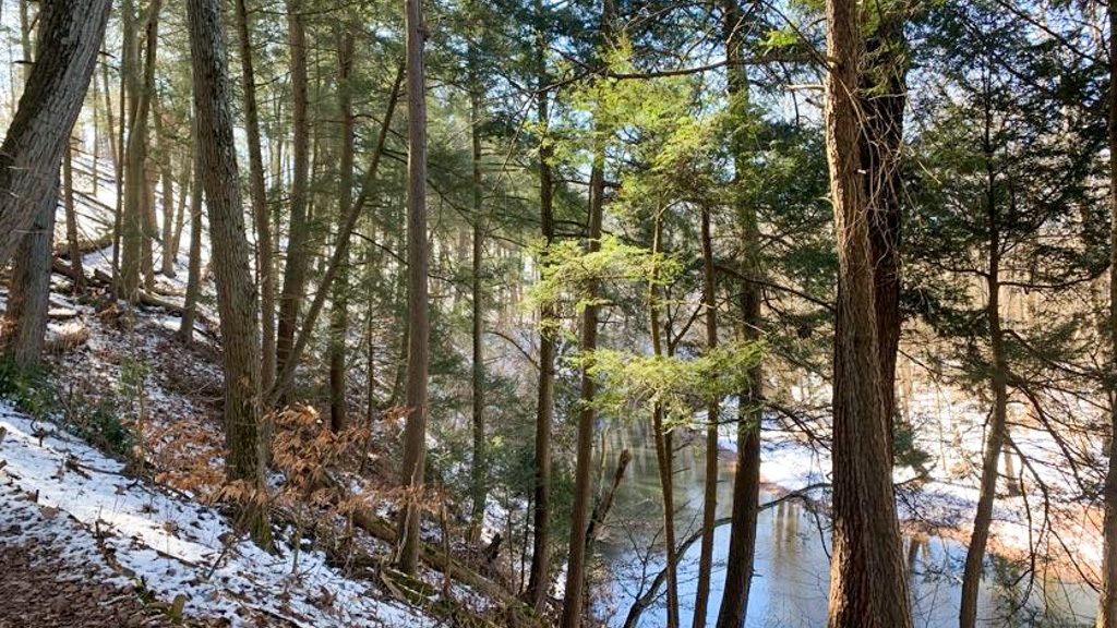
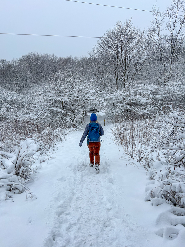
Head out to Settler’s Cabin park, one of the nine Allegheny County Parks, for a Springtime hike! See the modest waterfall, hike through freshly emerging wildflowers, and enjoy meandering through hemlock and pine groves. This park is beautiful all year round but is particularly lovely in the early spring. Afterward, check out Altered Genius’ new Trailside taproom right along the Montour Trail in Imperial!
THE HIKE: Settler’s Cabin South Loop

Length: 4 miles
Elevation Gain: 400 ft
Difficulty: Moderate
Time: 1.5 hours
Trail use: Biking, hiking, leashed pets
Parking: Park at Tomahawk Shelter
Settler’s Cabin Park is one of the many parks managed and maintained by Allegheny County. The large park boasts not only miles of wooded trail, but also large pavilions, a wave pool, playgrounds, tennis courts, and a hockey rink. There really is something for everyone! I grew up going to this park for birthday and graduation parties, but never knew that there were so many trails here too!
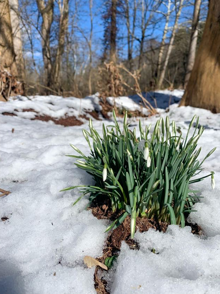
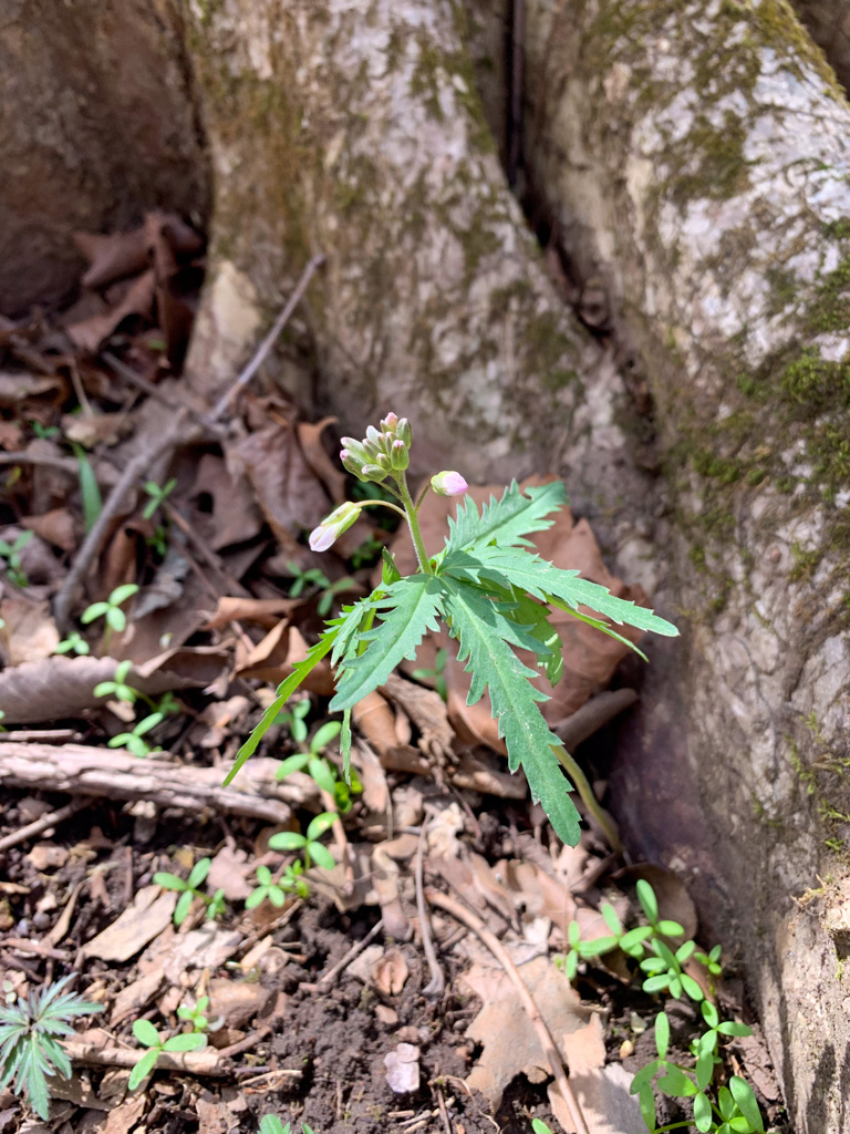
The park gets its name from a historic log cabin located onsite which archaeologists helped to date to 1780. The various pavilions are also named for the Native peoples that once lived in this area including the Algonquian, Seneca, Cayuga, and Chippewa. Prior to the land being purchased by the County in 1971, this area was an active coal mine. Thankfully, efforts are continually being made to reclaim and reforest the area, as well as to mitigate some of the residual mine drainage in some of the creeks. Because of its history, the land can support a unique variety of native flora in its more acidic soil. Settler’s Cabin is particularly known for its beautiful displays of wildflowers in the Spring and Fall.
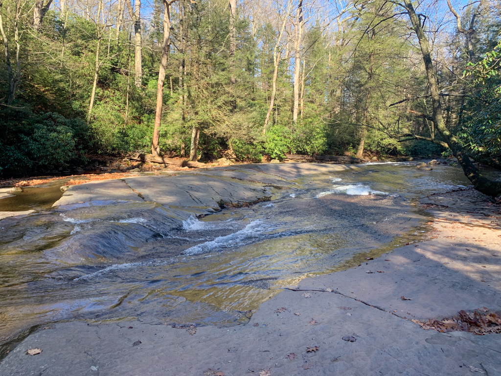
There’s over 10 miles of trails at this park but we chose to stick with a smaller loop that included the waterfall (my favorite spot) and a new section of the red trail that we hadn’t tackled before. This time of year, there were tiny flowers poking through the ground on a sunny March afternoon.
Settler’s Cabin is a fairly large park, so I’d recommend having a route picked out from AllTrails or use the County Park’s app to follow the trails as you can easily end up making it further away than expected. On this trek, I wanted to see where the planned connector to the Panhandle rail trail will be at the southwestern corner of the park. Eventually this connector trail will allow access from the park to South Park and all the way to the Great Allegheny Passage!


Where to park: This hike starts at the Tomahawk shelter where there is a large parking lot and portapotty. If there’s an event here, you can also park at the nearby playground or the dog park.

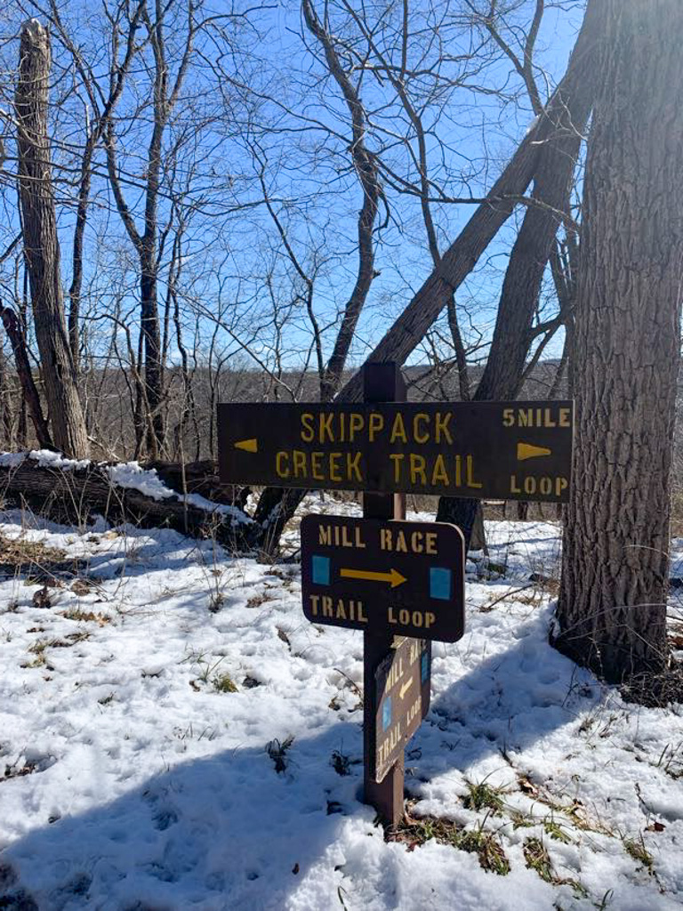
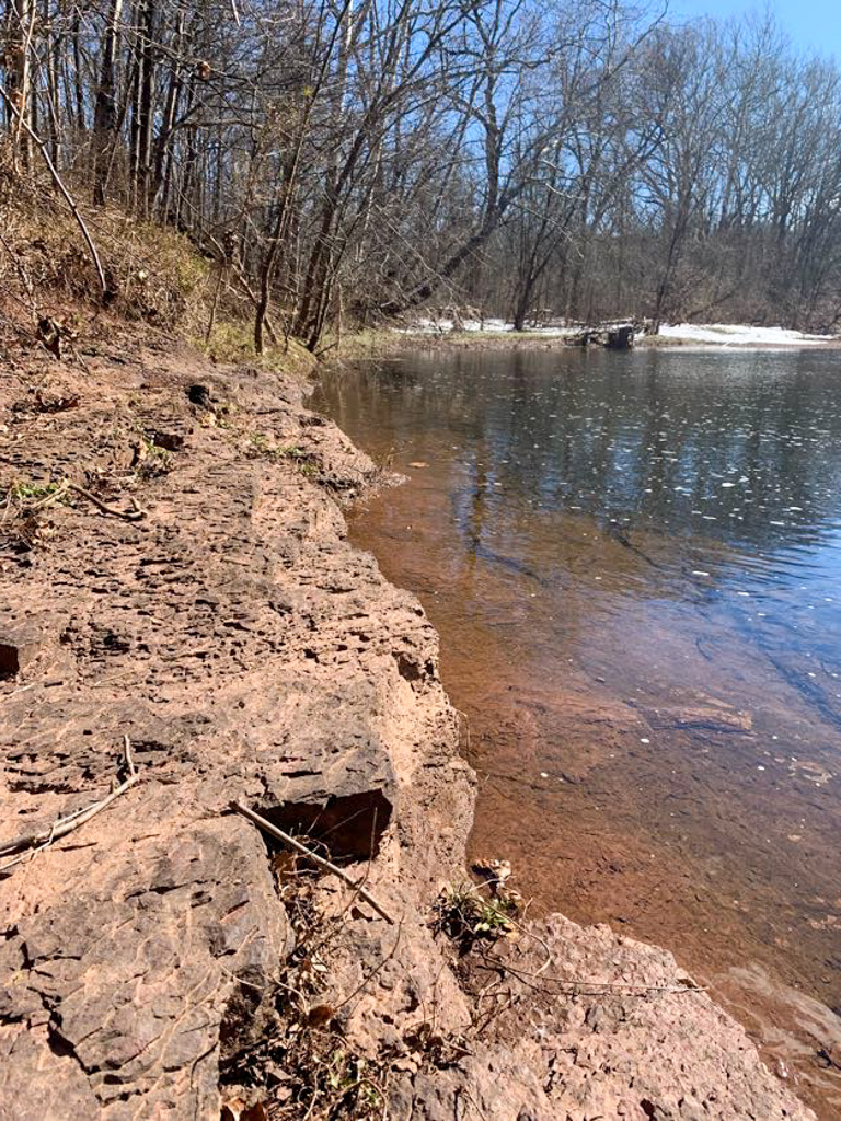
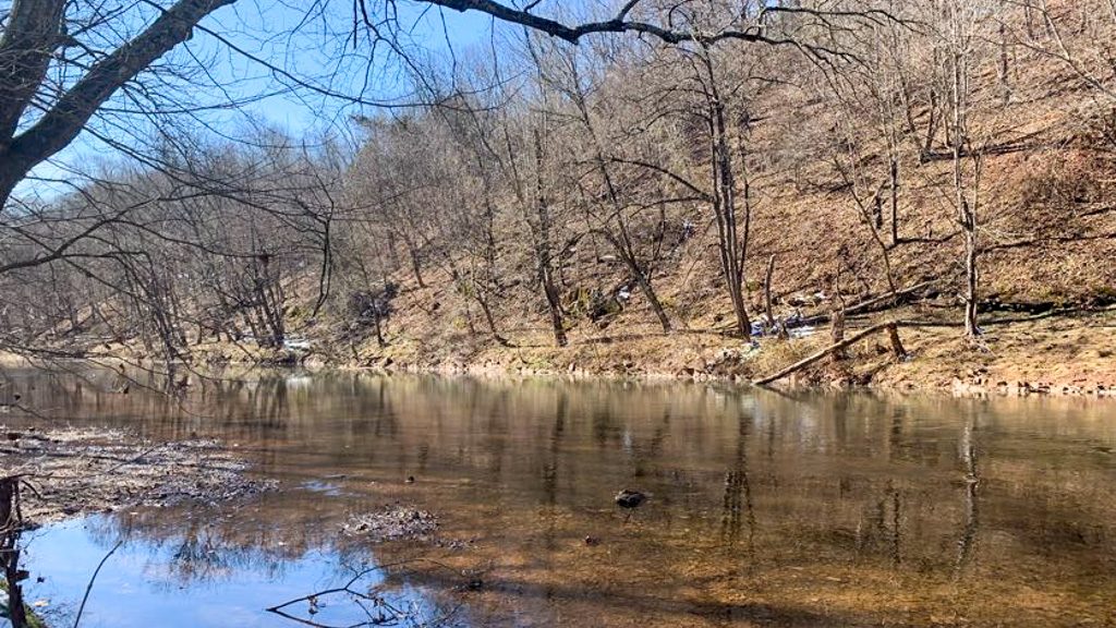
The Route: From the Tomahawk shelter, the trail starts at the tree line where there is a kiosk with a map and trail alerts. Head into the woods on the blue trail. The trail goes downhill through hemlock trees, then turn left where the blue trail splits from the red. Stay on the blue trail for about a half mile. Then follow the trail signs for the Green/Waterfall Trail. This trail is a wide, well maintained path that switchbacks down the hillside. The trail lets out at a small creek and there is a spur trail to the right to see the waterfall. This waterfall is only 4-ft and is by no means the most impressive falls in western PA but it’s still worth a visit and is a great place to sit and enjoy nature. From here, follow along the Green trail as it meanders along the creek bed. This is a prime section for spotting wildflowers! Just over a mile, the Green Trail turns right and heads up a steep section of hillside. This is the steepest hill that you’ll climb on the Trek. At the top of the hill, turn left onto the Red trail to continue along the quieter southern portion of the park. At about 2.3 miles, there is a trail intersection where heading to the left continues along the Red Trail and crosses over the paved Panhandle connector. Instead, turn right and get on the Yellow Trail. Follow the yellow trail for about a half mile, then turn right on the wide gravel path. Alltrails labels this as the purple trail but we didn’t see any blazes. Continue slightly uphill on this path until it intersections with another portion of the red trail. Turn left and continue along the Red Trail until it meets back up with the Blue Trail and the Tomahawk Shelter parking lot.
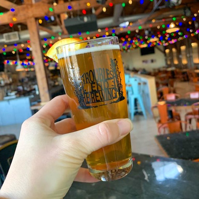
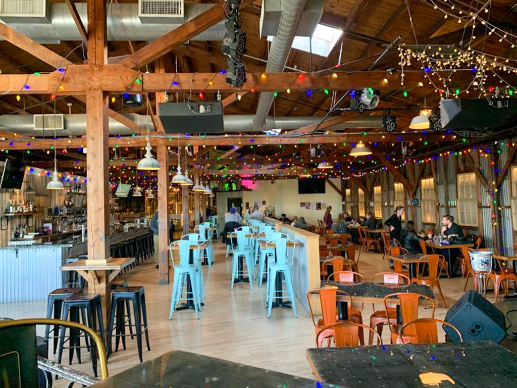
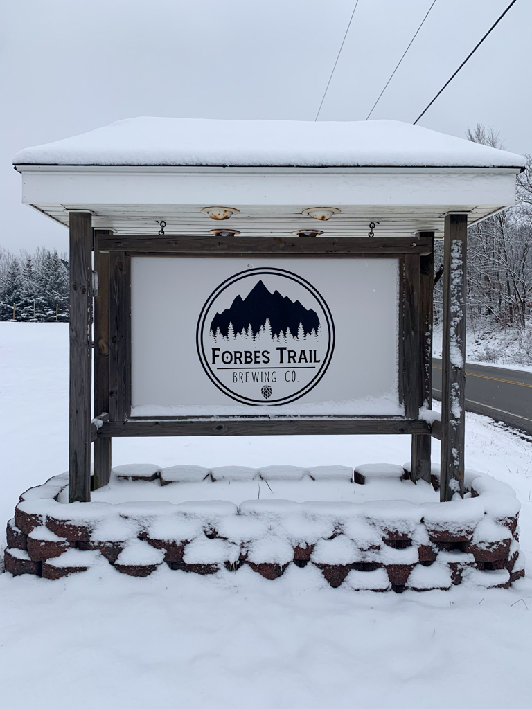
THE BEER: Altered Genius Trailside
Address: 258 Main St, Imperial, PA 15126
Distance from Trail Head: 14 mins, 6.3 miles
Website: www.alteredgeniusbrewing.com
Food?: BYOF, Food Trucks
Details: Outdoor seating, Potentially dog friendly outside
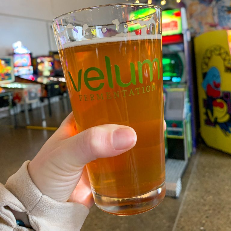
Altered Genius has been crafting unique beers and delicious foods in Ambridge since 2020. The owners may have opened their business during a difficult time but managed to quickly find a loyal following in the Ambridge community. Owners and brewers Donnie and Mike began homebrewing roughly 10 years while they were both working in alternative education. When they shifted to opening a brewery full time, it was a no-brainer that the brewery’s name had to give a nod to their past careers: hence Altered Genius.
The Ambridge brewery has been so successful that the owners knew it was time to bring their beer across the river. Their second location, called Altered Genius Trailside, opened in March 2024 along Main Street in Imperial. The best part? It’s right on the Montour Trail! This spacious taproom offers all the usual AG favorites, as well as cider from A Few Bad Apples. There’s no kitchen here, but expect a regular round of food trucks. I can’t wait to come back sit on the back patio, it looked like the perfect Sunday afternoon spot.
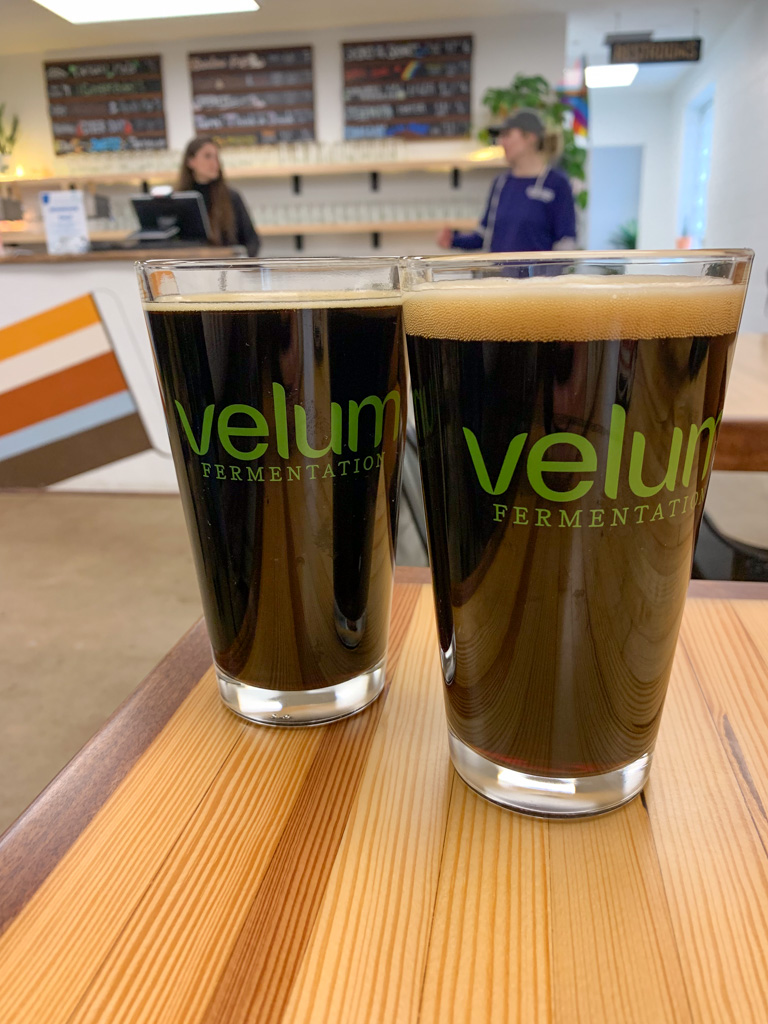
Our Beer:
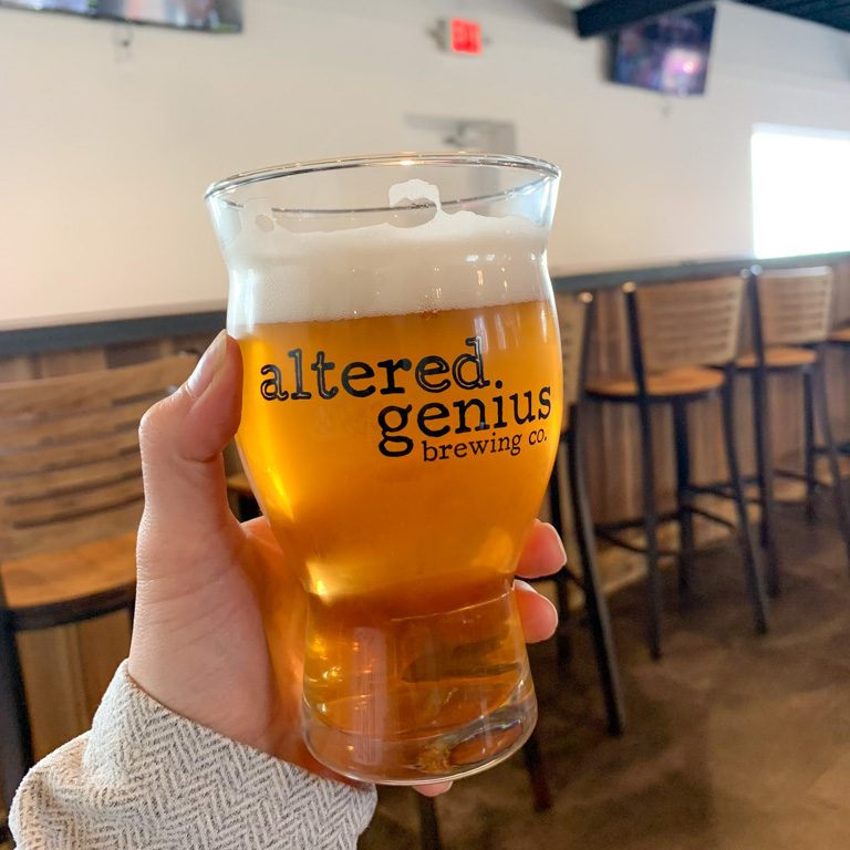
- Prim – German Pilsner – 5.1%
- Umbrella in a Brainstorm – Saison – 4.7%
- Lady Red Hair – Red IPA – 6.8%
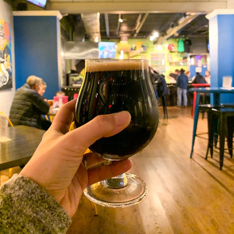
- Stephens Island – Irish Stout – 5%

Looking for more Hikes & Hops west of the city? Check out: Raccoon Creek State Park & Fermata Brewing, Robin Hill & Cobblehaus, and Montour Woods & Abjuration