For me, my year in hiking has had a lot of ups and downs! At the beginning of the year, I was hiking and traveling a lot. Then, I was training for an ultramarathon so hiking took a backseat. I also tackled a lot of house projects and finished a major writing project (more details soon!) so was out on the trails a bit less. Despite all of that, I’m still pleased that I hiked over 200 miles this year! With all of that time on trails, here is my round-up of my favorite trails I hiked in 2024 (preference to new-to-me hikes).
Looking for more adventures in Pennsylvania and beyond? Check out my new book: Beer Hiking Pennsylvania and New Jersey
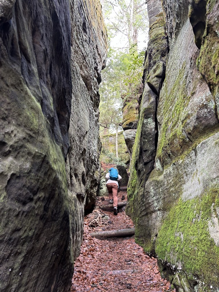
- Minister Creek Loop – Allegheny National Forest (PA)
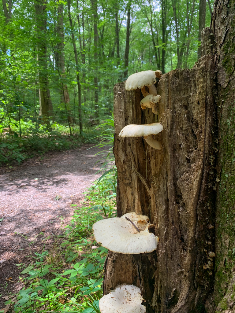
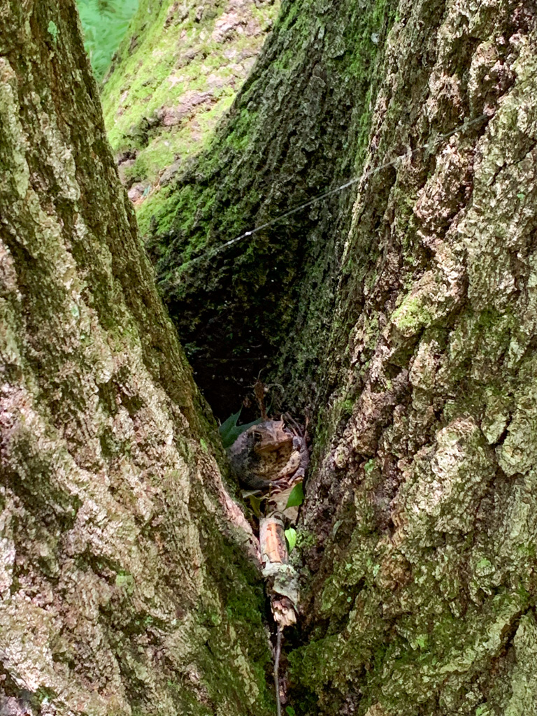
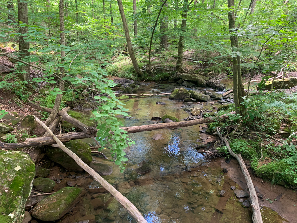
This stunning loop in Allegheny National Forest was by far a highlight of my year. Although it was cold and the creek waters were very high, I could not have asked for a better introduction to ANF. This 7-mile loop includes deep woods, clambering through rocky crevices, and stunning overlooks. Not exactly a trail for the faint of heart, this hike was a true challenge with a huge payoff at the end.


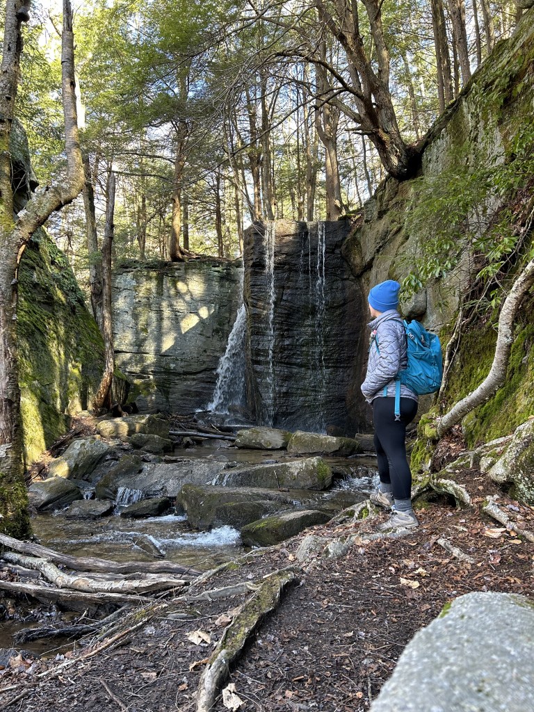
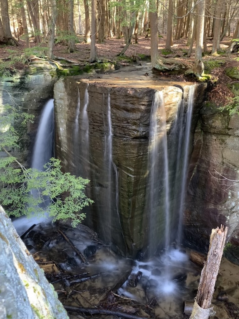
- Hector Falls – Allegheny National Forest (PA)
When the locals give you a hiking tip, you better take it! That’s exactly what happened on a weekend trip to Allegheny National Forest region. The owners of a brewery we were visited highly recommended this lesser known waterfall and I’m so glad we checked it out. Although the hike to the trail itself isn’t very interesting, the stunning double-sided waterfall at the end made it so worth it! The unique water feature flows over a rectangular rock jutting off a cliffside so when water flow is high enough, it creates two separate streams plunging off the rock. This was one of the coolest waterfalls I’ve had the pleasure of seeing, although I would recommend visiting in the spring when the water runoff is highest. Although the falls have low foot traffic, the parking area is quite small, so try to plan to visit outside of peak times.
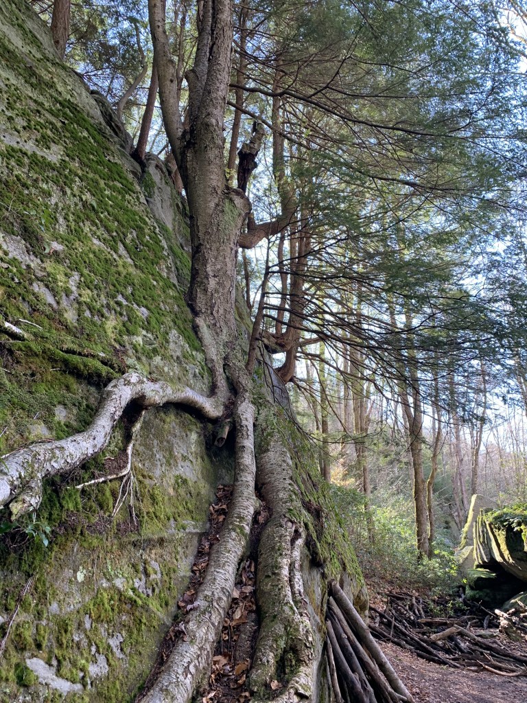
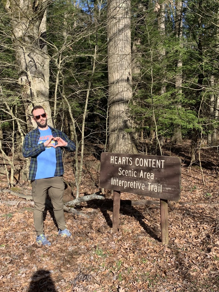
- Hearts Content Natural Area – Allegheny National Forest (PA)
If you’ve been following our hikes for a while, you know that Justin loves a big tree. So we always make a point to visit old growth forest areas when we can. Hearts Content is a relatively small hemlock and white pine old growth forest nestled in Allegheny National Forest. The trails are easy and it is a great hike for all ages. We were lucky to visit at golden hour and had the trails completely to ourselves. Prepare to be amazed by towering trees that are between 300-400 years old along the 1-mile scenic interpretive trail.


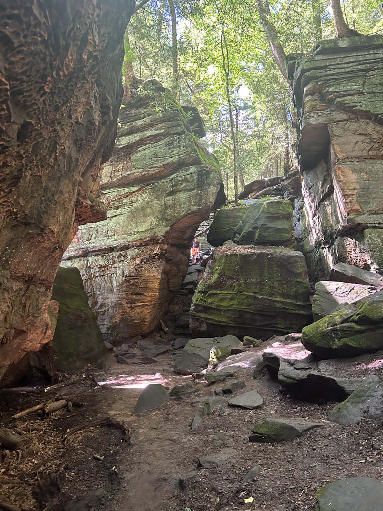
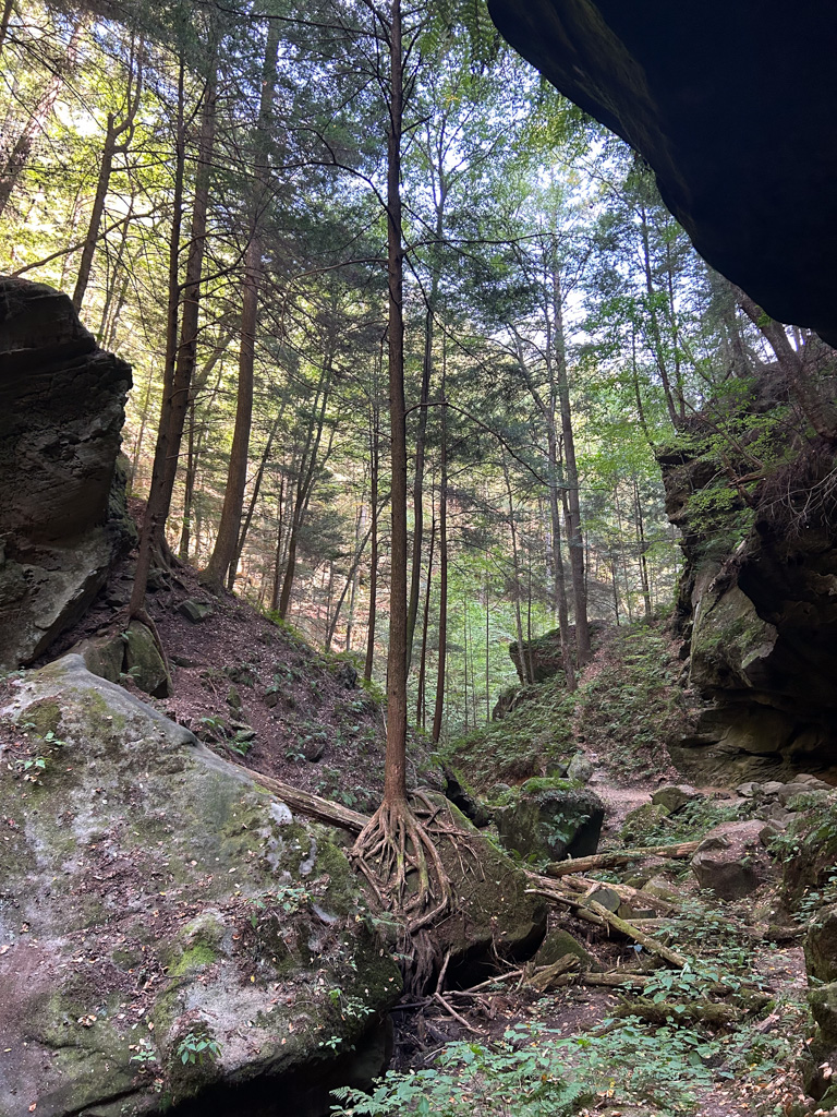
- Ledges Trail – Cuyahoga Valley National Park (OH)
On our very first trip to Cuyahoga Valley National Park we tackled the much-anticipated Ledges Trail and it did not disappoint. We loved meandering through the impressive cliffsides and peering through narrow crevices. We did a big loop from Kendall Lake to Ledges, which combined the geological beauty of Ledges with the scenic Kendall Lake. This loop can easily be shorten to accommodate little legs and would be a great trail for all ages.
Make it a Hike & Hop – Check out Ledges Trail & HiHo Brewing!


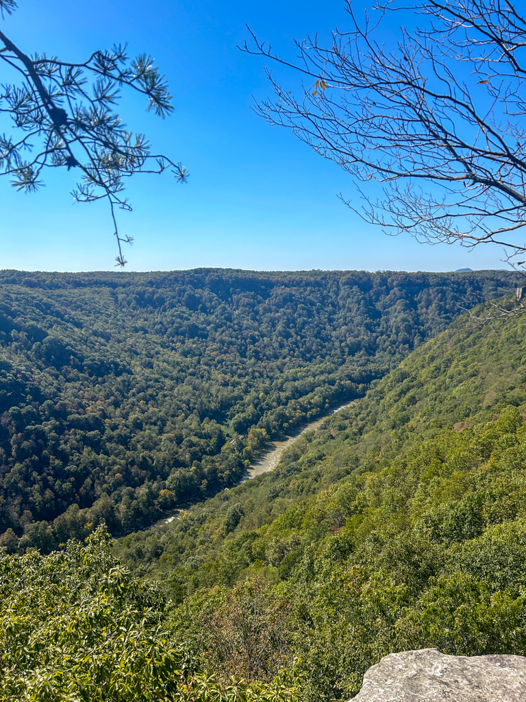
- Rock City & Rattlesnake to Overlook – Coopers Rock State Forest (WV)
Despite being just over an hour away from Pittsburgh, it took me until 2024 to finally visit Coopers Rock State Forest in West Virginia. There’s so much to see at this park, but if you only have time for one hike, definitely make it the Rock City & Rattlesnake trails. This incredible path leads from dense woods into sudden corridors surrounded by rock face. Finally the Rattlesnake Trail ends at the impressive Coopers Rock overlook, the crown jewel of the park.
Make it a Hike & Hop! Check out Coopers Rock & Screech Owl!


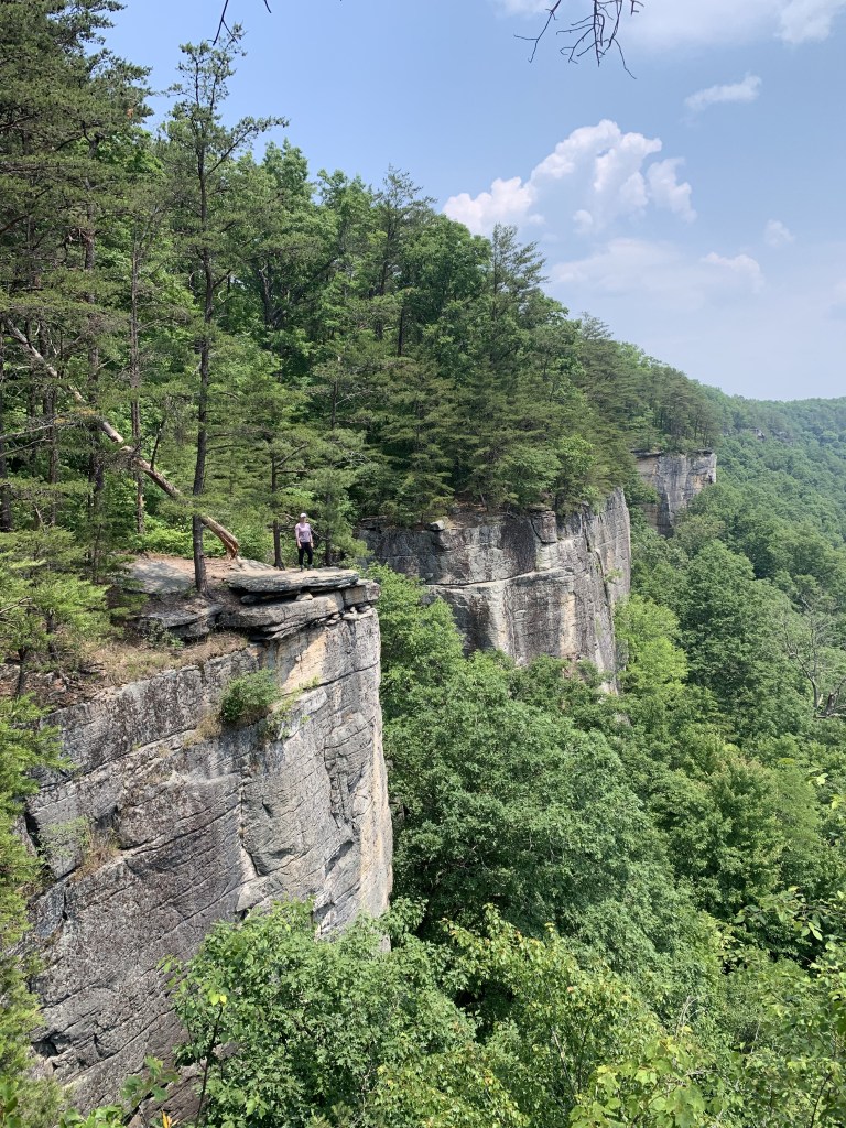
- Endless Wall Trail – New River Gorge National Park (WV)
Okay, I’ll admit, this wasn’t a new hike for me in 2024. But its so great that I had to include it as one of my favorites of the year and is one of the few repeat trails on this list. We visited New River Gorge NP at the beginning of October right as the leaves began to change. We did a LOT of hiking but the Endless Wall Trail remains my favorite of the park. The stunning views throughout the short loop just get more beautiful each time I visit. However, this is a very popular spot, so try to visit at off-times or during the week. Parking is a challenge here so please leave no trace and only park in designated areas!
Make it a Hike & Hop! Check out Endless Wall & FreeFolk Brewery

- Conkles Hollow Gorge Trail – Conkles Hollow State Nature Preserve (OH)
Another easy hike to take my end of the year round up! I’ve done the Conkles Hollow Rim hike a few times now (also highly recommend) but this time around, we wanted to do the Gorge trail. This 1-mile out and back flat trail leads you deep into the gorge with towering trees and cliff wall climbing up on either side. During wet seasons and after rain, there are various waterfalls spilling down the sides of the gorge. On a hot, sunny September day, it was amazing the temperature difference in the deepest reaches of the gorge. This is a must-hike during a visit to the Hocking Hills Area!
Make it a Hike & Hop! Check out Conkles Hollow & Double Edge Brewing
Want to explore more of Hocking Hills, OH? See my guide to visiting the state park and more.


- Red, Yellow, and Blue Loop – Hawk Mountain Sanctuary (PA)
This was by far my hardest hike of the year, but the challenge made it that much more fun! Hawk Mountain Sanctuary is a non-profit wild raptor preserve with an educational facility and miles of hiking trails. It’s the only hike on this list with a fee to visit (Adults $10, Seniors $7, Children between 6-12 $5, Under 5 FREE), but its supporting a fantastic cause so don’t let that hold you back. There’s a number of trails with varying difficulty, but we did a heart-pumping loop that began on the River of Rocks Trail (red) then climbs the steep Golden Eagle Trail (yellow). At the top, take the Skyline Trail (blue) along the ridge, ending with some of the most difficult and exhilarating rock climbs I’ve encountered on a trail. You’ll hoist yourself up onto the North Lookout and follow around the Lookout Trail (orange) for multiple vistas of the surrounding valley and soaring raptors. Be sure to check migration times for peak birdwatching months!


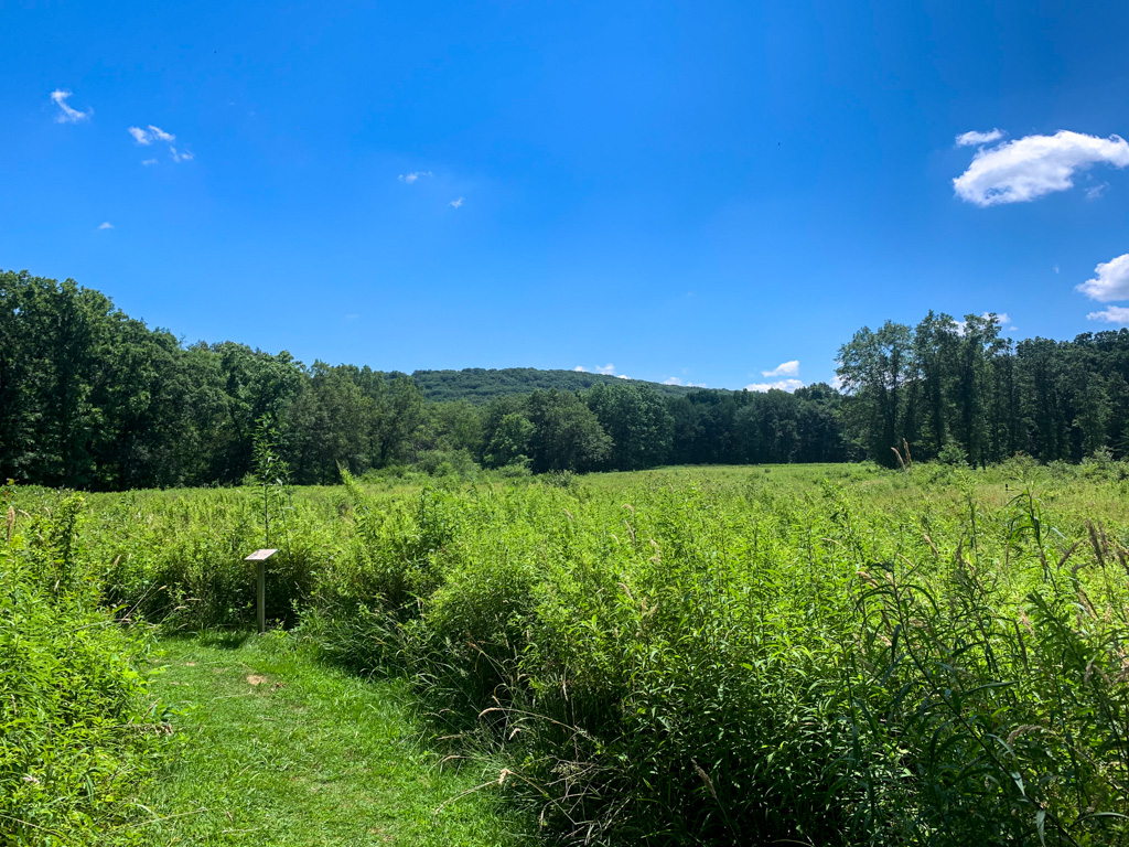
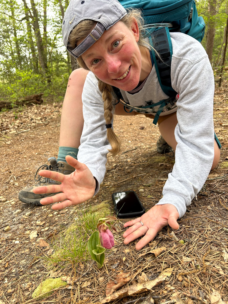
- Maurice River Bluffs – (NJ)
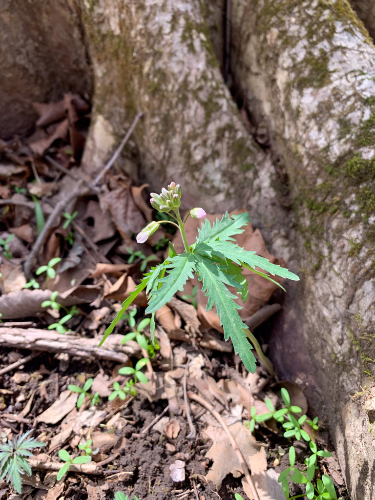
A writing project took me to New Jersey this year and I’ll admit that I didn’t go in with high expectations. But I was quickly proven wrong with this incredible hike along the Maurice River in Millville, NJ. This 500-acre preserve is managed by the Nature Conservancy and provides a key stopover for migrating birds and presents a uniquely hilly landscape in the lowlands of NJ. We completed a 5-6 mile loop of the entire preserve which included boardwalks along the water with spots to observe wildlife and sandy walks out along the bluffs for vistas of the surrounding wetlands. This hike was incredible but what made it one of my most memorable hikes this year was finally seeing a stunning lady slipper orchid in the wild. I cried.


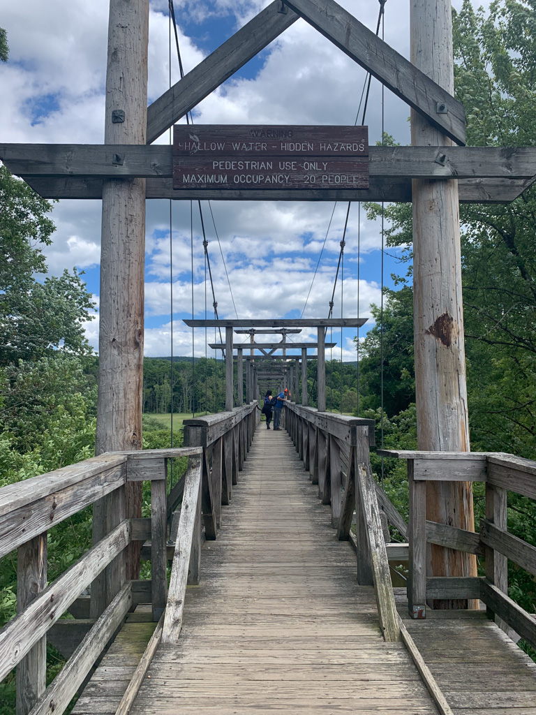
- Pochuck Valley & Stairway to Heaven – Appalachian Trail (NJ)
Another of my Jersey adventures took us along the Appalachian Trail in northern NJ. 72 miles of the famed trail run through the rugged northern region of New Jersey which boasts a markedly different landscape than the rest of the state. This 7-mile out-and-back trail includes boardwalks over wets and ends with a rocky climb to a stunning overlook. Along the way, you’ll encounter day- and thru-hikers all enjoying this unique path. Don’t let the easy path at the beginning fool you; the trek up the “stairway to heaven” is challenging but highly rewarding. From the soaring overlook on a clear day you can see all the way to the Catskill Mountains in New York!


Thanks for joining me on another year of hiking adventures! I can’t wait to see where 2025 takes me.