Fayette County, PA
Ohiopyle has got to be my favorite day trip from Pittsburgh. There’s so much to do in the area and so many awesome hikes to check out. It’s also a fantastic place to see fall foliage! This short and easy hike is a great way for the whole family to experience the beauty of Ohiopyle. Once you’ve seen all the vistas and waterfalls, head north to Yough River Brewing for a tasty brew beside a fire pit. Talk about the perfect fall day!
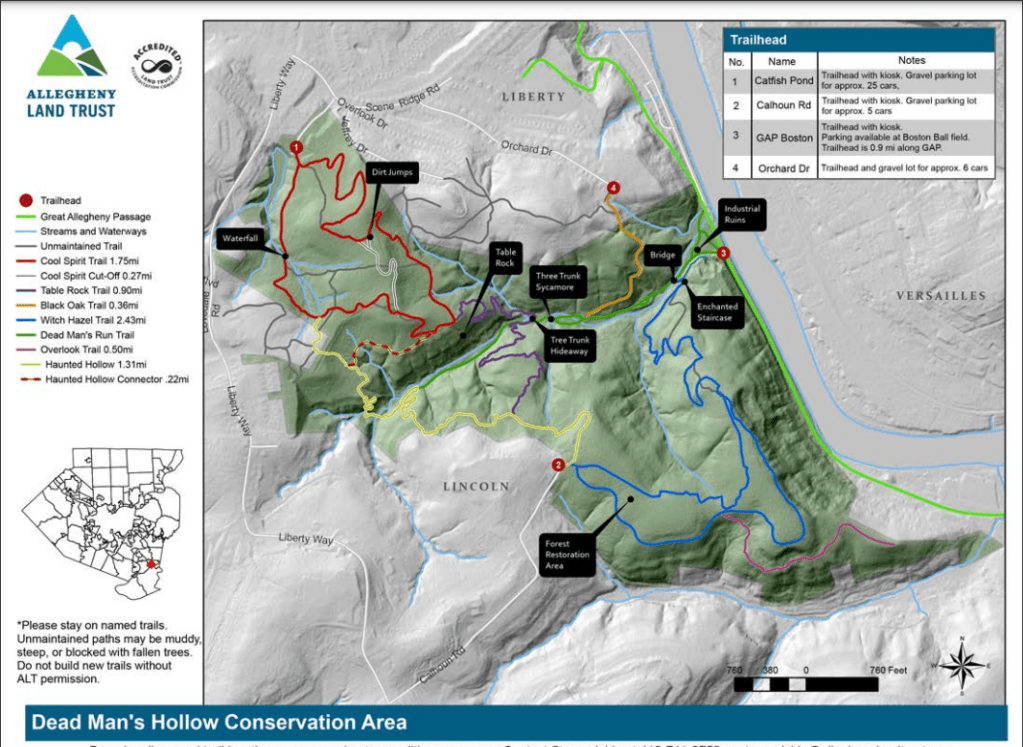
THE HIKE: Ferncliff Peninsula

Length: 1.8 miles
Elevation Gain: 137 ft
Difficulty: Easy
Time: 1 hour
Trail use: Hiking, Leashed pets
Parking: Large lot at state park office or at trailhead
H&H: 5/5
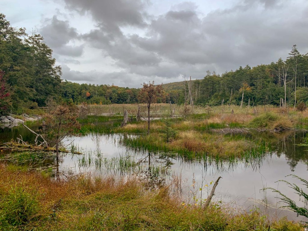
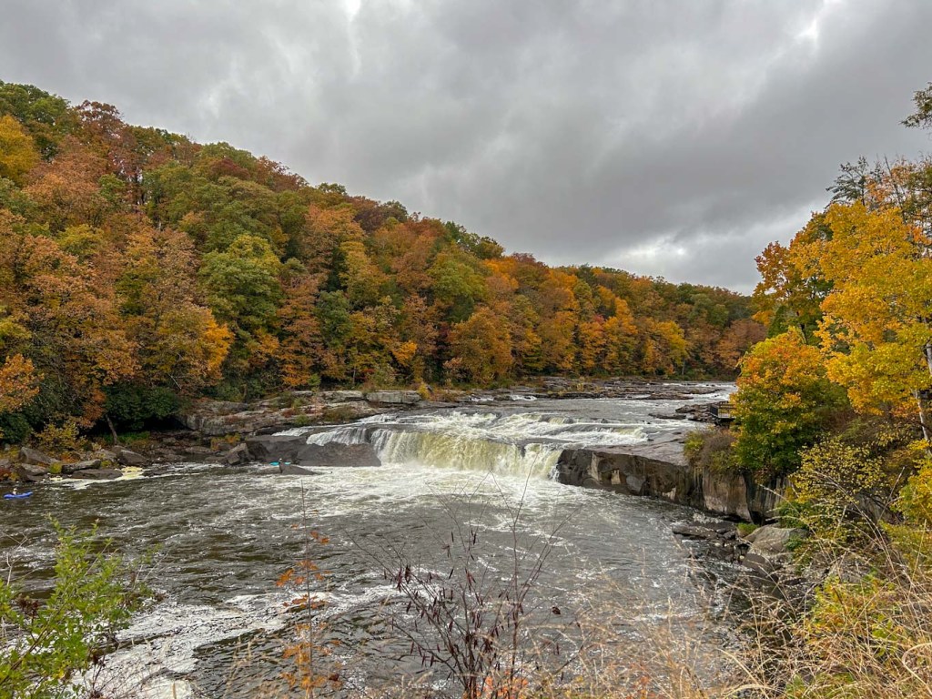
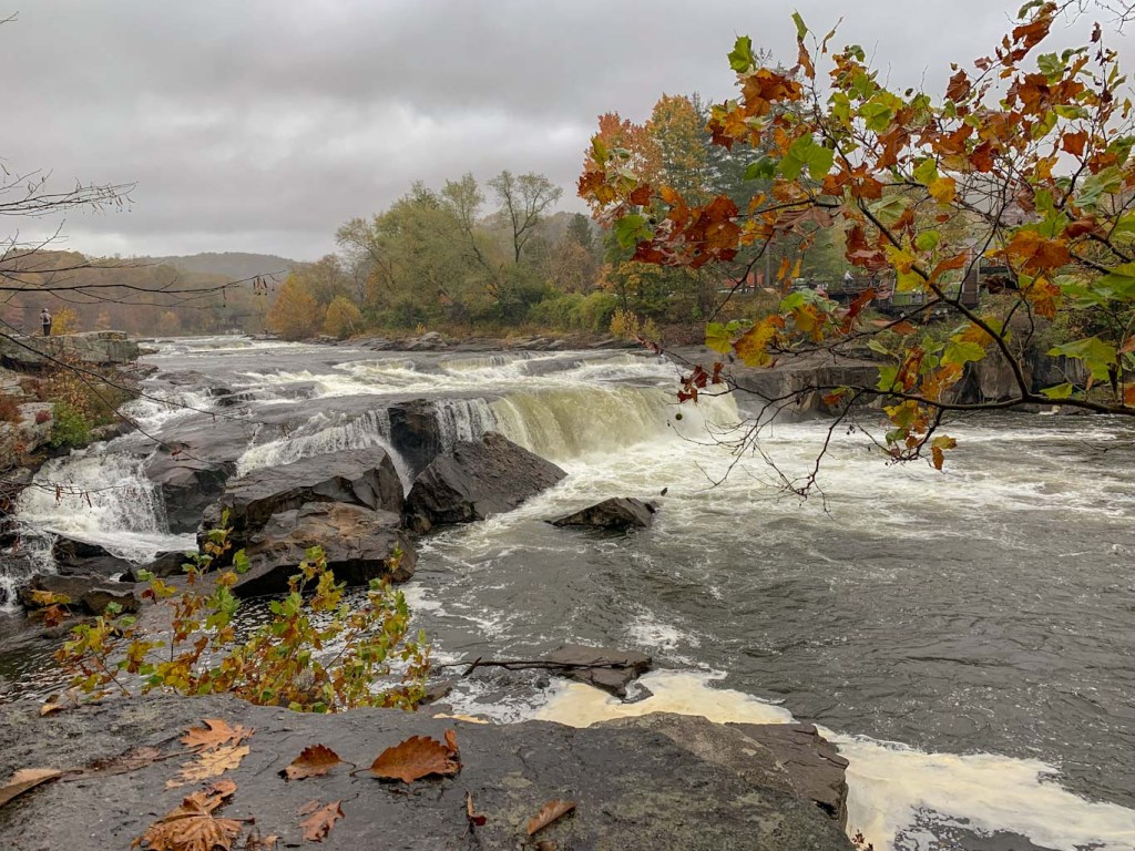
Ohiopyle is one of Pennsylvania’s most popular state parks. Located about 90 minutes south of Pittsburgh, it covers over 20,000 acres of wooded land along the Youghiogheny River. The park is probably best known for the massive waterfall that stretches the whole length of the river. It is also the start/endpoint of the 71 mile Laurel Highlands backpacking trail. Ohiopyle offers a wide range of outdoors activities, including camping, whitewater rafting, biking and more!.
History
The name Ohiopyle comes from a Lenapi word meaning “to turn white”, in reference to the foamy water as it cascades over the rocks. In prehistoric times, the area was settled by the Monongahela tribes who disappeared before extended contact with Europeans. As colonists began to settle along the eastern coast, it forced other tribes like the Lenapi, Shawnee, and Seneca peoples, further inland to areas like Ohiopyle. Eventually even these people were forced off the land by the French and Indian War.

In the era of the French and Indian War, George Washington was sent to retake the area now known as Pittsburgh from the French. He hoped to pass through Ohiopyle on the Youghiogheny to Pittsburgh but found the rocky water and waterfalls impossible to traverse. Facing an impending French attack, Washington built Fort Necessity just a few miles southwest of Ohiopyle. Washington ‘s defeat at Fort Necessity was the only military defeat of his career.
After the war and the following Whiskey Rebellion, industry moved into the Ohiopyle region and trades like lumbering became a major production, followed by mining, tanning, and other smaller industries. With the rise of railroads, Ohiopyle became accessible to tourists, and soon became a popular destination for Pittsburgh travelers, prompting the building of hotels and other attractions. One such attraction was the Ferncliff Hotel located in the heart of Ohiopyle. It was a draw for the wealthier families of Pittsburgh who could take the train out. Eventually the rise of automobiles led to the decline of resorts like these and the Ferncliff hotel was torn down in 1940.
The Kaufman family (of department store fame) frequented the southwest pa area to stay at their home Fallingwater. Edgar Kaufman loved the surrounding area and eventually purchased the Ferncliff peninsula in addition to many acres surrounding Fallingwater. He gifted the land to the Western Pennsylvania Conservancy and In the mid 1960s, it was incorporated into Ohiopyle State Park!
Ohiopyle has some really interesting geology that is outlined in a self-guided walking tour. The guide can be picked up at the Visitor Center. For a great overview of the geology tours, check out Adventuring with Kelly’s page.


The Hike
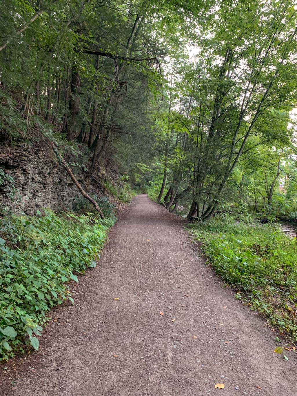
This short, easy hike is accessible from the visitor center by walking down main street to the Great Allegheny Passage bike trail. Cross over the river via the bike trail and the trailhead will be to the left. Alternatively, you can park in the Ferncliff Natural Area parking lot but please note that it fills up quickly during peak times! Generally, Ohiopyle is a very popular place so parking during peak times, especially during the weekends can be difficult. Consider carpooling or visiting during the week.
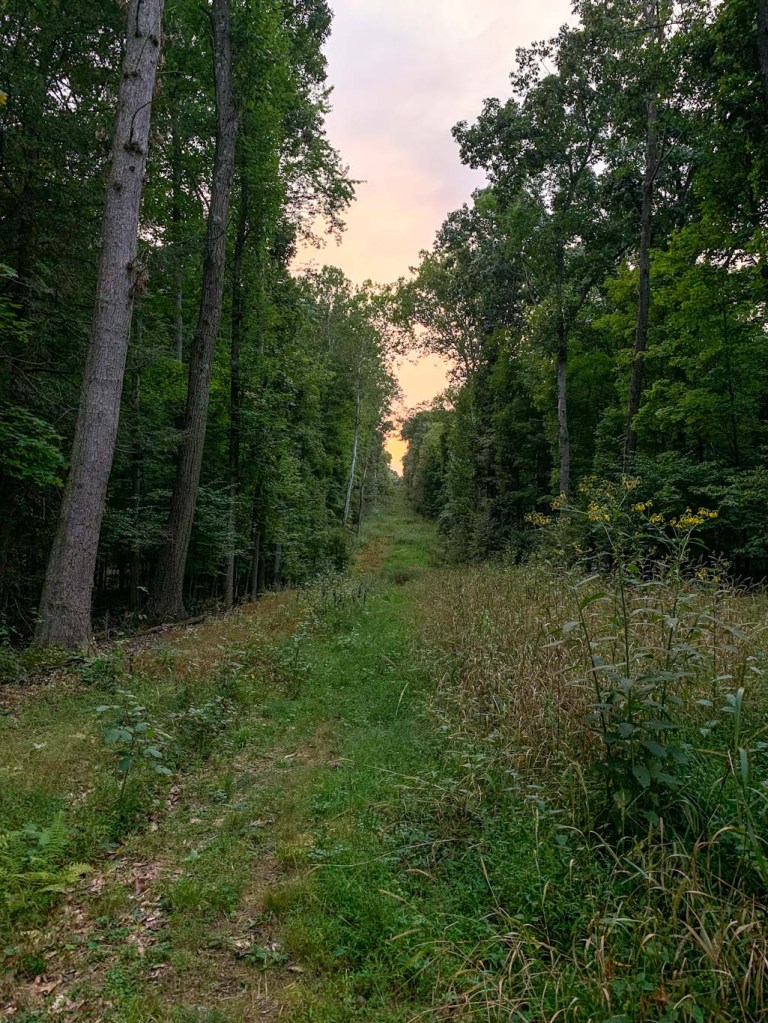
The Ferncliff Peninsula is a popular spot in Ohiopyle but sees less traffic then some of the other spots. It’s also a great option for people of varied abilities. The trail can be rocky at times, but there isn’t a lot of elevation and the path stays wide and easy to traverse. Unfortunately, it becomes more difficult during rainy weather as the trail becomes muddy and rocks are slippery.

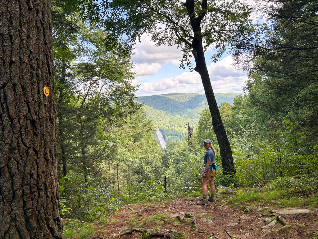
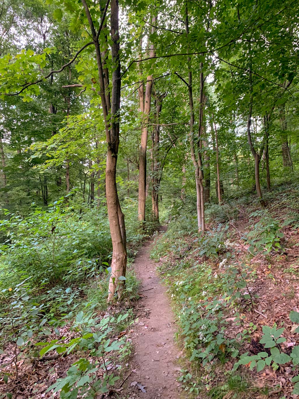
There are several intersecting trails in this area, but following the Ferncliff Trail allows a nice 1.8mile loop along the edge of the peninsula. I recommend going counterclockwise so that your hike ends with Ohiopyle Falls. Personally I like ending with a bang, although you can hike either direction. Just be sure to only stay on marked paths! Not only is going off official trails detrimental to the natural environment, it could also be hazardous in such a rocky area.
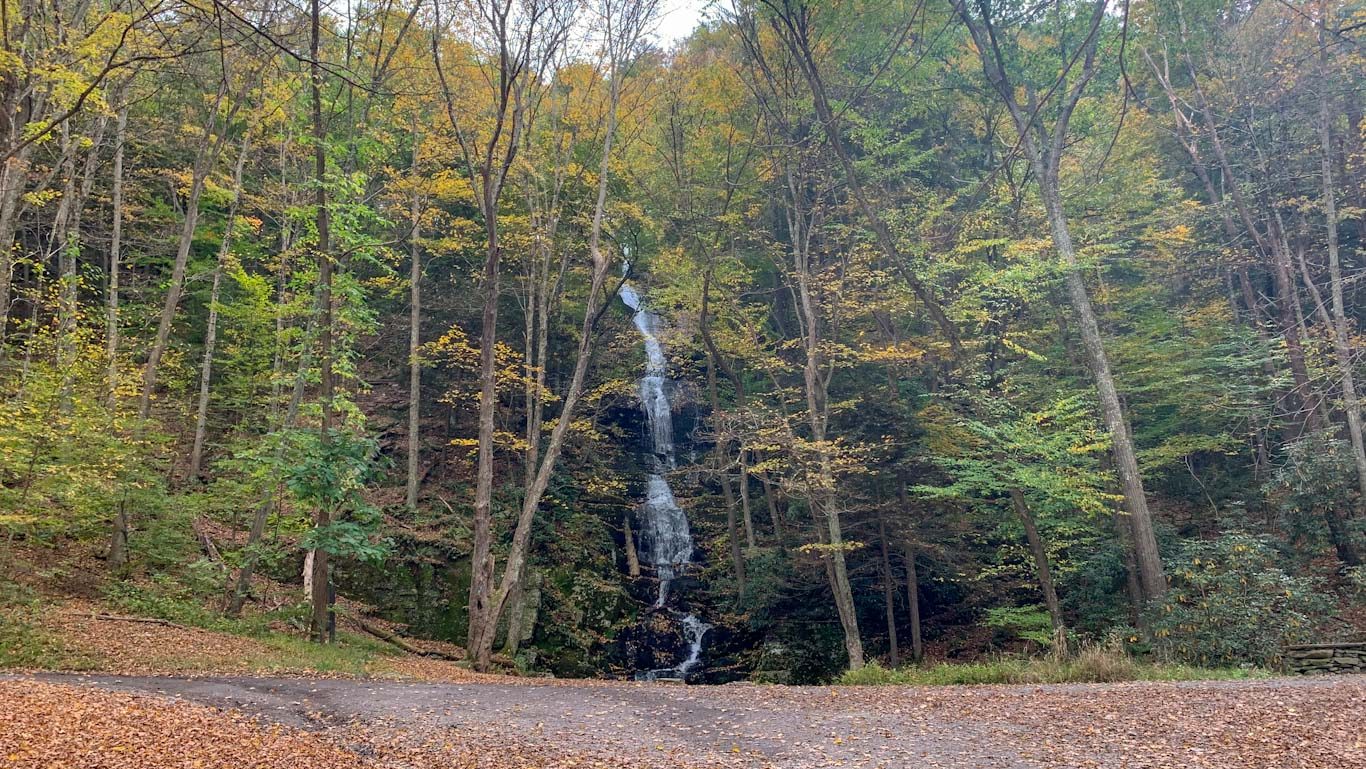
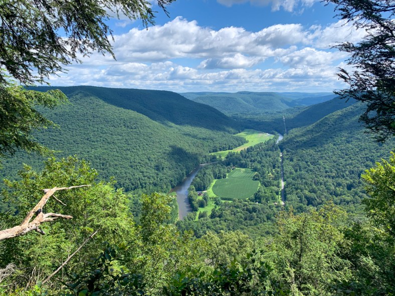
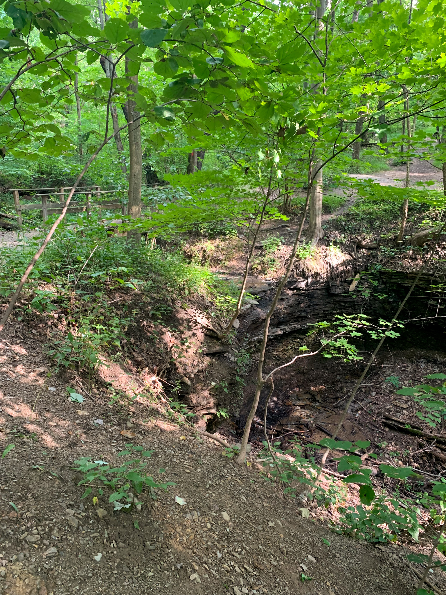
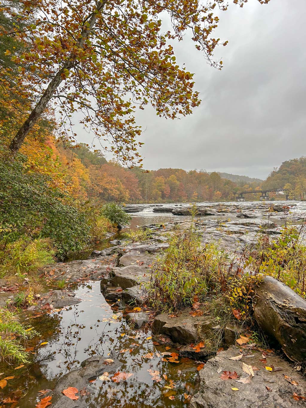
The first 1.5ish miles of this hike is a pleasant walk through tall trees with changes to see fossils in the exposed sandstone rock. Keep your eyes peeled; they will look like bike tracks embedded in the stone! After rounding the top of the peninsula, the trail follows through dense rhododendron thickets. Finally, there will be a set of wooden steps on the right that lead out to the waterfall viewpoint. This is a majestic spot so take lots of pictures and enjoy! Now, the trail will lead out onto the river rocks. Be careful during rainy times and be aware that during heavy rainfall, this trail section could be underwater. This is my favorite part of the trail. I love walking out on the rocks and feeling surrounded by the great river. When you’ve taken in all the sights and sounds, continue along the trail, following next to the river. The trail eventually bears to the left to take the Ferncliff trail back to the trailhead. Alternatively, there are steps leading up the GAP trail that go to the same place.
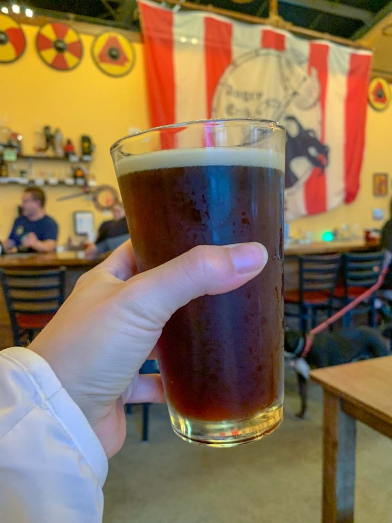
Now that you’ve seen the Ferncliff Peninsula, take the time to explore other spots in Ohiopyle! I highly recommend Cucumber Falls, Baughman Rock Overlook, and Meadow Run Trail. If you have time, Fallingwater is just up the road and Fort Necessity isn’t far. On the way back to Pittsburgh, make a stop in Connellsville to grab a beer at the new Yough River Brewing!
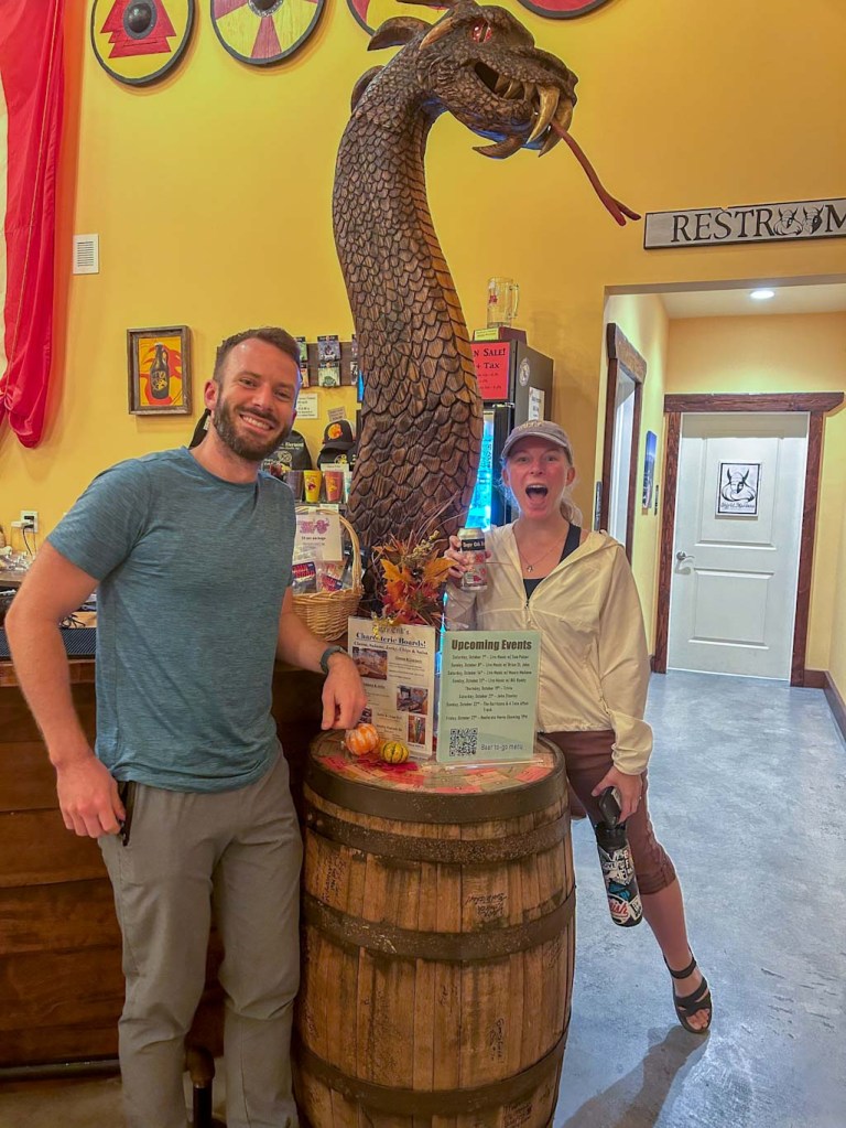
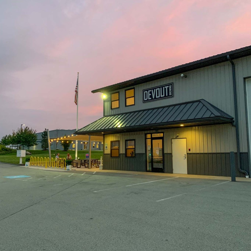
THE BEER: Yough River Brewery Co.

Address: 1030 S Arch St, Connellsville, PA 15425
Distance from Trail Head: 28 miles, 20 mins
Website: http://youghriverbrewing.com/
Food?: Food Trucks, BYOF
Details: Outdoor seating, Dog friendly outside
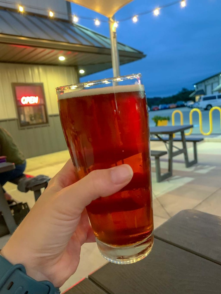
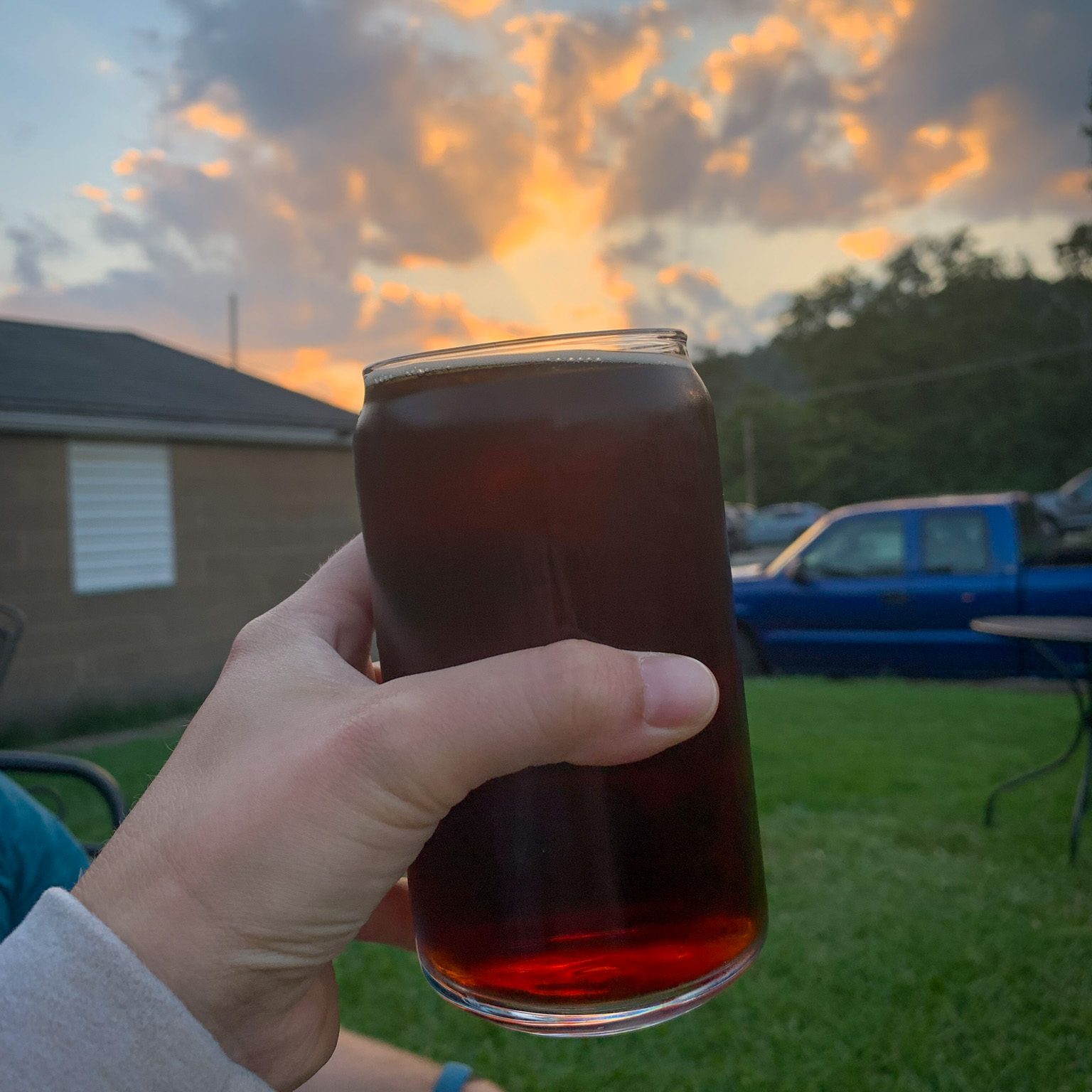
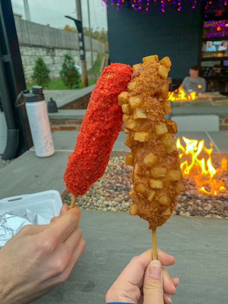
There’s so many incredible hikes in and around Ohiopyle, but it has already had a lack of breweries. No more! Yough River Brewery is newer taproom in Connellsville, PA. It’s still a bit of a drive from Ohiopyle, but is an easy stop on the way back to Pittsburgh. The taproom is located in an old plant nursery with plenty of outdoor space equipped with propane heaters to keep you toasty even as the weather starts to turn chilly. The taproom offers not only a wide selection of house made brews but also serve local ciders, wine, and liquor. Although I was there for the beer, some of the fall cocktails sounded delicious! They frequently host food trucks and on this location we had some surprisingly delicious corn dogs from Kickin’ Corndogs. Keep an eye on their social as weekends frequently feature musical guests.
We particularly liked that this taproom felt open to everyone, including dog owners and families. It was the perfect place to stop after a day of hiking! It’s also very close to the GAP trail in Connellsville so could be a great way to end a day of cycling!
Also huge shout out to the bar staff for letting me use a glass with a location for some photos!
Our Beer:
- Stairway to Hazy – NEIPA – 6.2%
- Wake Up Call – Coffee Stout – 5.9%
- Graveyard Shift – Pumpkin Beer – 6.4%
- Lou Dog – Dunkel – 5.8%
- Bearded Nomad – IPA – 6.7%
- Back Hop – Pale Ale – 5.6%
- Chuggy’s Razz – Wheat Beer – 5.9%
- Notorious Y.R.B – Blonde Ale – 4.5%
If you’re looking for other hikes and hops in the Laurel Highlands, check out Ohiopyle & Bloom Brew, Powdermill Nature Reserve & Four Seasons Brewing, and Wolf Rocks & Helltown.
Where else in the Laurel Highlands should Hikes & Hops explore?