Buttermilk Falls & Angry Erik Brewing

NW New Jersey

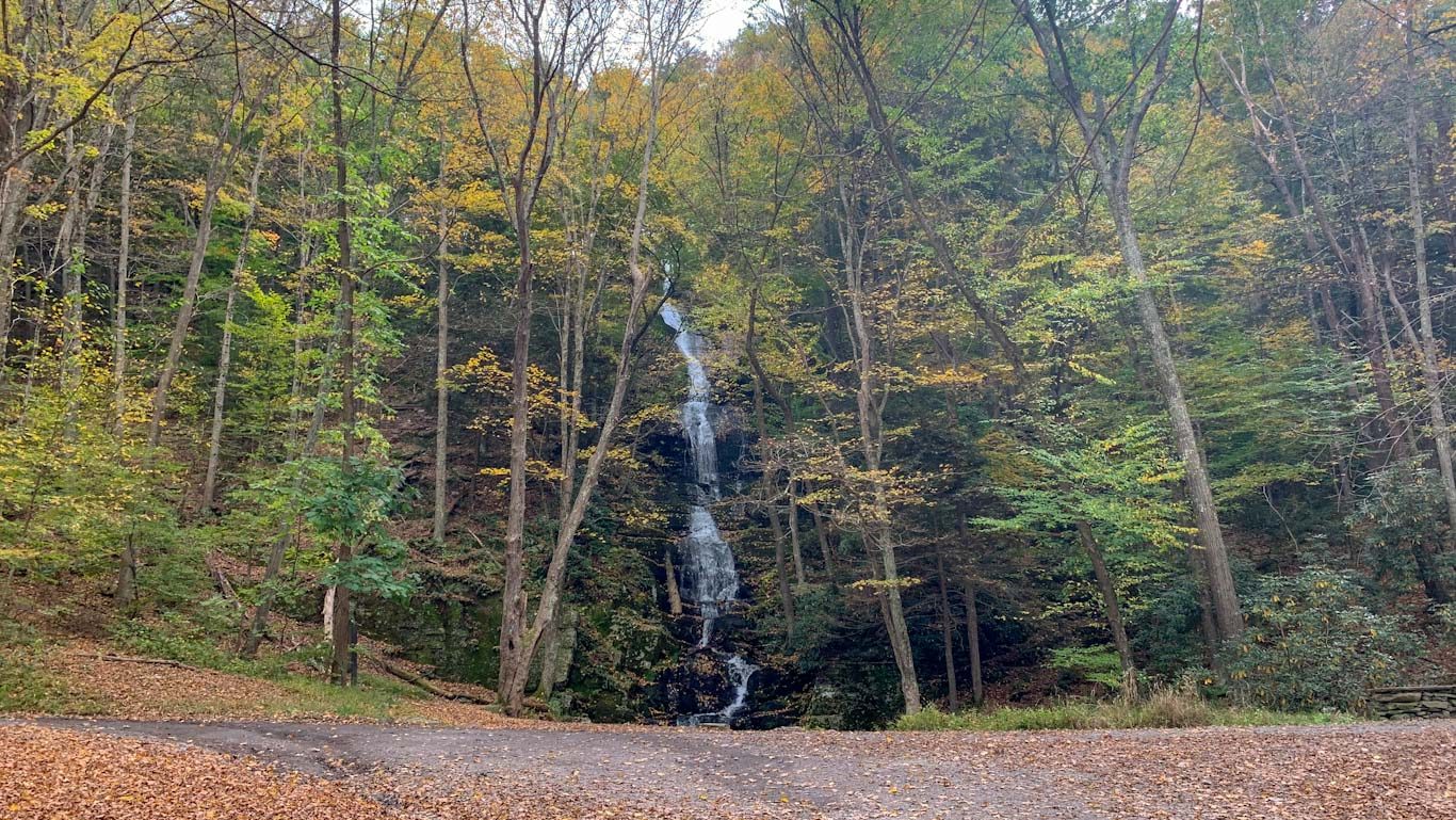
Visit the Delaware Water Gap Region for a view of New Jersey’s tallest waterfall! You won’t have to go far; it’s right at the trailhead! But if you have the time, I highly recommend this 6.5 mile loop. It’s challenging, but well worth it to experience a beautiful trek through the woods, a stretch on the Appalachian trail, and a lake only accessible by trail. Afterward, head to Hampton Township for robust brew at the viking-inspired Angry Erik Brewing! 

THE HIKE: Buttermilk Falls Loop

Length: 6.1 miles
Elevation Gain: 1,381 ft
Difficulty: Challenging
Time: 3 hours
Trail use: Hiking, leashed pets,
Parking: Large lot at trailhead, no bathroom facilities, road has no winter
H&H: 5/5

The Delaware Water Gap is a national recreation area managed by the National Park Service. A NRA is a different type of public lands designation with a particular focus on outdoor recreation. Most NRAs are found near urban areas so that they are more accessible to visitors! The 70,000 acre region was designated as NRA in 1975 after long controversy over the building of a dam in the area. Despite having removed families from their land, the government determined that the project was too costly and turned over the property to the NPS for recreation management. 

History 

The Delaware Water Gap region is the ancestral home of the Lenape people. There are several archaeological sites throughout the region that place the Lenape people in the area as far as 10,000 years ago. The first European settlers in the area were Dutch and French settlers from the Hudson Valley. After contact with the northern Lenape, called Munsee, the settlers named the region Minisink. For more information about the history of the region, see here

Geology 

A water gap is a place where a stream or river has carved a gap through a mountain ridge or range. In this area, the Delaware River cuts through the Appalachian Mountains, not only forming the gap but also acting as a border between Pennsylvania and New Jersey. The dramatic region was formed through hundreds of millions of years of water and glacial ice erosion. The river forms a steep gap between the Blue Mountains on the Pennsylvania side and the Kittatinny Ridge on the New Jersey side. Mount Minsi (PA) and Mount Tammany (NJ) are both very popular hikes that feature opposing sides of the DWG. 

The Hike

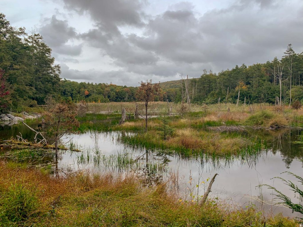
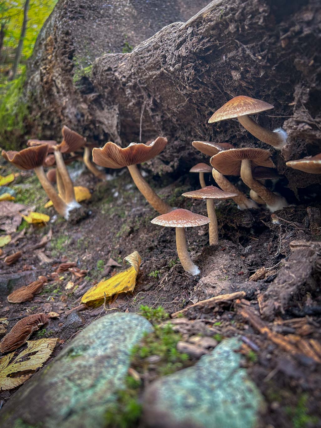
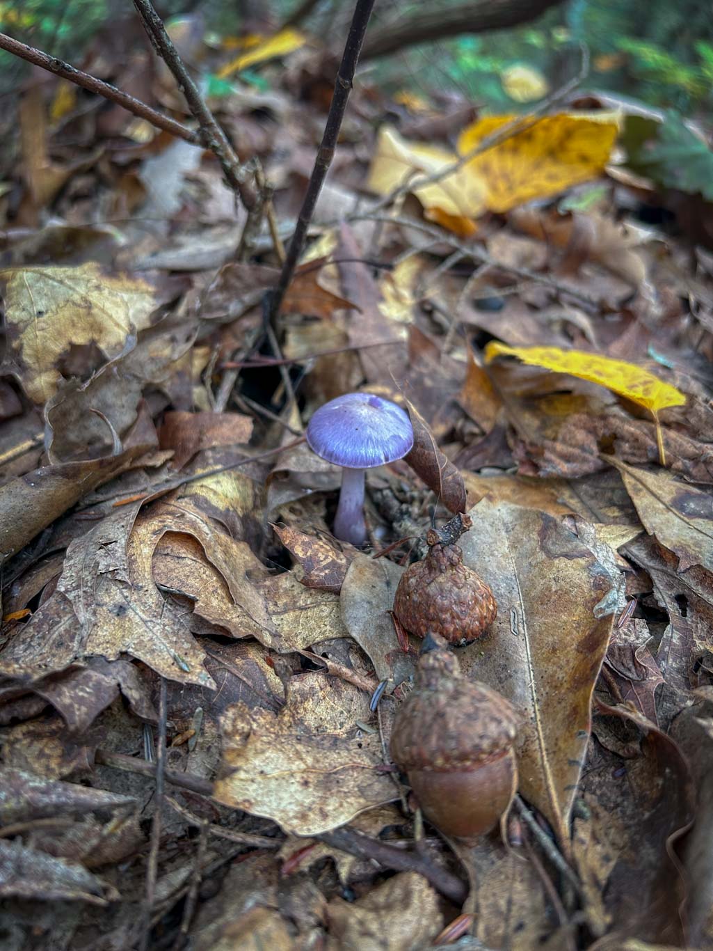
The Delaware Water Gap region is known for its plethora of waterfalls. Buttermilk Falls is the highest waterfall in New Jersey and is the feature of this hike. This loop will take you up the side of the Falls, along the Appalachian Trail and past two lakes, for a challenging but rewarding 6 mile loop. 

Fees: There are no fees for accessing the trails in the Delaware Water Gap Region. 

Find the Trailhead: The trailhead can be found at Mountain Rd, Layton, NJ 07851 or GPS coordinates: 41.13754848406089, -74.88950898816402. The road to the trailhead is unpaved and can be very bumpy and full of potholes. It’s best traveled with a bigger vehicle or by taking it very slow. Be aware that the road closes in winter and that the dirt parking area can fill up quickly during peak times. The access road is one lane at time and you may have to pull over to let others pass. 

Bathroom: There are no bathrooms at the trailhead but there are composting toilets at Crater Lake, approximately 2.5 miles into the hike. 

You won’t have to go far to enjoy New Jersey’s tallest waterfall; it’s right at the trailhead! But if you have the time, I highly recommend this 6.5 mile loop. It’s challenging, but well worth it to experience a beautiful trek through the woods, a stretch on the Appalachian trail, and a lake only accessible by trail. 

Crater Lake

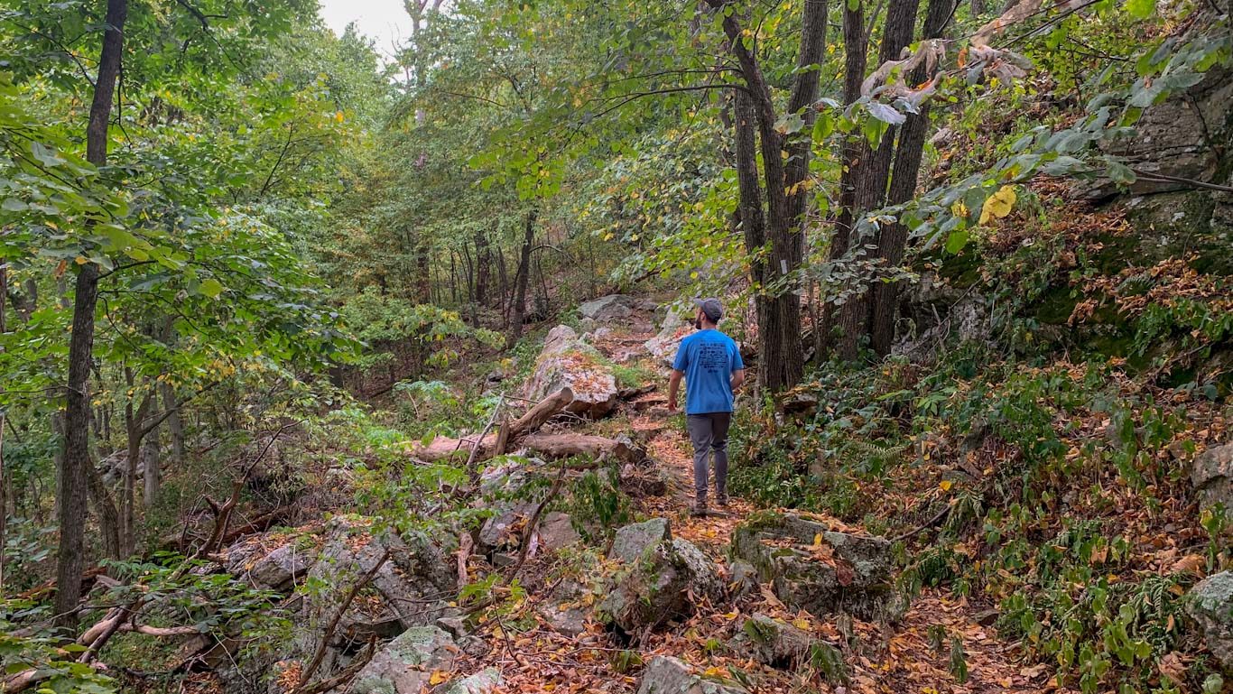
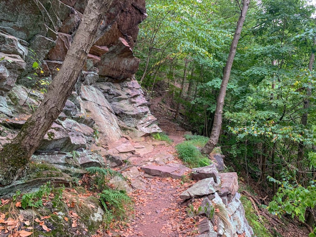
To start, take the stairs up the side of Buttermilk Falls. You’ll gain a lot of elevation in this hike and it’s mostly all in the first 1.5ish miles. Finally, the trail meets up with the Appalachian trail. This section of the trail is mostly flat and easy to traverse so it’s a nice break. Stay on the Appalachian trail for about 0.9 miles then follow the signs for Crater lake, leaving the AT behind. The path curves downhill and the lake is visible through the trees. From here you have a choice. You can do the whole loop around the lake (1.3 miles), or you can go to the small view point before the trail hits the access road. Whichever way you choose, you’ll retrace your steps back to where you left the AT. From there, head straight into the hemlock trees, following signs for Hemlock Lake. We followed the signs to the right for Blue Mountain Lake trail which were blazed green/red but it was difficult to tell. This trail took you around the lake and then met up with Woods Road. Turn left on Woods Road to go up to the lake and even dip your feet in if you need to cool off! From here, follow Woods Road all the way back until it crosses over Buttermilk Falls trail. It’s roughly a mile back to the parking area. 

After a hike like that, you’ve definitely earned a brew! 

Hemlock Lake

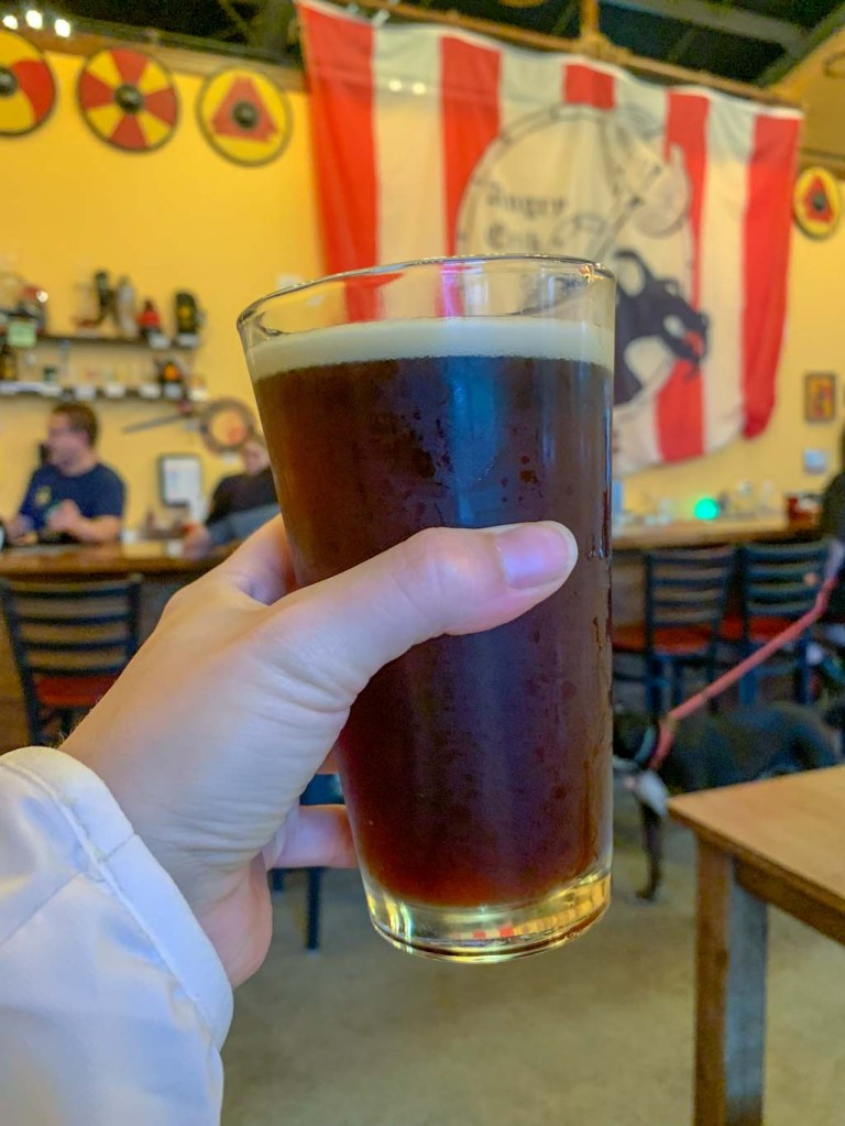
THE BEER: Angry Erik Brewery

Address: 2 Camre Dr, Newton, NJ 07860
Distance from Trail Head: 16 miles, 35 mins 
Website: http://www.angryerik.com/
Food?: Bar snacks
Details: Outdoor seating, Dog friendly

Just a warning, this drive might take a long time despite being only 16 miles due to the rough road and winding state forest roads to get out of the woods. Just take it easy and enjoy the ride! 

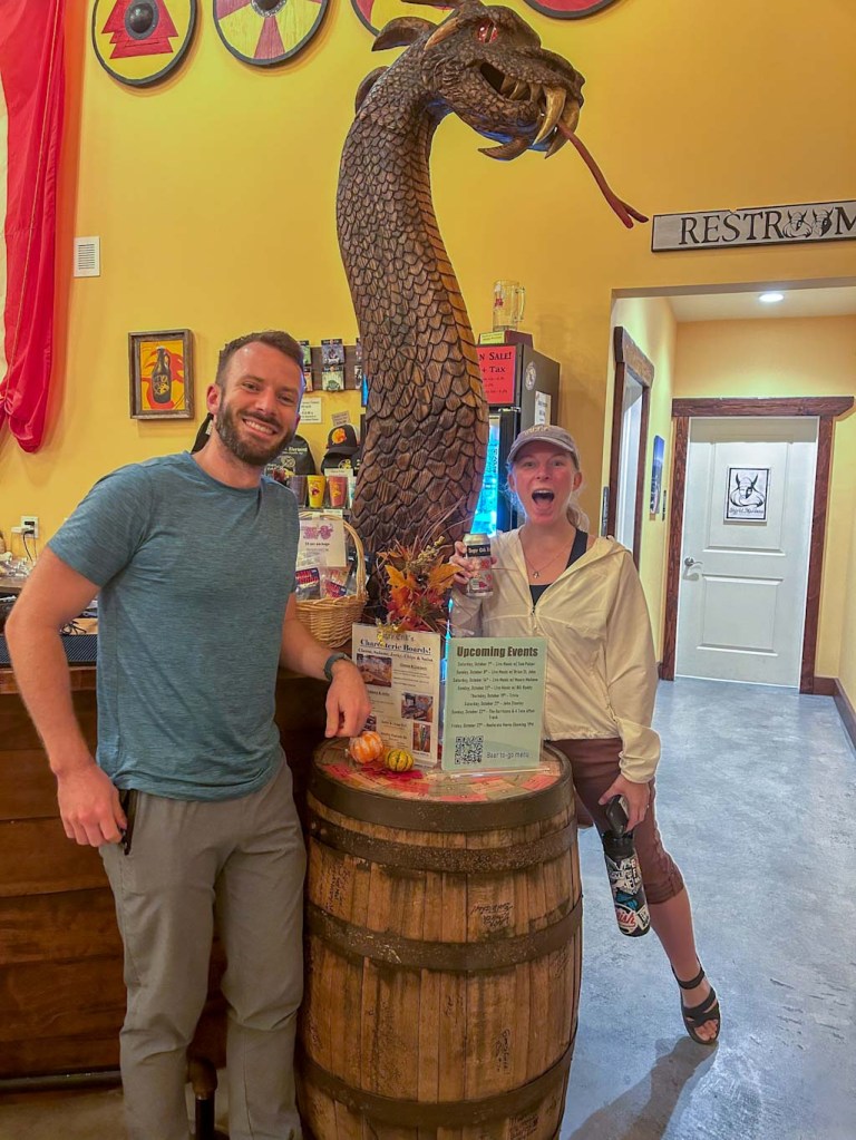
The husband and wife team of Heide and Erik started Angry Erik Brewing back in 2014. Originally the brewery was located about a mile away but demand soon outgrew the space. Now the brewery has a sprawling 7,000 sqft brewery and taproom right on the Paulinskill Rail Trail with a large outdoor biergarten. But the most striking thing about the taproom isn’t the size; it’s the viking iconography! The bar is set up to look like a viking long ship with a dragons head sprouting from the bow and a tail curling at the stern. Behind the bar a huge mast and sail reach toward the ceiling. It’s quite impressive! To further the viking theme, Angry Erik brews many traditional belgium style ales and some with unique twists. Our favorite of the night was the Leaf Erikson, a harvest amber ale with baking spices. 

We really loved our visit to Angry Erik. I don’t think we’ve ever been to a place that was so welcoming, so ready to chat beer with us, and even willing to take some silly pictures of us. Big thanks to the team to Angry Erik! I hope we’ll be back someday!

Our Beer:

Midnight in Autumn – Stout – 6%
Leaf Erikson – Pumpkin Beer – 6.1% 
Paulinskill Ale – Lemongrass Summer Ale – 6.8%
Ravol – Amber Ale – 6.8%

Peter’s Mountain & ZeroDay Brewing Co.

Harrisburg, PA

Well it looks like I have to eat my words from last week because here’s another Appalachian Trail hike! We went to Harrisburg last weekend and got to have another excursion in Rocksylvania. This time we tackled Peter’s Mountain Ridge, just north of the capital. The hike starts out a bit dicey with a dash around a street and railroad then takes you straight up, up and up! This hike is not for the faint of heart. Thankfully there are plenty great breweries in the area to quench that thirst you’ll work up! Some friends of ours introduced us to ZeroDay Brewing in the heart of Harrisburg. They had great brews and a full menu if you’re famished after those rock scrambles!

THE HIKE: Peter’s Mountain via Appalachian Trail

Length: 4 miles
Elevation Gain: 974 ft
Difficulty: Moderate
Time: 2-2.5 hours
Trail use: Hiking, Leashed Pets
Parking: Park in commuter lot across road
H&H: 3/5

As with all of my posts about the Appalachian Trail, I like to start out with a bit of a background on the trail just in case some people are new to hiking! The Appalachian Trail (or AT for short) runs for about 2,200 miles from Georgia to Maine and is very popular with backpackers and day-hikers alike! The AT stretches for almost 230 miles in PA, from the Mason-Dixon Line to the New Jersey border. The PA section is affectionately called Rocksylvania for its extremely rocky terrain in central PA. Throughout the whole length of the trail, it is marked by white blazes, so you can always find your way! 

Now that we’re back in PA, I have a dream of doing the whole PA section in day hikes (not a backpacker here!). So far I think we’ve gotten about 4 miles out of 230. Clearly we’re making strides! See what I did there…

Okay back to last weekend’s hike. Since we were in town for a concert, we wanted a hike that wasn’t too far from our hotel and that we could tackle in about 2 hours. Peters Mountain was the perfect choice, being a 4 mile loop and only about 20 minutes north of downtown Harrisburg. The ascent to Peters Mountain starts at the Clark’s Ferry Park n Ride where you’ll have to cross a large street and train tracks to get to the trail head. We didn’t love this part but the road wasn’t too busy so the sprint across traffic was doable. Just keep your fingers crossed that a train isn’t coming by because you might be waiting for a while! From there it’s up up up. Follow the white blazes for the AT as you go along switchback, quickly gaining elevation. The highway noise is quite loud and you can hear it most of the way up the hill. It was quite off-putting at first but eventually it faded to the background. 

I’ll be honest, this was another tough hike for us! The humidity was pretty high and the majority of the elevation is gained in the first 1.5 miles of the hike. Take breaks when needed and bring plenty of water! I couldn’t believe how quickly we went through our water. One great thing about this hike was how low the foot traffic was! I thought this would be a popular spot on a weekend but we only saw one other couple. I also love the rock scrambles along the ridge of the mountain. I just wish that we had been able to do this hike later in the year. We could only catch glimpses of the vistas through the trees but I can imagine that it’s gorgeous in the fall/winter. 

Trailhead across the railroad tracks
My triumph on finding a pawpaw forest

Be aware that this area is HIGHLY infected with spotted lantern flies. We tried to kill as many as we could but their numbers were just overwhelming. There had to be 100s along the ridge. It was so sad to see how they were destroying certain trees. They leave a gross black sludge around the base of large trees and I can’t imagine how devastating this might be for our forests! Also be prepared for lots of gnats and flies. Summer hiking always seems to mean constantly swatting! Oh and we saw a huge black snake slithering into a tree trunk on our way back down the mountain. Frankly I deserve a medal for not screaming. In fact I was so silent that J was confused why I was suddenly backing up. 

So overall, this hike was just middle of the road for me. I love the switchbacks and rock scrambles, but I hated the bugs, running across a busy road to the trailhead, and the loud highway noises. I think I would have enjoyed it much more if we had been able to see the vistas at the top! Oh well, this just has me excited for fall hiking! 

THE BEER: ZeroDay Brewing Company

Address: 925 N 3rd St, Harrisburg, PA 17102
Distance from Trail Head: 14 miles, 20 mins 
Website: http://zerodaybrewing.com/
Food?: Full Menu
Details: Outdoor seating but no pets
H&H Rating: 4/5

From ZeroDay Brewing’s Facebook page

One of the best parts of doing hikes in central PA is getting to meet up with friends along the way! One of my best friends from college lives in Philly now so we try to split the difference whenever we can. They’re also huge craft beer fans and were more than happy to introduce us to their favorite breweries in the Harrisburg area! One of the places they took us to was ZeroDay Brewing Company. ZeroDay has several locations in the Harrisburg area so be sure you know which one you want to go to! We went to their main taproom location and it had a great vibe. Lots of beers on tap and plenty of seating all around. I love when I go to a brewery and see so many different types of people, all enjoying the same space! 

If you’re like me, you’re probably wondering what “Zeroday” means. Well little did I know at the time but it’s actually a connection to hiking! From their website Zeroday means “a day taken during a journey in which no miles are logged, usually because the traveler has stopped in a town to resupply, rest and reinvigorate”. The name was actually inspired by one of the founder’s Appalachian Trail thru-hike and they see the name as a reminder to everyone to take a pause and “enjoy some of the side trails like offers because the views are almost always worth it”! Now that’s something I can get behind! 

Zeroday has expanded quite a bit in the years since their founding. Their original taproom is now their production facility and they offer three other bar locations throughout Harrisburg. The location we went to is their urban taproom only a few blocks away from the Capitol and features tacos from the Mexican kitchen La Catrina. They also have two outposts in Harrisburg, one at Broad Street Market where people can enjoy the farmers market and one at the Midtown Cinema which also has a gourmet hotdog menu. 

Also a fun fact, Zeroday’s Head Brewer is a woman named Hannah! What are the odds?!

Our Beer:

  • Pine Palace – West Coast IPA – 6.4%
  • Mango Habanero – Spicy Pale Ale – 6.66% 
  • Sunday Soiree – Mimosa Pale Ale – 5.6%
  • This Pilsner is My Love Language – Pilsner – 5%

SUM UP: The Peter’s Mountain ascent on the Appalachian Trail is a moderately difficult day hike just outside of Harrisburg, PA. There is amply parking in the Clarks Ferry Park n Ride but be aware that you will have to cross a large road and train tracks to reach the trailhead. ON this hike, expect to encounter steep inclines, switchbacks, and some rock scrambles. If you go in the fall and winter, you will have expansive views of the river valley. Sturdy boots are essential and hiking poles might be helpful. Afterward, head back into Harrisburg for a bite and a brew at ZeroDay Brewing. This is the perfect stop post-hike because one of the founders is actually an AT thru-hiker!